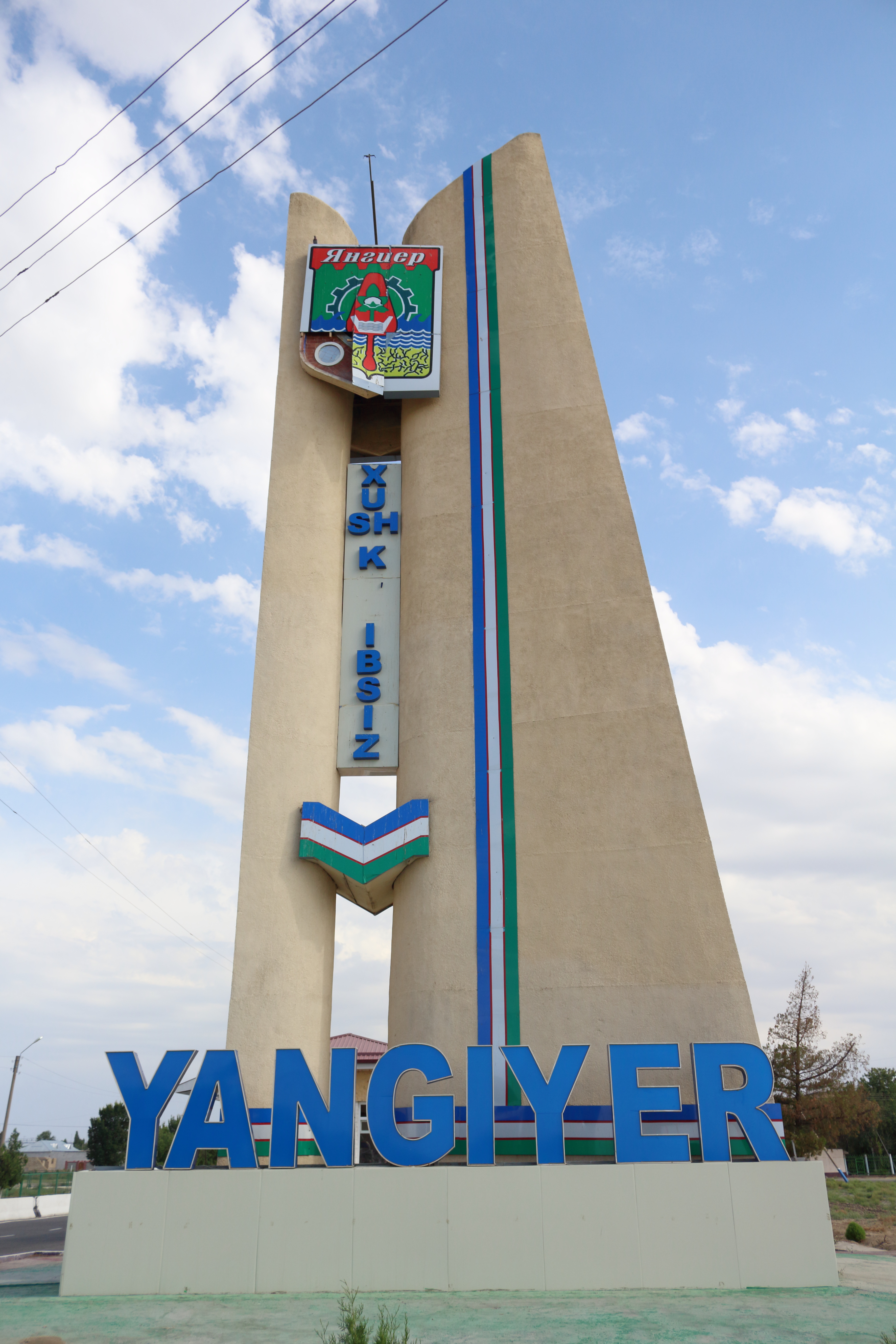
Yangier on:
[Wikipedia]
[Google]
[Amazon]
, settlement_type = City
, image_skyline =  , imagesize = 300px
, image_caption =
, image_flag =
, image_seal =
, image_map =
, map_caption =
, pushpin_map = Uzbekistan
, pushpin_label_position = bottom
, pushpin_mapsize = 300
, pushpin_map_caption = Location in Uzbekistan
, subdivision_type =
 , imagesize = 300px
, image_caption =
, image_flag =
, image_seal =
, image_map =
, map_caption =
, pushpin_map = Uzbekistan
, pushpin_label_position = bottom
, pushpin_mapsize = 300
, pushpin_map_caption = Location in Uzbekistan
, subdivision_type =
 Country
A country is a distinct part of the world, such as a state, nation, or other political entity. It may be a sovereign state or make up one part of a larger state. For example, the country of Japan is an independent, sovereign state, while the ...
, subdivision_name =
, subdivision_type1 = Region
In geography, regions, otherwise referred to as zones, lands or territories, are areas that are broadly divided by physical characteristics (physical geography), human impact characteristics (human geography), and the interaction of humanity and t ...
, subdivision_name1 = Sirdaryo Region
Sirdaryo Region (, russian: Сырдарьинская область, Syrdaryinskaya oblast) is one of the regions of Uzbekistan, located in the center of the country on the left bank of Syr Darya River. It borders with Kazakhstan, Tajikistan, T ...
, subdivision_type2 =
, subdivision_name2 =
, established_title =
, established_date =
, government_type =
, leader_title =
, leader_name =
, area_magnitude =
, area_total_sq_mi =
, area_total_km2 =
, area_land_sq_mi =
, area_land_km2 =
, area_urban_sq_mi =
, area_urban_km2 =
, area_metro_km2 = 30.0
, area_metro_sq_mi =
, population_as_of = 2021
, population_footnotes =
, population_total = 44200
, population_urban =
, population_metro =
, population_density_sq_mi =
, population_density_km2 =
, timezone =
, utc_offset =
, timezone_DST =
, utc_offset_DST =
, coordinates =
, elevation_footnotes =
, elevation_m =
, elevation_ft =
, postal_code_type = 121000
, postal_code = 121001
, area_code =
, website =
, footnotes =
Yangiyer ( uz, Yangiyer — ''new land'') — is a city
A city is a human settlement of notable size.Goodall, B. (1987) ''The Penguin Dictionary of Human Geography''. London: Penguin.Kuper, A. and Kuper, J., eds (1996) ''The Social Science Encyclopedia''. 2nd edition. London: Routledge. It can be def ...
in Sirdaryo Region
Sirdaryo Region (, russian: Сырдарьинская область, Syrdaryinskaya oblast) is one of the regions of Uzbekistan, located in the center of the country on the left bank of Syr Darya River. It borders with Kazakhstan, Tajikistan, T ...
, Eastern Uzbekistan
Uzbekistan (, ; uz, Ozbekiston, italic=yes / , ; russian: Узбекистан), officially the Republic of Uzbekistan ( uz, Ozbekiston Respublikasi, italic=yes / ; russian: Республика Узбекистан), is a doubly landlocked cou ...
. It is a district-level city. Its population is 44,200 (2021).
Etymology
The name of the city is translated from Uzbek as ''"new land".''History
It was established in 1957 as part of the grand Soviet project to cultivate the naturally saline virgin lands ofMirzachoʻl
Mirzachoʻl (russian: Голодная степь, lit=Hungry Steppe) is a loess plain of some 10,000 km2 on the left bank of Syr Darya in Uzbekistan, extending from the mouth of Ferghana Valley on the border with Tajikistan to the east across Sird ...
, a vast area of about 10,000 square kilometres in Eastern Uzbekistan. The shortage of irrigation
Irrigation (also referred to as watering) is the practice of applying controlled amounts of water to land to help grow Crop, crops, Landscape plant, landscape plants, and Lawn, lawns. Irrigation has been a key aspect of agriculture for over 5,00 ...
water was the main problem hindering the development of agriculture in the area.
Economy
The city has several plants including a plant of building materials, pipe plant, asphalt plant. Yangier also has a branch ofTashkent Institute of Agriculture and Irrigation Engineering
Tashkent (, uz, Toshkent, Тошкент/, ) (from russian: Ташкент), or Toshkent (; ), also historically known as Chach is the capital and largest city of Uzbekistan. It is the most populous city in Central Asia, with a population of 2 ...
, a college of civil engineering and a museum dedicated to cultivation of virgin lands of Mirzachoʻl
Mirzachoʻl (russian: Голодная степь, lit=Hungry Steppe) is a loess plain of some 10,000 km2 on the left bank of Syr Darya in Uzbekistan, extending from the mouth of Ferghana Valley on the border with Tajikistan to the east across Sird ...
References
Populated places in Sirdaryo Region Cities in Uzbekistan Cities and towns built in the Soviet Union Populated places established in 1957 {{Uzbekistan-geo-stub