Yan Chau Tong Marine Park on:
[Wikipedia]
[Google]
[Amazon]
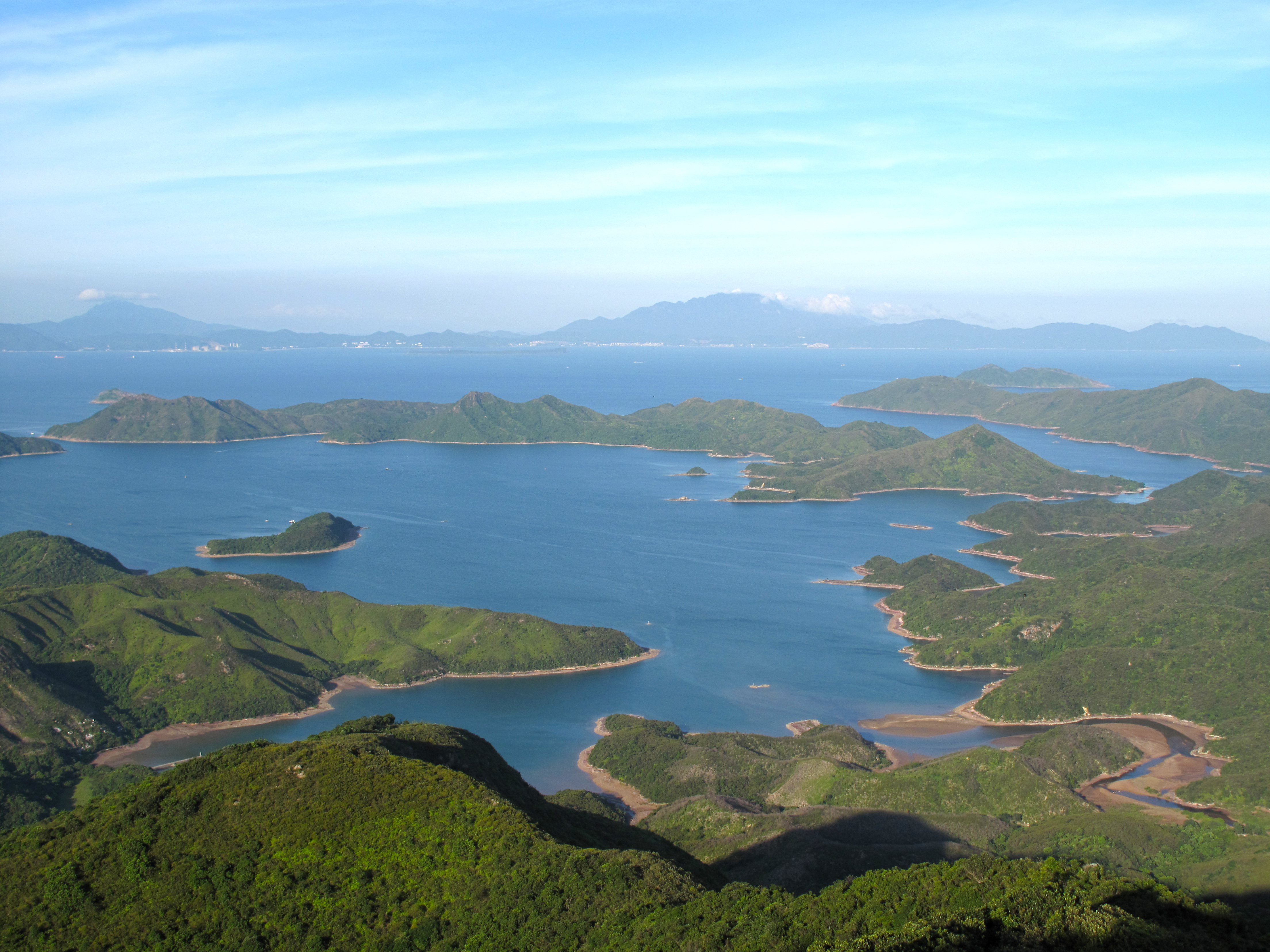
 Double Haven or Yan Chau Tong () is a harbour enclosed by Double Island,
Serene and picturesque marine park - Yan Chau Tong
Ports and harbours of Hong Kong North District, Hong Kong Hong Kong UNESCO Global Geopark {{HongKong-protected-area-stub
 Double Haven or Yan Chau Tong () is a harbour enclosed by Double Island,
 Crescent Island
Crescent Island () is a small, roughly crescent-shaped island lying close south of Mollyhawk Island in the Bay of Isles, South Georgia. It was roughly charted in 1912–13 by Robert Cushman Murphy. It was surveyed and named in 1929–30 by Disco ...
and Crooked Island within the north-eastern New Territories of Hong Kong. It is known for its scenery and natural environment, and for the calm seas from which its English name derives. Double Haven contains many deep red coloured rocks because of iron oxide.
Villages in Double Haven
*Lai Chi Wo
Lai Chi Wo is a Hakka village near Sha Tau Kok, in the northeastern New Territories of Hong Kong. It is described as a "walled village" by some sources. Lai Chi Wo is located within Plover Cove Country Park and near Yan Chau Tong Marine Park.
...
()
* Sam A Tsuen
Sam A () is a village in the northeastern New Territories of Hong Kong, named after the bay of Sam A Wan ().
Administration
Sam A is a recognized village under the New Territories Small House Policy.
History
The Tsang () of Sam A have the sa ...
()
* Kat O ()
Islands
Islands within Double Haven include: * Chap Mo Chau * Double Island (Wong Wan Chau) * Fu Wong Chau * Kat O (Crooked Island) *Ngo Mei Chau
Crescent Island or Ngo Mei Chau () is an island of Hong Kong, located southeast of Crooked Island (Kat O) and northeast of Double Island (Wong Wan Chau). Administratively, it is part of North District.
Conservation
Crescent Island has been part ...
(Crescent Island)
* Pak Ka Chau
* Yan Chau
Conservation
Parts of the haven fall within Yan Chau Tong Marine Park () to protect the wildlife of the marine creatures. Plover Cove (Extension) Country Park was designated in 1979 to protect the ecology of Double Haven. It also forms a major part ofHong Kong Global Geopark
Hong Kong UNESCO Global Geopark (), formerly Hong Kong National Geopark (香港國家地質公園), was inaugurated on 3 November 2009. It is a single entity of land area over 150 km2 across parts of the eastern and northeastern New Territo ...
, Northeast New Territories Sedimentary Rock Region.The two main ecological features of this area are mangroves and seagrass beds, which are a nursery for marine life.
The Double Haven Special Area
Double Haven or Yan Chau Tong () is a harbour enclosed by Double Island, Crescent Island and Crooked Island within the north-eastern New Territories of Hong Kong. It is known for its scenery and natural environment, and for the calm seas from w ...
() covers 0.8 hectare and was designated in 2011. It includes the islets Pak Ka Chau, Yan Chau (both within Double Haven) as well as the islet of Ap Lo Chun and a part of Ap Chau (both within Crooked Harbour). The geology of the area is characterised by sedimentary rocks of the Jurassic and Cretaceous periods.
Transportation
* A ferry service runs between Ma Liu Shui Ferry Pier, which sails across Double Haven on Sunday and public holidays. * A hiking route from Wu Kau Tang toLai Chi Wo
Lai Chi Wo is a Hakka village near Sha Tau Kok, in the northeastern New Territories of Hong Kong. It is described as a "walled village" by some sources. Lai Chi Wo is located within Plover Cove Country Park and near Yan Chau Tong Marine Park.
...
overlooks Double Haven.
See also
*Hong Kong Global Geopark
Hong Kong UNESCO Global Geopark (), formerly Hong Kong National Geopark (香港國家地質公園), was inaugurated on 3 November 2009. It is a single entity of land area over 150 km2 across parts of the eastern and northeastern New Territo ...
* Plover Cove (Extension) Country Park
* Crooked Harbour
References
External links
Serene and picturesque marine park - Yan Chau Tong
Ports and harbours of Hong Kong North District, Hong Kong Hong Kong UNESCO Global Geopark {{HongKong-protected-area-stub