Williams Hills on:
[Wikipedia]
[Google]
[Amazon]
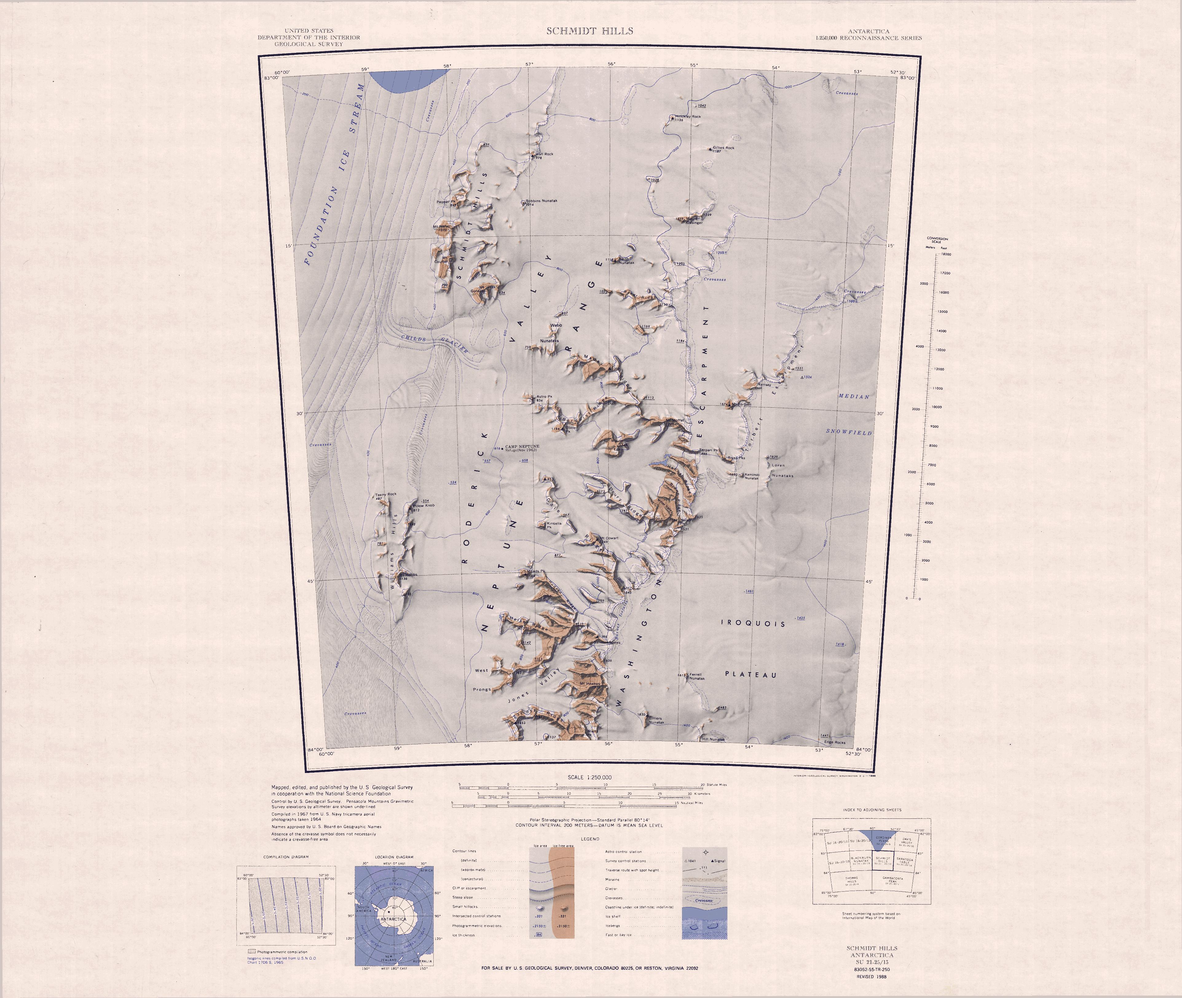
Williams Hills () is a compact group of hills, long, located south of
 The Williams Hills are in the southwest of the Neptune Range on the east side of the
Childs Glacier
Childs Glacier () is a glacier in the Neptune Range of the Pensacola Mountains, draining westward from Roderick Valley to enter Foundation Ice Stream. It was mapped by the United States Geological Survey from surveys and from U.S. Navy air ph ...
and west of Roderick Valley
Schmidt Hills () is a group of rock hills, long, lying north of Childs Glacier and west of Roderick Valley in the Neptune Range of the Pensacola Mountains, Antarctica.
Mapping and name
The Schmidt Hills were mapped by the United States Geolog ...
in the Neptune Range, Pensacola Mountains
The Pensacola Mountains are a large group of mountain ranges of the Transantarctic Mountains System, located in the Queen Elizabeth Land region of Antarctica.
Geography
They extend 450 km (280 mi) in a NE-SW direction. Subranges of the ...
, Antarctica.
Mapping and name
The Williams Hills were mapped by the United States Geological Survey (USGS) from surveys and United States Navy air photographs in 1956–1966. They were named by the United StatesAdvisory Committee on Antarctic Names
The Advisory Committee on Antarctic Names (ACAN or US-ACAN) is an advisory committee of the United States Board on Geographic Names responsible for recommending commemorative names for features in Antarctica.
History
The committee was established ...
(US-ACAN) for Paul L. Williams, USGS geologist with the Neptune Range field party in 1963–64.
Location
 The Williams Hills are in the southwest of the Neptune Range on the east side of the
 Foundation Ice Stream
Foundation Ice Stream is a major ice stream in Antarctica's Pensacola Mountains. The ice stream drains northward for along the west side of the Patuxent Range and the Neptune Range to enter the Ronne Ice Shelf westward of Dufek Massif. The Unit ...
.
They are south of the Schmidt Hills and west of the southern end of the Washington Escarpment, from which they are separated by the Roderick Valley.
Named features include, from south to north, Mount Hobbs, Pillow Knob and Teeny Rock.
Features
Mount Hobbs
. A mountain, high, the highest summit of Williams Hills. Named by US-ACAN for Ens. James W. Hobbs, United States Navy, of the Ellsworth Station winter party, 1958.Pillow Knob
. A peak, high, protruding through the snow cover at the northeast end of Williams Hills. The descriptive name was suggested by Dwight L. Schmidt, USGS geologist to these mountains, 1962–1966.Teeny Rock
. A small rock at the northwest end of Williams Hills. The name by US-ACAN alludes to the small size of the feature.References
Sources
* * *{{Include-USGov , agency=United States Geological Survey Hills of Queen Elizabeth Land Pensacola Mountains