Westfield, Cumbernauld on:
[Wikipedia]
[Google]
[Amazon]


 Westfield is an area of the town of


 Westfield Road runs from the Craiglinn Roundabout near Broadwood Farm to Deerdykes Roundabout on Mollins Road which is at the border between North Lanarkshire and


 Westfield is an area of the town of
 Cumbernauld
Cumbernauld (; gd, Comar nan Allt, meeting of the streams) is a large town in the historic county of Dunbartonshire and council area of North Lanarkshire, Scotland. It is the tenth most-populous locality in Scotland and the most populated t ...
in Scotland
Scotland (, ) is a country that is part of the United Kingdom. Covering the northern third of the island of Great Britain, mainland Scotland has a border with England to the southeast and is otherwise surrounded by the Atlantic Ocean to the ...
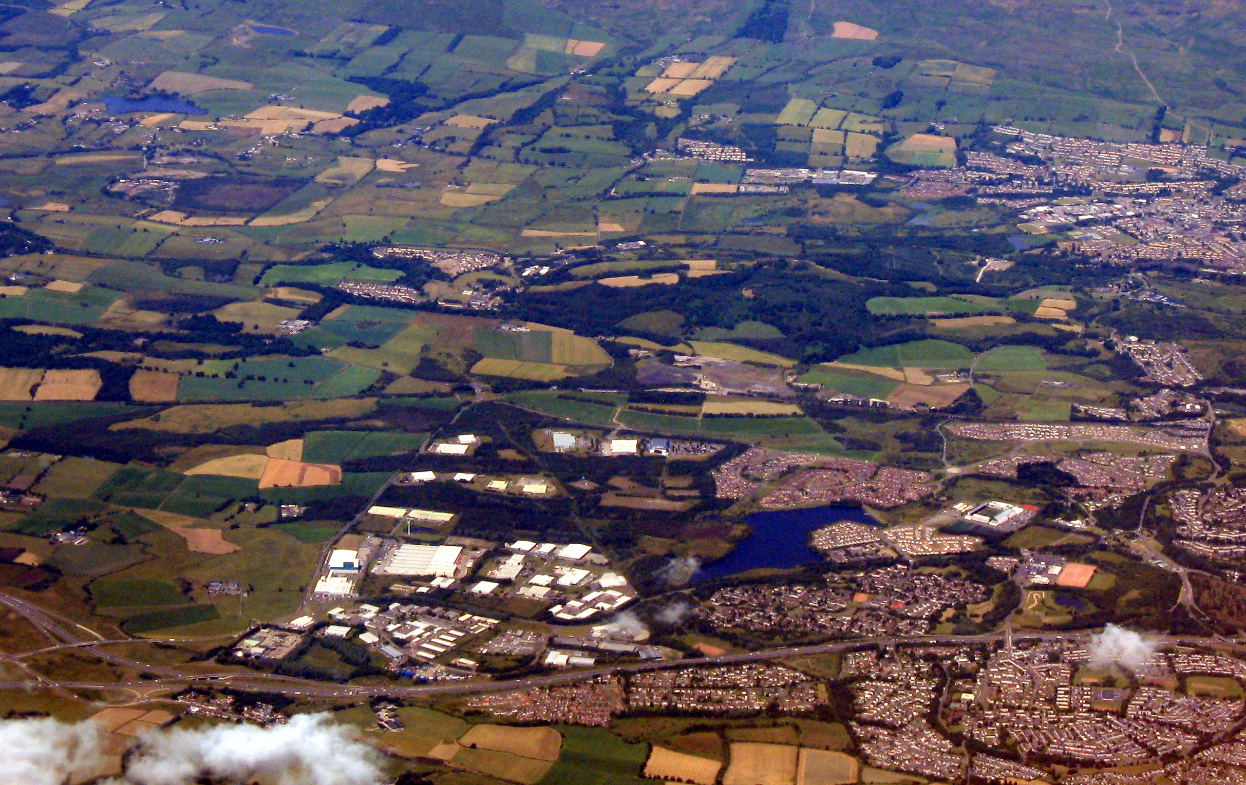
. Westfield is a popular residential area originally built by Cumbernauld Development Corporation in the late 1970s and early 1980s (construction began 1975). It comprises a residential area and a large industrial estate.
Historically there was a farm at Westfield as shown on Roy's map of the Lowlands and the 1st 25 inch Ordnance Survey Map of Scotland.
It is located near Condorrat
Condorrat is a former village in North Lanarkshire, Scotland. Like Luggiebank, Castlecary and Dullatur, it predates the new town of Cumbernauld, but unlike those Condorrat was officially included in the designated new town area. Since then it has ...
and Broadwood Stadium
Broadwood Stadium is a multi-use community stadium and sports complex in the Westfield area of Cumbernauld, North Lanarkshire. The stadium is currently the home of Cumbernauld Colts and Open Goal Broomhill of the Scottish Lowland Football Lea ...
, home of Clyde FC
Clyde Football Club is a Scottish semi-professional football club who play in Scottish League One. Formed in 1877 at the River Clyde in Glasgow, the club host their home matches at New Douglas Park, having played at Broadwood Stadium from 199 ...
. Historically, there were two local primary schools, St Francis of Assisi Primary School and Westfield Primary School. St. Francis of Assisi Primary School closed in 2009. The site has been re-developed by North Lanarkshire Council with new, high quality social housing available to rent. The new street is named Netherinch Way. Westfield also has other modern, private developments for example a new Bellway Housing development sits near Broadwood stadium along with a neighboring housing development. Westfield has a selection of frequent bus services to Airdrie, Cumbernauld Town Centre, Glasgow
Glasgow ( ; sco, Glesca or ; gd, Glaschu ) is the most populous city in Scotland and the fourth-most populous city in the United Kingdom, as well as being the 27th largest city by population in Europe. In 2020, it had an estimated popul ...
, Kilsyth
Kilsyth (; Scottish Gaelic ''Cill Saidhe'') is a town and civil parish in North Lanarkshire, roughly halfway between Glasgow and Stirling in Scotland. The estimated population is 9,860. The town is famous for the Battle of Kilsyth and the relig ...
and Kirkintilloch
Kirkintilloch (; sco, Kirkintulloch; gd, Cair Cheann Tulaich) is a town and former barony burgh in East Dunbartonshire, Scotland. It lies on the Forth and Clyde Canal and on the south side of Strathkelvin, about northeast of central Glasgow. ...
with buses operated by David Allan Coaches, First Group & McGills. In 2017 plans for a new retail park near Broadwood Studium were approved.
Westfield Road and Industrial Estates


 Westfield Road runs from the Craiglinn Roundabout near Broadwood Farm to Deerdykes Roundabout on Mollins Road which is at the border between North Lanarkshire and
 East Dumbartonshire
East Dunbartonshire ( sco, Aest Dunbartanshire; gd, Siorrachd Dhùn Bhreatainn an Ear) is one of the 32 council areas of Scotland. It borders the north of Glasgow and contains many of the affluent areas to the north of the city, including Bear ...
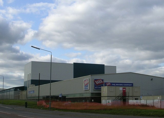
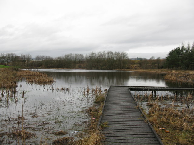
. South of Westfield Road are St. Maurice's High School, St Maurice's Pond, the residential area around Westfield Drive and the industrial area around Deerdykes Road. North of Westfield Road are Broadwood and Collingwood with the residential area around Smithstone and Blackwood north of them. West of the residential areas are industrial areas around Orchardton Road, Drum Mains Park, Little Drum Road and Hunt Hill. Barr's Irn-Bru may be the best known product from this area of Cumbernauld.
Westfield is located with good access to the M80 and M73, which provides links to Glasgow, Falkirk
Falkirk ( gd, An Eaglais Bhreac, sco, Fawkirk) is a large town in the Central Lowlands of Scotland, historically within the county of Stirlingshire. It lies in the Forth Valley, northwest of Edinburgh and northeast of Glasgow.
Falkirk had a ...
, Stirling and Edinburgh
Edinburgh ( ; gd, Dùn Èideann ) is the capital city of Scotland and one of its 32 Council areas of Scotland, council areas. Historically part of the county of Midlothian (interchangeably Edinburghshire before 1921), it is located in Lothian ...
.
References
{{Areas of Cumbernauld Areas of Cumbernauld