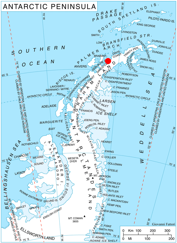
Valdivia Point on:
[Wikipedia]
[Google]
[Amazon]
 Valdivia Point () is a point forming both the northwest side of the entrance to Salvesen Cove and the north extremity of
SCAR Composite Gazetteer of Antarctica
Headlands of Graham Land Danco Coast {{DancoCoast-geo-stub
Pefaur (Ventimiglia) Peninsula
Pefaur (Ventimiglia) Peninsula is the heavily glaciated peninsula projecting 11 km in northwest direction from Danco Coast on the west side of Antarctic Peninsula. Bounded by Hughes Bay to the northeast and Charlotte Bay to the south, and separa ...
on Danco Coast
The Danco Coast () is the portion of the west coast of the Antarctic Peninsula between Cape Sterneck and Cape Renard. This coast was explored in January and February 1898 by the Belgian Antarctic Expedition under Adrien de Gerlache, who named it f ...
, Graham Land
Graham Land is the portion of the Antarctic Peninsula that lies north of a line joining Cape Jeremy and Cape Agassiz. This description of Graham Land is consistent with the 1964 agreement between the British Antarctic Place-names Committee and ...
in Antarctica
Antarctica () is Earth's southernmost and least-populated continent. Situated almost entirely south of the Antarctic Circle and surrounded by the Southern Ocean, it contains the geographic South Pole. Antarctica is the fifth-largest contine ...
. Charted and named ''Valdivia Insel'', after the German ship Valdivia, by the Swedish Antarctic Expedition
The Swedish Antarctic Expedition of 1901–1903 was a scientific expedition led by Otto Nordenskjöld and Carl Anton Larsen. It was the first Swedish endeavour to Antarctica in the Heroic Age of Antarctic Exploration.
Background
Otto Nordensk ...
under Nordenskjold, 1901–04. Air photos taken by the Falkland Islands and Dependencies Aerial Survey Expedition
The Falkland Islands and Dependencies Aerial Survey Expedition (FIDASE) was an aerial survey of the Falkland Islands Dependencies and the Antarctic peninsula which took place in the 1955–56 and 1956–57 southern summers.
Funded by the Colonial ...
(FIDASE) in 1956-57 show the feature to be joined to the mainland.
Map
* British Antarctic Territory. Scale 1:200000 topographic map. DOS 610 Series, Sheet W 64 60. Directorate of Overseas Surveys, Tolworth, UK, 1978.References
SCAR Composite Gazetteer of Antarctica
Headlands of Graham Land Danco Coast {{DancoCoast-geo-stub