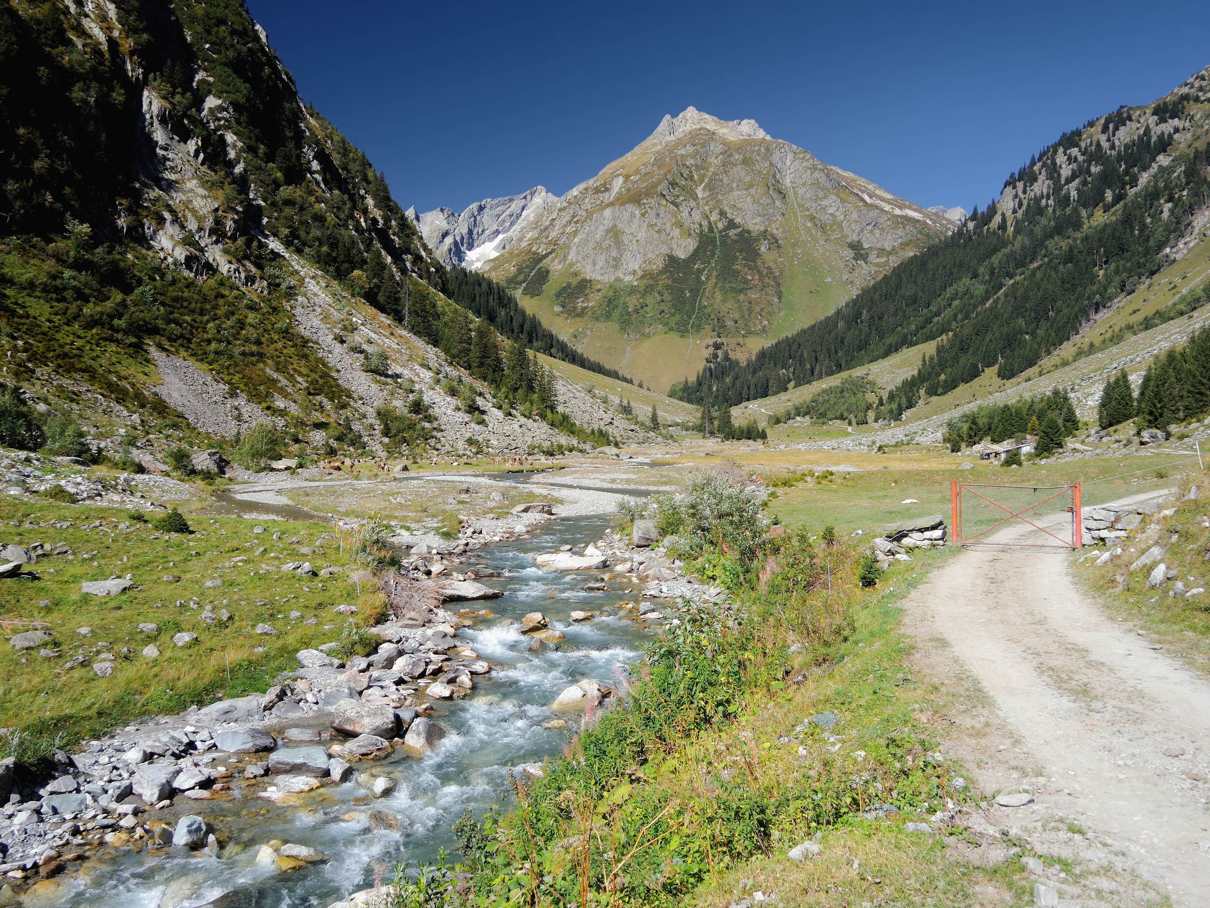
Val Russein on:
[Wikipedia]
[Google]
[Amazon]
 The Val Russein is a valley of the
 The Val Russein is a valley of the
 Swiss Alps
The Alpine region of Switzerland, conventionally referred to as the Swiss Alps (german: Schweizer Alpen, french: Alpes suisses, it, Alpi svizzere, rm, Alps svizras), represents a major natural feature of the country and is, along with the Swiss ...
, located south of the Tödi Group in Graubünden. The valley is drained by the ''Aua da Russein'', a tributary of the Vorderrhein
The Vorderrhein (German; English: ''Anterior Rhine''; Sursilvan: ; Sutsilvan: ''Ragn Anteriur''; Rumantsch Grischun, Vallader, and Puter: ''Rain Anteriur''; Surmiran: ''Ragn anteriour'') is one of the two sources of the Rhine. Its catchment area ...
, near Cumpadials
Cumpadials is the smallest of the four villages in the municipality of Sumvitg, Graubünden, Switzerland. It has a station on the Disentis
Disentis (German) or Mustér (, Romansh), with its official name Disentis/Mustér is a village and a mun ...
(962 m). The Val Russein belongs to the municipalities of Disentis
Disentis (German) or Mustér (, Romansh), with its official name Disentis/Mustér is a village and a municipality in the Surselva Region in the Swiss canton of Graubünden.
The skiing and summer tourism resort high up in the Rhine valley is th ...
and Sumvitg
Sumvitg (; german: Somvix) is a municipality in the Surselva Region in the canton of Graubünden in Switzerland.
History
Sumvitg is first mentioned in 1175 as ''in Summovico''.
Geography
Sumvitg has an area, , of . Of this area, 24.8% is us ...
.
Three valleys converge at Alp Cavrein (1,575 m) to form the main Val Russein: Val Cavadiras, Val Gronda da Cavrein and Val Gronda da Russein. The entire valley is approximately 10 kilometres long.
The Val Russein includes some of the highest mountains in the canton of Graubünden outside the Bernina Range
The Bernina Range is a mountain range in the Alps of eastern Switzerland and northern Italy. It is considered to be part of the Rhaetian Alps within the Central Eastern Alps. It is one of the highest ranges of the Alps, covered with many glaciers. ...
. The highest mountain is the Tödi
The Tödi (), is a mountain massif and with the mountain peak Piz Russein the highest mountain in the Glarus Alps and the highest summit in the canton of Glarus, Switzerland. It is located on the border between the cantons of Graubünden, to the ...
(also named ''Piz Russein'') with a height of 3,614 metres above sea level. Other high summits overlooking the valley are Piz Urlaun
Piz Urlaun is a mountain of the Glarus Alps, located on the border between the Swiss cantons of Glarus and Graubünden. It lies on the ridge between the Tödi
The Tödi (), is a mountain massif and with the mountain peak Piz Russein the highe ...
(3,359 m), Düssi
, photo= Maderanertal04.jpg
, photo_caption= The Düssi from the Maderanertal
, elevation_m= 3256
, elevation_ref=
, prominence_m= 429
, prominence_ref=Retrieved from the Swisstopo topographic maps. The key col is the Fuorcla Val Pintga (2 ...
(3,256 m) and Piz Cambrialas
Piz Cambrialas (3,208 m) is a mountain of the Glarus Alps, overlooking the Val Russein in the Swiss canton of Graubünden.
The mountain lies in the range between the Maderanertal and the Val Russein and has two summits of nearly-identical heig ...
(3,208 m). The Val Russein is connected to the canton of Uri Uri may refer to:
Places
* Canton of Uri, a canton in Switzerland
* Úri, a village and commune in Hungary
* Uri, Iran, a village in East Azerbaijan Province
* Uri, Jammu and Kashmir, a town in India
* Uri (island), an island off Malakula Islan ...
by the Fuorcla Cavadiras (2,609 m) and to the canton of Glarus
, neighboring_municipalities= Glarus Nord, Glarus Süd, Muotathal (SZ), Innerthal (SZ)
, twintowns= Wiesbaden-Biebrich (Germany)
}
Glarus (; gsw, Glaris; french: Glaris; it, Glarona; rm, Glaruna) is the capital of the canton of Glarus in S ...
by the Sandpass (2,781 m).
A small hydroelectric dam is located at Barcuns Dadens, at an elevation of 1,362 metres. At the bottom of the valley, the river is crossed by a road bridge and a rail viaduct.
References
*Swisstopo
Swisstopo is the official name for the Swiss Federal Office of Topography (in German language, German: ''Bundesamt für Landestopografie''; French language, French: ''Office fédéral de topographie''; Italian language, Italian: ''Ufficio fed ...
maps
Valleys of the Alps
Valleys of Graubünden
{{Graubünden-geo-stub