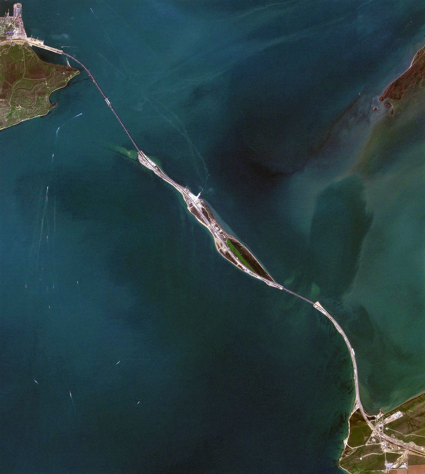
Tuzla Spit on:
[Wikipedia]
[Google]
[Amazon]
__NOTOC__
Tuzla Spit or Kosa Tuzla (russian: Тузлинская коса, Коса Тузла, uk, Коса Тузла) was a long narrow Mys Tuzla, Krasnodarskiy Kray, Russia
Mindat.org to the north-west in the direction of the city

«Остров Тузла»
— Севастополь «ОК», № 1-2, 2000 г.
— Тамань. Ру > Фотогалерея > Коса Тузла
Фотография окончания искусственной косы с воздуха
* ttp://mapl37.narod.ru/map2/index25.html Лист карты L-37-XXV Аршинцево. Масштаб: 1:200 000. Издание 1982 г. Destroyed landforms Spits of the sea of Azov Spits of Crimea Spits of Krasnodar Krai Kerch Strait
peninsula
A peninsula (; ) is a landform that extends from a mainland and is surrounded by water on most, but not all of its borders. A peninsula is also sometimes defined as a piece of land bordered by water on three of its sides. Peninsulas exist on all ...
or sandy spit in the eastern part of the Strait of Kerch
The Kerch Strait, uk, Керченська протока, crh, Keriç boğazı, ady, Хы ТӀуалэ is a strait in Eastern Europe. It connects the Black Sea and the Sea of Azov, separating the Kerch Peninsula of Crimea in the west f ...
which extended from Mindat.org to the north-west in the direction of the city
Kerch
Kerch ( uk, Керч; russian: Керчь, ; Old East Slavic: Кърчевъ; Ancient Greek: , ''Pantikápaion''; Medieval Greek: ''Bosporos''; crh, , ; tr, Kerç) is a city of regional significance on the Kerch Peninsula in the east of t ...
for almost .
History
In 1925 the spit was cut by a storm, formingTuzla Island
Tuzla Island (, , crh, Тузла; from Turkish "tuzla" – salty, saline, literally: ''saltpan'') is a sandy islet in the form of a spit located in the middle of the Strait of Kerch between the Kerch Peninsula in the west and the Taman Pe ...
. The open-water channel between Tuzla Island and the Russian mainland where the spit had previously existed reached over a kilometer in width.
Tuzla Spit consisted of the Tuzla Island () and two small islands on the Russia
Russia (, , ), or the Russian Federation, is a List of transcontinental countries, transcontinental country spanning Eastern Europe and North Asia, Northern Asia. It is the List of countries and dependencies by area, largest country in the ...
n side ( and ), and a narrow sand bar connecting them all. The two small islands were re-connected to each other by the 2003 construction by Russia of the 4.1 km long Tuzla dam ().
The Tuzla Spit formed the southern shore of the Taman Bay
The Taman Bay ( Russian: Таманский залив) is a shallow bay or gulf on the east coast of the Strait of Kerch shaped on the southern side by the Tuzla Spit and to the north by the Chushka Spit. It dips into the Taman Peninsula of Kras ...
; the northern shore is the Chushka Spit
__NOTOC__
The Chushka Spit (russian: Коса Чушка) is a sandy spit in the northern part of the Strait of Kerch which extends from Cape Achilleion to the south-west in the direction of the Black Sea for almost . Administratively, it belong ...
.Crimean bridge
The remnants of the Tuzla Spit were utilized in the building of theCrimean Bridge
The Crimean Bridge ( rus, Крымский мост, r=Krymskiy most, p=ˈkrɨmskʲij most), also called Kerch Strait Bridge or Kerch Bridge, is a pair of parallel bridges, one for a four-lane road and one for a double-track railway, spanning t ...
.

See also
*Spits of Azov Sea
__NOTOC__
The Spits of the Sea of Azov are narrow strips of land in the Sea of Azov which can be as long as 112 km (Arabat Spit, the world's longest spit), 45 km (Fedotov Spit), 31 km (Achuevsk Spit), 30 km (Obitochna Spit) an ...
* Dolgaya Spit
The Dolgaya Spit or Kosa Dolgaya (russian: Коса Долгая) is a sandy spit in the Sea of Azov.Arabat Spit
The Arabat Spit ( uk, Арабатська коса; russian: Арабатская коса) or Arabat Arrow is a barrier spit that separates the large, shallow and very salty Syvash lagoons from the Sea of Azov. The spit runs between the Hen ...
References
{{commonscategory, Tuzla Spit, position=leftExternal links
«Остров Тузла»
— Севастополь «ОК», № 1-2, 2000 г.
— Тамань. Ру > Фотогалерея > Коса Тузла
Фотография окончания искусственной косы с воздуха
* ttp://mapl37.narod.ru/map2/index25.html Лист карты L-37-XXV Аршинцево. Масштаб: 1:200 000. Издание 1982 г. Destroyed landforms Spits of the sea of Azov Spits of Crimea Spits of Krasnodar Krai Kerch Strait