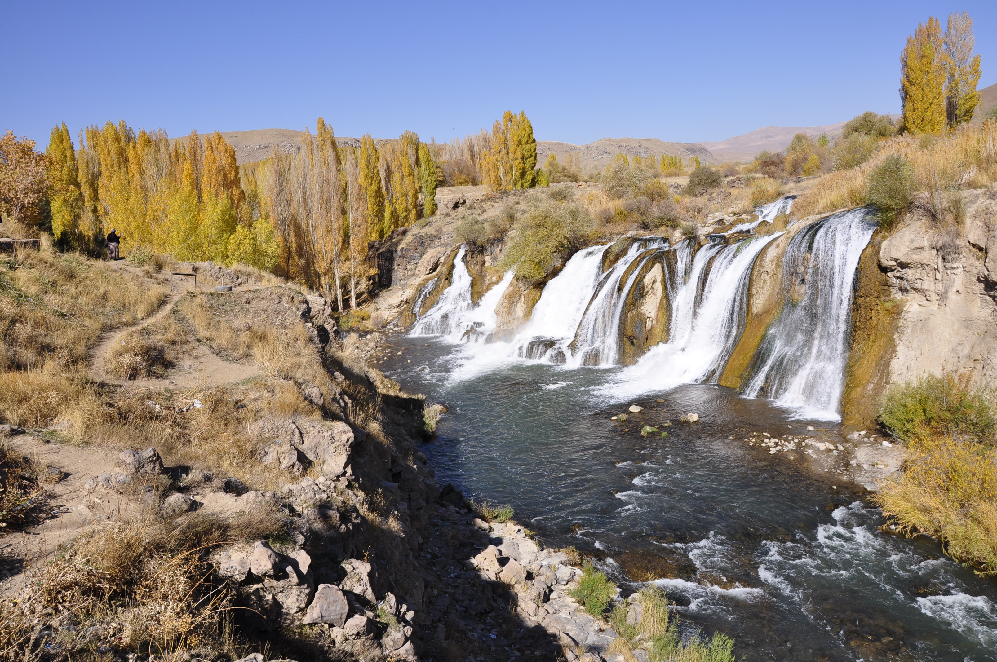
Tortum Waterfall on:
[Wikipedia]
[Google]
[Amazon]
The Tortum Waterfall is the tallest waterfall in Turkey. Since the completion of the Tortum Dam and 
 A recreation area around the waterfall with an observation platform allows visitors a close sightline to the waterfall. A staircase leads underneath the waterfall. After the waterfall (with its drop of ), the river flows over a series of cascades until its arrival in the Tev Valley.

www.baliklikoyu.com
{{Waterfalls of Turkey Waterfalls of Turkey Landforms of Erzurum Province Tourist attractions in Erzurum Province Landslide-dammed lakes Lakes of Turkey
Hydroelectric
Hydroelectricity, or hydroelectric power, is electricity generated from hydropower (water power). Hydropower supplies one sixth of the world's electricity, almost 4500 TWh in 2020, which is more than all other renewable sources combined and ...
Plant in 1960, water is drawn from Tortum Lake through channels and tunnels, and allowed to rush down into the turbines. The waterfall is fed only from the surplus water and thus now functions only for a very short period during the months of May and June when the water level of the lake is exceptionally high. During the other months the bed of the waterfall is almost dry. The lake and waterfall are located in the Tortum
Tortum ( ota, تورتوم) is a town and district of Erzurum Province in the Eastern Anatolia Region of Turkey. The population is 4,507 as of 2010. The current mayor is Muammer Yiğider from the Great Unity Party (BBP).
History
Tortum was par ...
district, north of Erzurum
Erzurum (; ) is a city in eastern Anatolia, Turkey. It is the largest city and capital of Erzurum Province and is 1,900 meters (6,233 feet) above sea level. Erzurum had a population of 367,250 in 2010.
The city uses the double-headed eagle as ...
in Eastern Anatolia Region
The Eastern Anatolia Region ('' tr, Doğu Anadolu Bölgesi'') is a geographical region of Turkey. The most populous province in the region is Van Province. Other populous provinces are Malatya, Erzurum and Elazığ.
It is bordered by the Black ...
.
Tortum Lake
The lake, long and wide, was formed as the result of alandslide
Landslides, also known as landslips, are several forms of mass wasting that may include a wide range of ground movements, such as rockfalls, deep-seated grade (slope), slope failures, mudflows, and debris flows. Landslides occur in a variety of ...
, which blocked the valley though which the Tortum River flowed. At the same time, the water sought a new outlet over a fault with a drop of . The hollow left in the Kemerlidağ slope on the left of the valley by the fall of rock is still clearly visible. Tortum Lake is surrounded by limestone
Limestone ( calcium carbonate ) is a type of carbonate sedimentary rock which is the main source of the material lime. It is composed mostly of the minerals calcite and aragonite, which are different crystal forms of . Limestone forms whe ...
marls of the Cretaceous period
The Cretaceous ( ) is a geological period that lasted from about 145 to 66 million years ago (Mya). It is the third and final period of the Mesozoic Era, as well as the longest. At around 79 million years, it is the longest geological period of t ...
. Earth pillars can be seen on the eastern shores of the lake. The view of the lake from the steep slopes along the edge is scenic. The maximum depth of the lake is . The lake lies about above sea level.
Some geologist
A geologist is a scientist who studies the solid, liquid, and gaseous matter that constitutes Earth and other terrestrial planets, as well as the processes that shape them. Geologists usually study geology, earth science, or geophysics, althou ...
s claim that this landslide is a very old one. These experts, among whom are to be counted a number of foreign geologists, believe that the landslide took place at the end of the Quaternary period
The Quaternary ( ) is the current and most recent of the three period (geology), periods of the Cenozoic era (geology), Era in the geologic time scale of the International Commission on Stratigraphy (ICS). It follows the Neogene Period and spa ...
. Other opinions state that the landslide is comparatively recent and occurred only a few centuries ago.
 A recreation area around the waterfall with an observation platform allows visitors a close sightline to the waterfall. A staircase leads underneath the waterfall. After the waterfall (with its drop of ), the river flows over a series of cascades until its arrival in the Tev Valley.
Smaller lakes
Four small lakes were formed on the rubble from the landslide by water seeping from underground through the material from the rock fall. The water of these lakes is remarkably clear and blue. These four lakes, Incegöl, Karagöl, Efendigilin Gölü and Nazlıgilin Gölü, contain large quantities oftrout
Trout are species of freshwater fish belonging to the genera '' Oncorhynchus'', ''Salmo'' and ''Salvelinus'', all of the subfamily Salmoninae of the family Salmonidae. The word ''trout'' is also used as part of the name of some non-salmoni ...
.
External links
www.baliklikoyu.com
{{Waterfalls of Turkey Waterfalls of Turkey Landforms of Erzurum Province Tourist attractions in Erzurum Province Landslide-dammed lakes Lakes of Turkey