Tiu Chung Chau on:
[Wikipedia]
[Google]
[Amazon]


 Jin Island or Tiu Chung Chau () is an island in the
 Jin Island or Tiu Chung Chau () is an island in the
 Port Shelter
Port Shelter, known in Cantonese as Ngau Mei Hoi (), is a harbour south of Sai Kung Peninsula in Hong Kong. The water body connects to Inner Port Shelter (known in Cantonese as Sai Kung Hoi; ), as well as Hebe Haven (), Rocky Harbour () and oth ...
, the New Territories
The New Territories is one of the three main regions of Hong Kong, alongside Hong Kong Island and the Kowloon Peninsula. It makes up 86.2% of Hong Kong's territory, and contains around half of the population of Hong Kong. Historically, it ...
, Hong Kong. Administratively it is part of the Sai Kung District
Sai Kung District is one of the 18 districts of Hong Kong, a special administrative region of China. The district comprises the southern half of the Sai Kung Peninsula, the Clear Water Bay Peninsula in the New Territories and a strip of lan ...
.
Geography
Jin Island is located south of the larger island ofKau Sai Chau
Kau Sai Chau is an island located off the coast of Sai Kung Peninsula, Hong Kong, with an area of 6.70km², making it the 6th largest island of Hong Kong. It is under the administration of Sai Kung District.
The island was formerly known a ...
, from which it is separated by a narrow channel. The island has a maximum elevation of 216 m and an area of 1.8 km2. The smaller Bay Islet
Bay Islet or See Chau () is an uninhabited island in Sai Kung District, Hong Kong.
Geography
Bay Islet is located in Rocky Harbour, also known as Leung Shuen Wan Hoi, and is separated from Jin Island by the See Chau Mun
See or SEE may refer to: ...
(See Chau) is located off its eastern coast, from which it is separated by the channel See Chau Mun ().
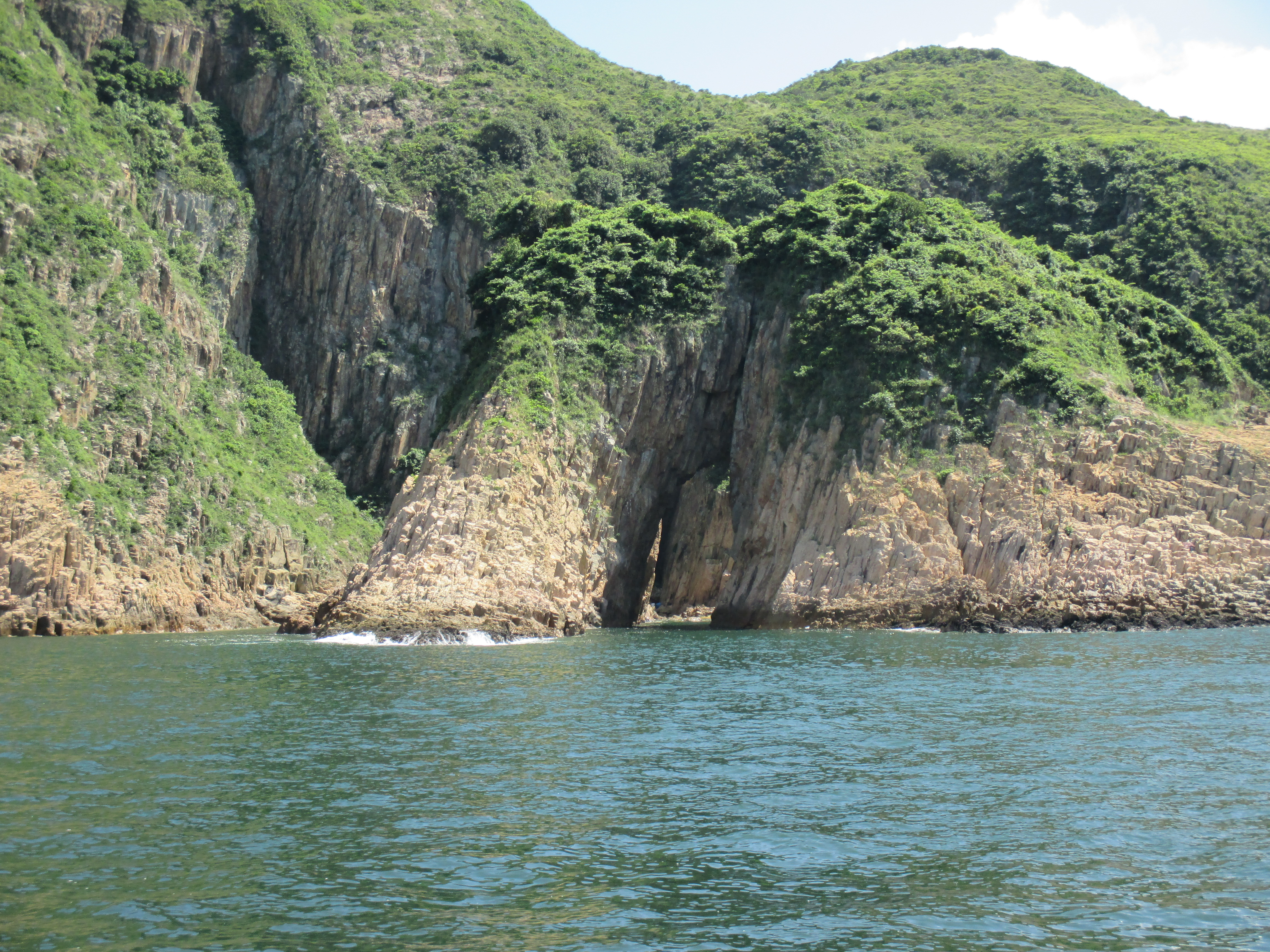
Because of exposure to the easterly winds and sea waves, landforms such as sea caves, stacks, arches and inlets add to the natural landscape of Jin Island.
The best-known sea cave in Jin Island is Kam Chung Ngam (), commonly known as Goldfish Wagging Tail (). Tourists can get a perfect shot of the fish shape from the top of the hill.
Conservation
The Ung Kong Group Special Area () covers 176.8 hectares and was designated in 2011. It consists ofBasalt Island
Basalt Island or Fo Shek Chau () is an island of Hong Kong and administratively part of the Sai Kung District. Together with Wang Chau and Bluff Island, it forms the Ung Kong () Group and is part of Hong Kong Global Geopark.
Geography
Basalt I ...
, Bluff Island Bluff Island may refer to the following islands:
*Bluff Island (Andaman and Nicobar Islands)
*Bluff Island (Antarctica), Prydz Bay, Antarctica
*Bluff Island (Hong Kong) Bluff Island, indigenously known as Sha Tong Hau Shan (), also known as Ung Kon ...
, Wang Chau, their surrounding islets, and Kam Chung Ngam in the southern part of Jin Island. The geology of the area is characterised by volcanic rock
Volcanic rock (often shortened to volcanics in scientific contexts) is a rock formed from lava erupted from a volcano. In other words, it differs from other igneous rock by being of volcanic origin. Like all rock types, the concept of volcanic r ...
s of the Cretaceous
The Cretaceous ( ) is a geological period that lasted from about 145 to 66 million years ago (Mya). It is the third and final period of the Mesozoic Era, as well as the longest. At around 79 million years, it is the longest geological period of th ...
periods.
References
Uninhabited islands of Hong Kong Sai Kung District {{HongKong-geo-stub