Tibthorpe on:
[Wikipedia]
[Google]
[Amazon]
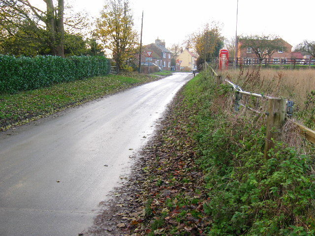
Tibthorpe is a village and  The village has no
"Kirkburn: Geographical and Historical information from the year 1892 (Bulmers')"
(includes Tibthorpe),
civil parish
In England, a civil parish is a type of administrative parish used for local government. It is a territorial designation which is the lowest tier of local government below districts and counties, or their combined form, the unitary authority ...
in the East Riding of Yorkshire
The East Riding of Yorkshire, or simply East Riding or East Yorkshire, is a ceremonial county and unitary authority area in the Yorkshire and the Humber region of England. It borders North Yorkshire to the north and west, South Yorkshire to t ...
, England. According to the 2011 UK census
A census of the population of the United Kingdom is taken every ten years. The 2011 census was held in all countries of the UK on 27 March 2011. It was the first UK census which could be completed online via the Internet. The Office for National ...
, Tibthorpe parish had a population of 157, a decrease on the 2001 UK census
A nationwide census, known as Census 2001, was conducted in the United Kingdom on Sunday, 29 April 2001. This was the 20th UK census and recorded a resident population of 58,789,194.
The 2001 UK census was organised by the Office for National ...
figure of 162.
It is to the west of Driffield
Driffield, also known as Great Driffield, is a market town and civil parish in the East Riding of Yorkshire, England. The civil parish is formed by the town of Driffield and the village of Little Driffield. By road, it is north-east of Leeds ...
on the edge of the Yorkshire Wolds
The Yorkshire Wolds are low hills in the counties of the East Riding of Yorkshire and North Yorkshire in north-eastern England. The name also applies to the district in which the hills lie.
On the western edge, the Wolds rise to an escarpment wh ...
, it lies on the B1248 road
B roads are numbered routes in Great Britain of lesser importance than A roads. See the article Great Britain road numbering scheme
The Great Britain road numbering scheme is a numbering scheme used to classify and identify all roads in G ...
between the villages of Bainton to the south and Wetwang
Wetwang is a Yorkshire Wolds village and civil parish in the East Riding of Yorkshire, England, west of Driffield on the A166 road.
At the 2011 census, it had a population of 761, an increase on the 2001 census figure of 672.
Toponymy
Th ...
to the north. High Wood and Low Wood to the south are a haven for wildlife.
The village has a long history stretching back to before the ''Domesday Book
Domesday Book () – the Middle English spelling of "Doomsday Book" – is a manuscript record of the "Great Survey" of much of England and parts of Wales completed in 1086 by order of King William I, known as William the Conqueror. The manusc ...
'' when it was known as Tibetorp. It is recorded that centuries ago monks from Watton Abbey pastured sheep around the village and could rest at a 'chapel of ease' located in the village.
 The village has no
 pub
A pub (short for public house) is a kind of drinking establishment which is licensed to serve alcoholic drinks for consumption on the premises. The term ''public house'' first appeared in the United Kingdom in late 17th century, and was ...
, school or church. There was once a Methodist Chapel, built in 1823, that was demolished some years ago, along with a number of 18th century cottages, during road construction.
In the past several small businesses flourished in the village, including a cobbler
Cobbler(s) may refer to:
*A person who repairs, and sometimes makes, shoes
Places
* The Cobbler, a mountain located near the head of Loch Long in Scotland
* Mount Cobbler, Australia
Art, entertainment and media
* ''The Cobbler'' (1923 film) ...
, a fishmonger, a milkman, a butcher and a fruiterer as well as a village store and blacksmith
A blacksmith is a metalsmith who creates objects primarily from wrought iron or steel, but sometimes from #Other metals, other metals, by forging the metal, using tools to hammer, bend, and cut (cf. tinsmith). Blacksmiths produce objects such ...
.
References
*External links
"Kirkburn: Geographical and Historical information from the year 1892 (Bulmers')"
(includes Tibthorpe),
Genuki GENUKI is a genealogy web portal, run as a charitable trust. It "provides a virtual reference library of genealogical information of particular relevance to the UK and Ireland". It gives access to a large collection of information, with the emphas ...
.org.uk. Retrieved 16 April 2012
*
{{authority control
Villages in the East Riding of Yorkshire
Civil parishes in the East Riding of Yorkshire