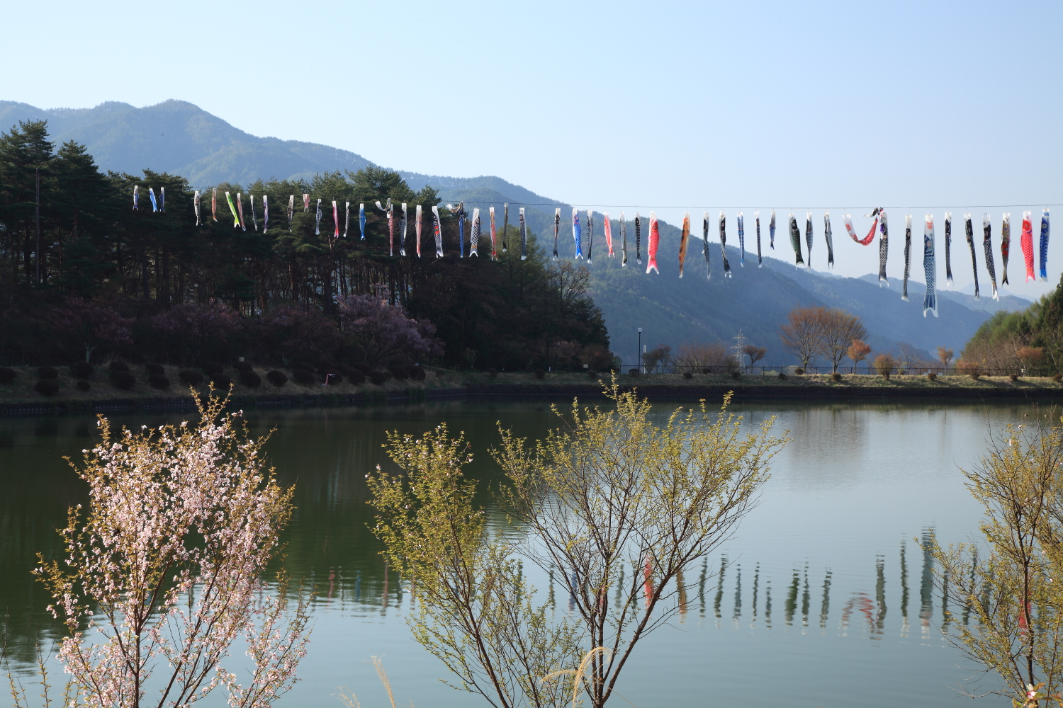
Tatsuno, Nagano on:
[Wikipedia]
[Google]
[Amazon]
 is a town located in


Official Website
Towns in Nagano Prefecture {{Nagano-geo-stub
Nagano Prefecture
is a landlocked prefecture of Japan located in the Chūbu region of Honshū. Nagano Prefecture has a population of 2,052,493 () and has a geographic area of . Nagano Prefecture borders Niigata Prefecture to the north, Gunma Prefecture to the ...
, Japan
Japan ( ja, 日本, or , and formally , ''Nihonkoku'') is an island country in East Asia. It is situated in the northwest Pacific Ocean, and is bordered on the west by the Sea of Japan, while extending from the Sea of Okhotsk in the north ...
. , the town had an estimated population of 18,951 in 7917 households, and a population density of 112 persons per km2. The total area of the town is .
Geography
Tatsuno is located in the Ina Valley of south-central Nagano Prefecture, bordered by the Kiso Mountains. The Tenryū River flows through the town, which is surrounded by mountains and is rich in a natural environment. It is takes about 3 hours from Tokyo, 2 hours from Nagoya, 5 hours from Kyoto by train and equally by car. Part of the town is within the borders of theEnrei Ōjō Prefectural Natural Park
is a Prefectural Natural Park in central Nagano Prefecture, Japan. Established in 1964, the park spans the borders of the municipalities of Okaya, Shiojiri, and Tatsuno.
See also
* National Parks of Japan
National may refer to:
Commo ...
. The Yokokawa Dam
Yokokawa Dam ( ja, 横川ダム) is a dam in the Nagano Prefecture, Japan
Japan ( ja, 日本, or , and formally , ''Nihonkoku'') is an island country in East Asia. It is situated in the northwest Pacific Ocean, and is bordered on the we ...
is located in Tatsuno.
Surrounding municipalities
*Nagano Prefecture ** Okaya ** Suwa ** Shiojiri ** Minamiminowa ** MinowaClimate
The village has a climate characterized by characterized by warm and humid summers, and cold winters ( Köppen climate classification ''Dfa''). The average annual temperature in Tatsuno is . The average annual rainfall is with July as the wettest month. The temperatures are highest on average in August, at around , and lowest in January, at around .History
The area of present-day Tatsuno was part of ancientShinano Province
or is an old province of Japan that is now Nagano Prefecture.
Shinano bordered on Echigo, Etchū, Hida, Kai, Kōzuke, Mikawa, Mino, Musashi, Suruga, and Tōtōmi Provinces. The ancient capital was located near modern-day Matsumoto, whi ...
. The village of Inatomi established on April 1, 1889, by the establishment of the municipalities system, and was elevated to town status on January 1, 1947, changing its name to Tatsuno at that time. The neighboring village of Asahi was annexed on April 1, 1955, followed by Kawashima on September 30, 1956, and Ono on March 31, 1961.
Demographics
Per Japanese census data, the population of Tatsuno has declined slightly in recent decades.Education
Tatsuno has five public elementary schools and five public middle school operated by the town government, and one high school operated the Nagano Prefectural Board of Education. TheShinshu Honan Junior College
200px
is a private junior college in Tatsuno, Nagano, Japan
Japan ( ja, 日本, or , and formally , ''Nihonkoku'') is an island country in East Asia. It is situated in the northwest Pacific Ocean, and is bordered on the west by the Sea ...
is also located in Tatsuno.
Transportation
Railway
*East Japan Railway Company
The is a major passenger railway company in Japan and is the largest of the seven Japan Railways Group companies. The company name is officially abbreviated as JR-EAST or JR East in English, and as in Japanese. The company's headquarters are ...
- Chūō Main Line
The , commonly called the Chūō Line, is one of the major trunk railway lines in Japan. It connects Tokyo and Nagoya, although it is the slowest direct railway connection between the two cities; the coastal Tōkaidō Main Line is slightly faste ...
(old line)
** - -
*Central Japan Railway Company
is the main railway company operating in the Chūbu (Nagoya) region of central Japan. It is officially abbreviated in English as JR Central and in Japanese as JR Tōkai ( ja, JR東海, links=no). ''Tōkai'' is a reference to the geographical ...
- Iida Line
** - - -
Highway
* Chūō Expressway *International relations
* - Waitomo, New Zealand.Local attractions
* : one of the most famous places in Japan for fireflies (called in Japan) every summer. However, the intentional introduction of non-native fireflies and its negative influence on the native fireflies of Tatsuno were highlighted in an academic journal. and several major newspapers. Yomiuri Shimbun (July 28, 2008; evening edition, p13). *Enrei Ōjō Prefectural Natural Park
is a Prefectural Natural Park in central Nagano Prefecture, Japan. Established in 1964, the park spans the borders of the municipalities of Okaya, Shiojiri, and Tatsuno.
See also
* National Parks of Japan
National may refer to:
Commo ...
References
External links
*Official Website
Towns in Nagano Prefecture {{Nagano-geo-stub