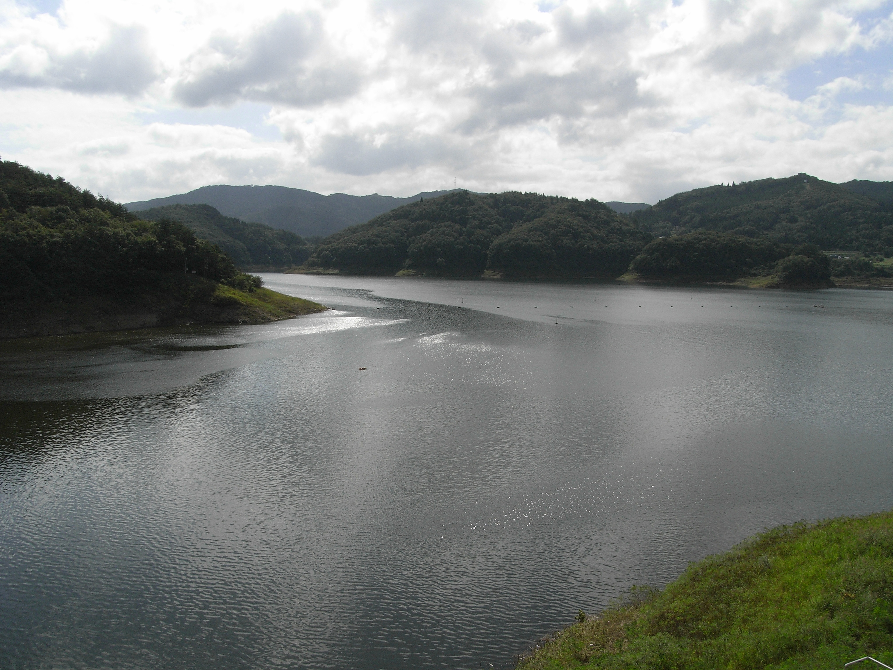
Tase Dam on:
[Wikipedia]
[Google]
[Amazon]
 is a multipurpose
Tase Dam at Dam Net
{{Dams in Iwate Prefecture Dams in Iwate Prefecture Dams completed in 1954 Hydroelectric power stations in Japan Hanamaki, Iwate Gravity dams
dam
A dam is a barrier that stops or restricts the flow of surface water or underground streams. Reservoirs created by dams not only suppress floods but also provide water for activities such as irrigation, human consumption, industrial use, a ...
located on the Sarugaishi River
The is a river in Iwate Prefecture, Japan.
The Sarugaishi River rises in the Kitakami Mountains just south of Mt. Yakushi in Tōno and empties into the Kitakami River in Hanamaki. The Tase Dam is on the Sarugaishi River, in eastern Hanamaki in ...
in the former town of Tōwa which is now a part of the city of Hanamaki
is a Cities of Japan, city in Iwate Prefecture, Japan. , the city had an estimated population of 94,691, and a population density of 100 persons per km², in 37,773 households. The total area of the city is . Hanamaki is famous as the birthplace ...
in Iwate Prefecture
is a prefecture of Japan located in the Tōhoku region of Honshu. It is the second-largest Japanese prefecture at , with a population of 1,210,534 (as of October 1, 2020). Iwate Prefecture borders Aomori Prefecture to the north, Akita Prefectur ...
, in the Tohoku region of northern Japan
Japan ( ja, 日本, or , and formally , ''Nihonkoku'') is an island country in East Asia. It is situated in the northwest Pacific Ocean, and is bordered on the west by the Sea of Japan, while extending from the Sea of Okhotsk in the north ...
. Completed in 1954, it is managed by the Tohoku Regional Development Bureau of the Ministry of Land, Infrastructure and Transport. Located on the Sarugaishi River
The is a river in Iwate Prefecture, Japan.
The Sarugaishi River rises in the Kitakami Mountains just south of Mt. Yakushi in Tōno and empties into the Kitakami River in Hanamaki. The Tase Dam is on the Sarugaishi River, in eastern Hanamaki in ...
, a branch of the Kitakami River
The is the fourth largest river in Japan and the largest in the Tōhoku region. It is long and drains an area of . page 793 It flows through mostly rural areas of Iwate and Miyagi Prefectures. The source of the river is the Mount Nanashirug ...
, it is the first of the dams completed as part of the Kitakami Area Comprehensive Development Plan (KVA). The dam creates , a popular sightseeing spot.
History
The lower reaches of the Kitakami River are subject to flooding, especially near its dual mouths at the city ofIchinoseki, Iwate
is a city located in Iwate Prefecture, in the Tōhoku region of northern Japan. , the city had a population of 114,476 and a population density of 91 persons per km² in 46,375 households. It is currently the second largest city by population in ...
, and plans to increase the river width were impractical due to urbanisation of the area. The Home Ministry
An interior ministry (sometimes called a ministry of internal affairs or ministry of home affairs) is a government department that is responsible for internal affairs.
Lists of current ministries of internal affairs
Named "ministry"
* Ministry ...
, together with Tokyo Imperial University
, abbreviated as or UTokyo, is a public research university located in Bunkyō, Tokyo, Japan. Established in 1877, the university was the first Imperial University and is currently a Top Type university of the Top Global University Project by ...
drafted a flood control
Flood control methods are used to reduce or prevent the detrimental effects of flood waters."Flood Control", MSN Encarta, 2008 (see below: Further reading). Flood relief methods are used to reduce the effects of flood waters or high water level ...
plan in 1926, which was upgraded in 1938 when implementation began. The plan called for the construction of five large dams on the main stream of the Kitakami River and its major branches. Work on the Tase Dam began in 1941
However, despite the forced relocation of local inhabitants due to the urgent need for hydroelectric power generated by the Tase Dam for the war effort, material and labor shortages during World War II
World War II or the Second World War, often abbreviated as WWII or WW2, was a world war that lasted from 1939 to 1945. It involved the vast majority of the world's countries—including all of the great powers—forming two opposin ...
delayed the completion of the dam. Although work resumed immediately after the end of the war; however, typhoons in 1947 and 1948 created severe damage. Under the 1950 National Land Planning Act promulgated by the Yoshida administration, work on the Tase Dam came under the aegis of the Kitakami Area Comprehensive Development Plan (KVA), which was modelled after the American Tennessee Valley Authority
The Tennessee Valley Authority (TVA) is a federally owned electric utility corporation in the United States. TVA's service area covers all of Tennessee, portions of Alabama, Mississippi, and Kentucky, and small areas of Georgia, North Carolina ...
(TVA). Construction on the dam was completed in 1954.
Iwate Prefectural Road 178 passes over the top of the dam. The dam is used for generating electricity, flood prevention, irrigation, and recreation.
References
*Japan Commission on Large Dams. ''Dams in Japan: Past, Present and Future''. CRC Press (2009).See also
*Tase Dam at Dam Net
{{Dams in Iwate Prefecture Dams in Iwate Prefecture Dams completed in 1954 Hydroelectric power stations in Japan Hanamaki, Iwate Gravity dams