Tiros-1 on:
[Wikipedia]
[Google]
[Amazon]
TIROS-1 (or TIROS-A) was the first full-scale

Track the current position of TIROS 1TIROS – NASA ScienceFinal Report on the TIROS I Meteorological Satellite SystemThe Smithsonian National Air and Space Museum Exhibition List
- preserved by InfoAge Science History Center
* ttp://noaasis.noaa.gov/NOAASIS/ml/40yearsa.html TIROS I is Launched - NOAASISbr>TIROS-1 50th Anniversary & Resources on Satellite MeteorologyNASA's YouTube video of TIROS-1
{{DEFAULTSORT:Tiros-1 Spacecraft launched in 1960 Weather satellites of the United States Weather imaging satellites Satellites in low Earth orbit
weather satellite
A weather satellite or meteorological satellite is a type of Earth observation satellite that is primarily used to monitor the weather and climate of the Earth. Satellites can be polar orbiting (covering the entire Earth asynchronously), or ge ...
(the Vanguard 2
Vanguard 2 (or Vanguard 2E before launch) is an Earth-orbiting satellite launched 17 February 1959 at 15:55:02 GMT, aboard a Vanguard SLV-4 rocket as part of the United States Navy's Project Vanguard. The satellite was designed to measure clo ...
satellite was the first experimental/prototype weather satellite), the first of a series of Television Infrared Observation Satellite
TIROS, or Television InfraRed Observation Satellite, is a series of early weather satellites launched by the United States, beginning with TIROS-1 in 1960. TIROS was the first satellite that was capable of remote sensing of the Earth, enablin ...
s placed in low Earth orbit
A low Earth orbit (LEO) is an orbit around Earth with a period of 128 minutes or less (making at least 11.25 orbits per day) and an eccentricity less than 0.25. Most of the artificial objects in outer space are in LEO, with an altitude never mor ...
.
Program
The TIROS Program was NASA's first experimental step to determine if satellites could be useful in the study of the Earth. At that time, the effectiveness of satellite observations was still unproven. Since satellites were a new technology, the TIROS Program also tested various design issues for spacecraft: instruments, data and operational parameters. The goal was to improve satellite applications for Earth-bound decisions, such as "should we evacuate the coast because of the hurricane?". The TIROS-1 Program's first priority was the development of a meteorological satellite information system. Weather forecasting was deemed the most promising application of space-based observations.Spacecraft
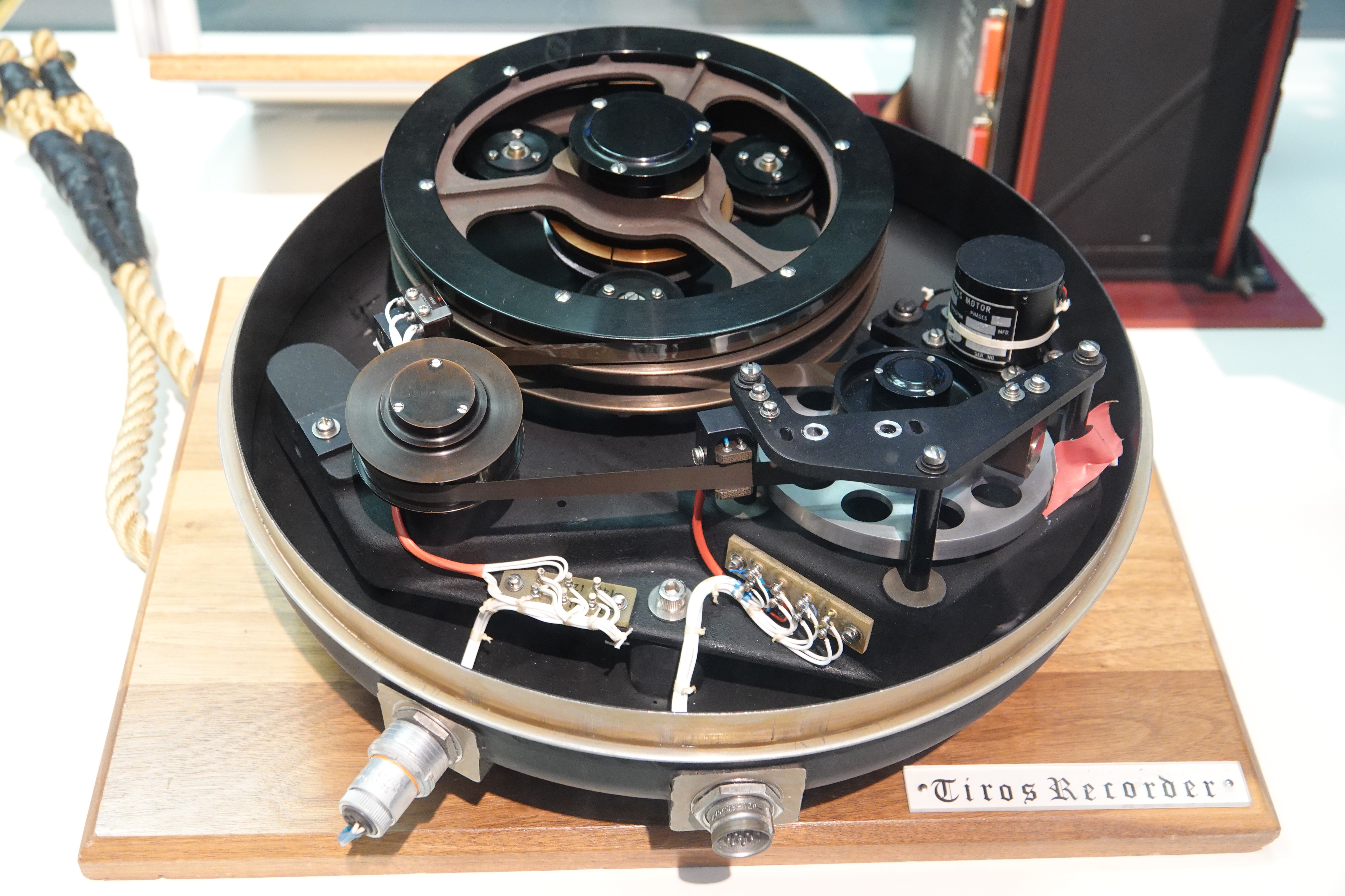
TIROS 1 was an 18-sided right prism, across opposite corners and high. Spacecraft power was supplied by approximately 9000 - by silicon solar cells mounted on the cover assembly and by 21 nickel-cadmium batteries. A single monopole antenna for reception of ground commands extended out from the top of the cover assembly. A pair of crossed-dipole telemetry antennas (235 MHz) projected down and diagonally out from the baseplate. Mounted around the edge of the baseplate were five diametrically opposed pairs of small, solid-fuel thrusters that maintained the satellite spin rate between 8 and 12 rpm. The satellite was equipped with two -diameter vidicon TV cameras, one wide angle and one narrow angle, for taking earth cloudcover pictures. The pictures were transmitted directly to a ground receiving station or were stored in a tape recorder on board for later playback, depending on whether the satellite was within or beyond the communication range of the station. The satellite was spin-stabilized.
Mission
Launched into orbit from Cape Canaveral Space Launch Complex 17A on 1 Apr 1960 at 11:40:09 UTC by a Thor Able II rocket, the satellite performed normally from launch until June 15, 1960, when an electrical power failure prevented further useful TV transmission. Over its -month lifespan, TIROS 1 returned 23,000 photos of the Earth, 19,000 of them usable for weather analysis. For the first time, it was possible to view large scale cloud patterns in their totality, and from this, identify storm regions. The satellite provided the first long-term observations of a developing storm from orbit, tracking the disintegration of a large cyclonic mass off the coast ofBermuda
)
, anthem = "God Save the King"
, song_type = National song
, song = " Hail to Bermuda"
, image_map =
, map_caption =
, image_map2 =
, mapsize2 =
, map_caption2 =
, subdivision_type = Sovereign state
, subdivision_name =
, e ...
over the course of four days. In addition, TIROS 1 returned data on smaller scale structures such as tornadoes and jet streams, and findings returned from the satellite complemented and enhanced ground-based findings.
TIROS 1 remains in orbit as of November 2020.
See also
*First images of Earth from space
This is a timeline of first images of Earth from space. The initial photographs and digital images of planet Earth taken from outer space were preceded by aerial photography and continue in the form of satellite imagery.
For the purpose of this ...
References
External links
Track the current position of TIROS 1
- preserved by InfoAge Science History Center
* ttp://noaasis.noaa.gov/NOAASIS/ml/40yearsa.html TIROS I is Launched - NOAASISbr>TIROS-1 50th Anniversary & Resources on Satellite Meteorology
{{DEFAULTSORT:Tiros-1 Spacecraft launched in 1960 Weather satellites of the United States Weather imaging satellites Satellites in low Earth orbit