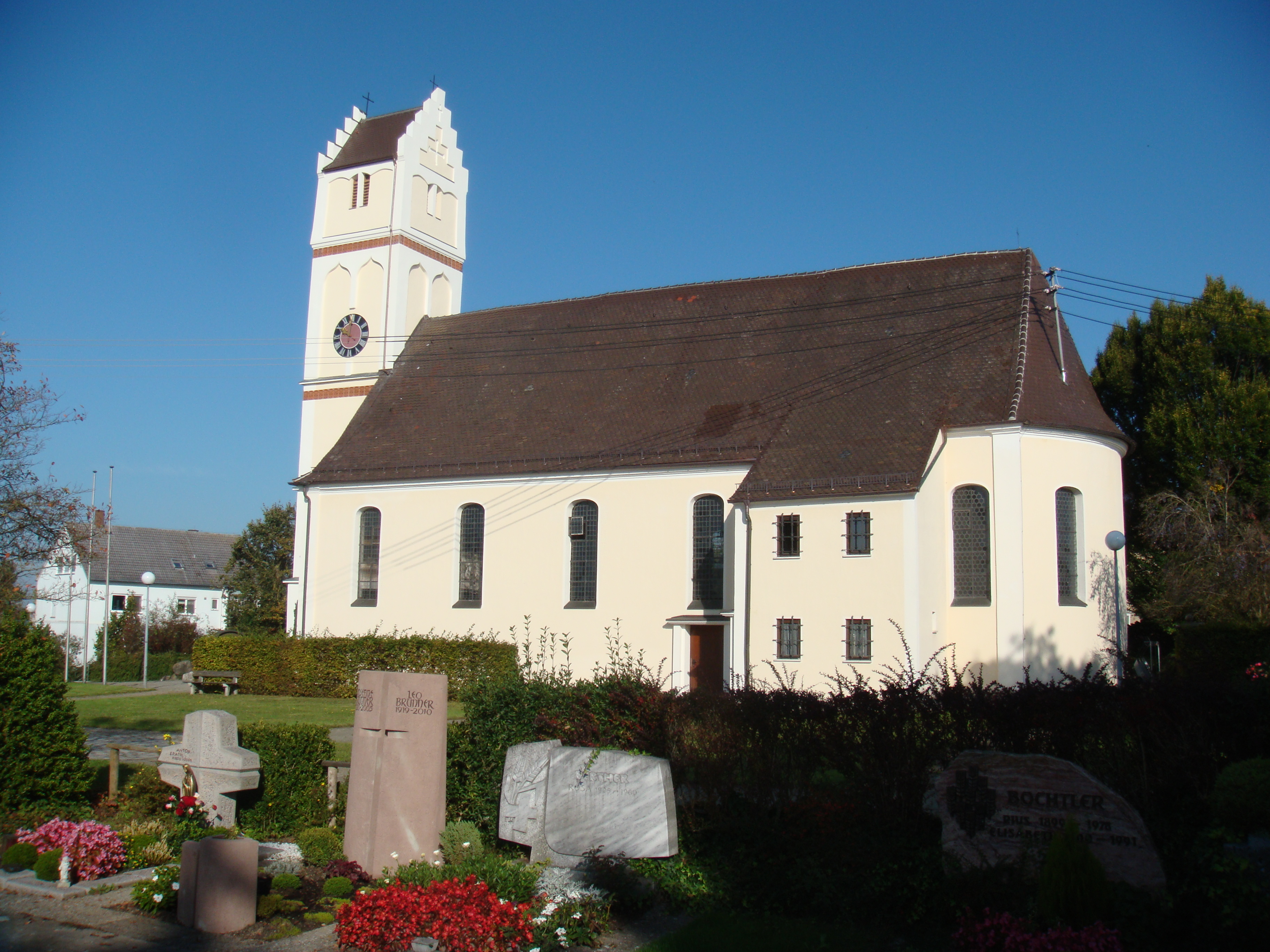
Staig on:
[Wikipedia]
[Google]
[Amazon]
Staig is a municipality in the district of

Alb-Donau
Alb-Donau-Kreis is a (district) in Baden-Württemberg, Germany. It is bounded by (from the south and clockwise) the districts of Biberach (district), Biberach, Reutlingen (district), Reutlingen, Göppingen (district), Göppingen and Heidenheim ( ...
in Baden-Württemberg
Baden-Württemberg (; ), commonly shortened to BW or BaWü, is a German state () in Southwest Germany, east of the Rhine, which forms the southern part of Germany's western border with France. With more than 11.07 million inhabitants across a ...
in Germany
Germany,, officially the Federal Republic of Germany, is a country in Central Europe. It is the second most populous country in Europe after Russia, and the most populous member state of the European Union. Germany is situated betwe ...
.
The community belongs to the Gemeindeverwaltungsverband-Kirchberg Weihungstal with headquarter in Illerkirchberg
Illerkirchberg is a town in the district of Alb-Donau in Baden-Württemberg in Germany.
Unterkirchberg (Lower Kirchberg) had a Roman castrum built around 40 AD as part of the Upper Germanic-Rhaetian Limes to secure the street along the south s ...
.
Geography
Staig is located on the plateau between theDanube
The Danube ( ; ) is a river that was once a long-standing frontier of the Roman Empire and today connects 10 European countries, running through their territories or being a border. Originating in Germany, the Danube flows southeast for , pa ...
and Iller
The Iller (; ancient name Ilargus) is a river of Bavaria and Baden-Württemberg in Germany. It is a right tributary of the Danube, long.
It is formed at the confluence of the rivers Breitach, Stillach and Trettach near Oberstdorf in the Allgäu ...
south of Ulm
Ulm () is a city in the German state of Baden-Württemberg, situated on the river Danube on the border with Bavaria. The city, which has an estimated population of more than 126,000 (2018), forms an urban district of its own (german: link=no, ...
. The districts Steinberg and Altheim lying on the ridge of both sides of Weihung
Weihung is a river of Baden-Württemberg, Germany. It passes through Wain and Illerkirchberg, and flows into the Danube near Ulm.
See also
*List of rivers of Baden-Württemberg
A list of rivers of Baden-Württemberg, Germany:
A
* Aal
* Aalba ...
valley. The other districts are in the valley of the Weihungon or in a side valley. The community thus belongs to the landscape of the Holzstöcke.
Neighboring communities
The municipality is bordering to the north to district Unterweiler of Ulm, on the east toIllerkirchberg
Illerkirchberg is a town in the district of Alb-Donau in Baden-Württemberg in Germany.
Unterkirchberg (Lower Kirchberg) had a Roman castrum built around 40 AD as part of the Upper Germanic-Rhaetian Limes to secure the street along the south s ...
, in the southeast to Illerrieden, on the south to Schnürpflingen
Schnürpflingen is a municipality in the district of Alb-Donau in Baden-Württemberg in Germany.
Mayors
*1945-1976: Alfred Jans
*1976-1986: Jürgen Guse
*1986–2010: Manfred Häberle
*2010–current: Michael Knoll (independent)
References< ...
and on the west to Hüttisheim
Hüttisheim is a municipality in the district of Alb-Donau in Baden-Württemberg in Germany.
The municipality is a member of the local government association Kirchberg Weihungstal headquartered in Illerkirchberg.
Geography
Hüttisheim lies be ...
.Municipality arrangement
The municipality Staig consists of the six districts Altheim, Essendorf, Harthausen, Staig, Steinberg and Weinstetten.History
Staig was first mentioned as "Steiga" in 1127, Altheim followed in 1194. The eldest district however is Harthausen, which appeared in a document already 1093. The other districts followed in the 14th century. On April 1, 1972, the municipality of Steinberg was incorporated into Weinstetten, which was renamed Staig on October 9, 1972. On January 1, 1976 Altheim ob Weihung was being added.References
Alb-Donau-Kreis Württemberg Municipalities in Baden-Württemberg {{AlbDonau-geo-stub