Shirreff Base on:
[Wikipedia]
[Google]
[Amazon]
Shirreff Base (official name Cape Shirreff Field Station)Cape Shirreff Field Station.
SCAR Composite Antarctic Gazetteer is a seasonal field station in the Southern Ocean operated by the
Antarctic Digital Database (ADD).
Scale 1:250000 topographic map of Antarctica. Scientific Committee on Antarctic Research (SCAR), 1993–2016.
Management Plan for Antarctic Specially Protected Area No. 149 Cape Shirreff and San Telmo Island.
Measure 2 (2005), Annex H, ATCM XXVIII Final Report. Stockholm, 2005
Photo of Shirreff Base
with Black Point and
General Geography and History of Livingston Island.
In: ''Bulgarian Antarctic Research: A Synthesis''. Eds. C. Pimpirev and N. Chipev. Sofia: St. Kliment Ohridski University Press, 2015. pp. 17–28.
 Geography of Livingston Island
Outposts of the South Shetland Islands
1996 establishments in Antarctica
{{LivingstonIsland-geo-stub
SCAR Composite Antarctic Gazetteer is a seasonal field station in the Southern Ocean operated by the
United States
The United States of America (U.S.A. or USA), commonly known as the United States (U.S. or US) or America, is a country primarily located in North America. It consists of 50 states, a federal district, five major unincorporated territori ...
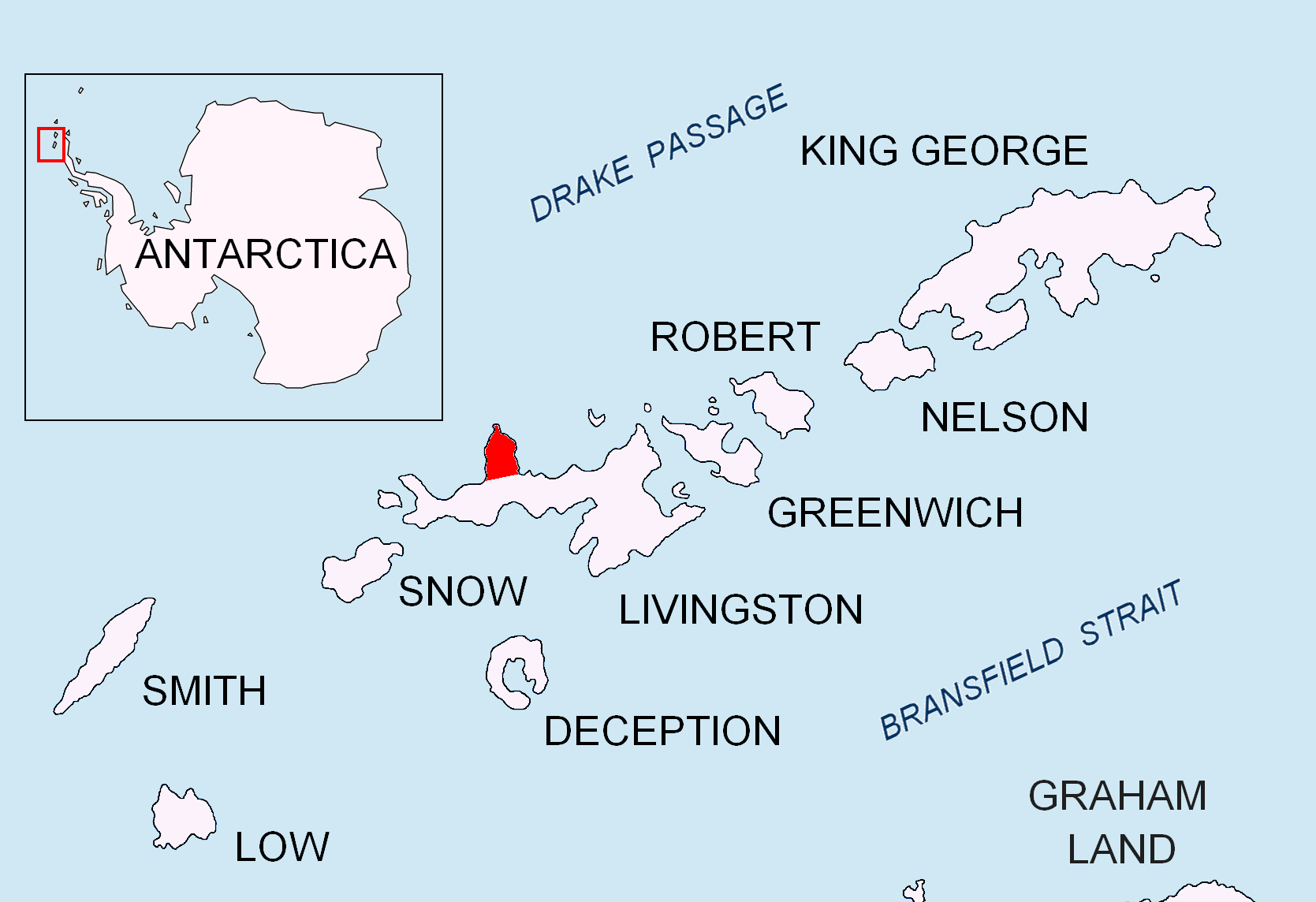
and opened in 1996. It is situated on the east side of Cape Shirreff
Cape Shirreff is a prominent cape at the north end of the rocky peninsula which separates Hero Bay and Barclay Bay on the north coast of Livingston Island, in the South Shetland Islands of Antarctica. The cape was named by Edward Bransfield i ...
on Ioannes Paulus II Peninsula
Ioannes Paulus II Peninsula ( bg, Полуостров Йоан Павел II, Poluostrov Yoan Pavel II, ) is an ice-covered peninsula on the north coast of Livingston Island in the South Shetland Islands, Antarctica that is bounded by Hero Bay ...
on Livingston Island
Livingston Island (Russian name ''Smolensk'', ) is an Antarctic island in the Southern Ocean, part of the South Shetlands Archipelago, a group of Antarctic islands north of the Antarctic Peninsula. It was the first land discovered south of 60 ...
in the South Shetland Islands
The South Shetland Islands are a group of Antarctic islands with a total area of . They lie about north of the Antarctic Peninsula, and between southwest of the nearest point of the South Orkney Islands. By the Antarctic Treaty of 1 ...
off the Antarctic peninsula.
It is near the Chilean base called Doctor Guillermo Mann.
Location
The base is located at which is 1.58 km southeast of Cape Shirreff and 3.32 km west-northwest of Black Point (detailed Chilean mapping in 2004. Bulgarian mapping in 2005 and 2009).Maps
* L.L. Ivanov et al., Antarctica: Livingston Island and Greenwich Island, South Shetland Islands (from English Strait to Morton Strait, with illustrations and ice-cover distribution), 1:100000 scale topographic map, Antarctic Place-names Commission of Bulgaria, Sofia, 2005. * L.L. Ivanov. Antarctica: Livingston Island and Greenwich, Robert, Snow and Smith Islands. Scale 1:120000 topographic map. Troyan: Manfred Wörner Foundation, 2010. (First edition 2009. )Antarctic Digital Database (ADD).
Scale 1:250000 topographic map of Antarctica. Scientific Committee on Antarctic Research (SCAR), 1993–2016.
See also
* List of research stations in Antarctica *Antarctic field camps
Many Antarctic research stations support satellite field camps which are, in general, seasonal camps. The type of field camp can vary – some are permanent structures used during the annual Antarctic summer, whereas others are little more than te ...
Notes
References
Management Plan for Antarctic Specially Protected Area No. 149 Cape Shirreff and San Telmo Island.
Measure 2 (2005), Annex H, ATCM XXVIII Final Report. Stockholm, 2005
Photo of Shirreff Base
with Black Point and
Mount Friesland
Mount Friesland is a mountain rising to in the homonymous Friesland Ridge, the summit of Tangra Mountains and Livingston Island in the South Shetland Islands, Antarctica. Its north rib is connected to Pliska Ridge by Nesebar Gap on the west, a ...
in the background. NOAA Fisheries Service's Southwest Fisheries Science Center.
* Ivanov, LGeneral Geography and History of Livingston Island.
In: ''Bulgarian Antarctic Research: A Synthesis''. Eds. C. Pimpirev and N. Chipev. Sofia: St. Kliment Ohridski University Press, 2015. pp. 17–28.
 Geography of Livingston Island
Outposts of the South Shetland Islands
1996 establishments in Antarctica
{{LivingstonIsland-geo-stub