Sveti Rok Tunnel on:
[Wikipedia]
[Google]
[Amazon]


 The Sveti Rok Tunnel is a road
 The Sveti Rok Tunnel is a road
 tunnel
A tunnel is an underground passageway, dug through surrounding soil, earth or rock, and enclosed except for the entrance and exit, commonly at each end. A pipeline is not a tunnel, though some recent tunnels have used immersed tube cons ...
in Lika, Croatia
, image_flag = Flag of Croatia.svg
, image_coat = Coat of arms of Croatia.svg
, anthem = "Lijepa naša domovino"("Our Beautiful Homeland")
, image_map =
, map_caption =
, capit ...
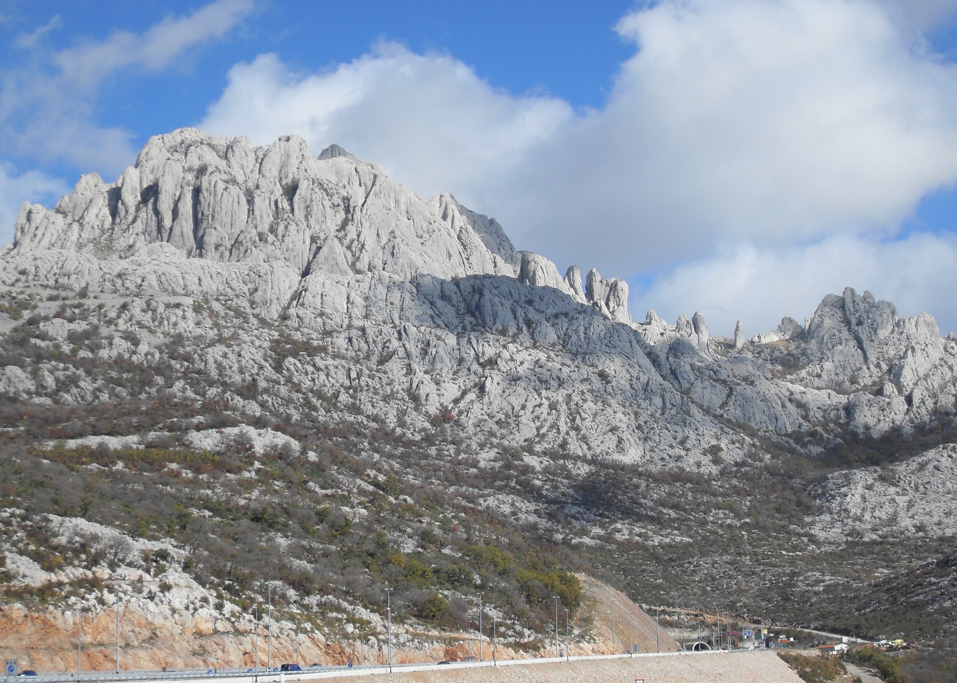
. It is long and passes through the Velebit
Velebit (; it, Alpi Bebie) is the largest, though not the highest, mountain range in Croatia. The range forms a part of the Dinaric Alps and is located along the Adriatic coast, separating it from Lika in the interior. Velebit begins in the nor ...
mountains. The tunnel runs between the Sveti Rok
Sveti Rok is a village in the Lovinac municipality, in Lika–Senj County, Croatia. Sveti Rok has a population of 292. The majority of the population are Croats.
History
Until 1918, Sveti Rok (named ''Sanct Roch'' before 1850) was part of the A ...
and Rovanjska exits on the A1 highway (Zagreb
Zagreb ( , , , ) is the capital (political), capital and List of cities and towns in Croatia#List of cities and towns, largest city of Croatia. It is in the Northern Croatia, northwest of the country, along the Sava river, at the southern slop ...
–Dubrovnik
Dubrovnik (), historically known as Ragusa (; see notes on naming), is a city on the Adriatic Sea in the region of Dalmatia, in the southeastern semi-exclave of Croatia. It is one of the most prominent tourist destinations in the Mediterran ...
); eponymous villages are located near the tunnel's northbound and southbound entrances respectively.
Description
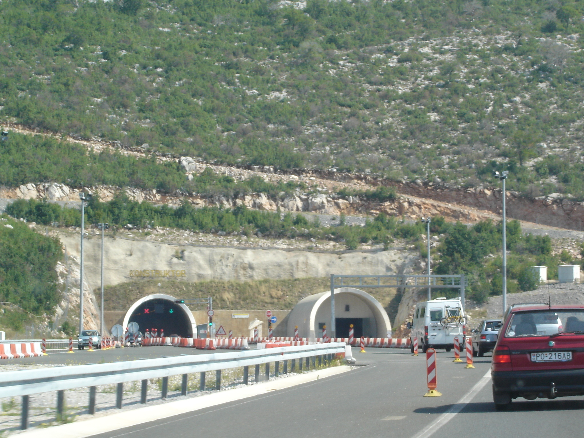
The northern portal of the tunnel is located at 561meters above sea level
Height above mean sea level is a measure of the vertical distance (height, elevation or altitude) of a location in reference to a historic mean sea level taken as a vertical datum. In geodesy, it is formalized as ''orthometric heights''.
The com ...
, while the southern portal is located at 510 meters. The eastern tunnel is slightly longer than the western ( vs ). The tunnel tubes are apart, and are connected by 4 passages for vehicles and 15 other passages, accessible on foot.
Since the Sveti Rok Tunnel and the Mala Kapela Tunnel
Mala Kapela Tunnel ( hr, Tunel Mala Kapela) is the most significant structure on the Croatian A1 motorway route. As it is long (northbound tube), Mala Kapela Tunnel is the longest tunnel in Croatia. The tunnel is geographically located between t ...
are of similar lengths, and their construction was carried out concurrently, they are similar in form and function: the tunnel also has wide carriageways, permitting driving speeds of up to 100 km/h. The tunnel features an autonomous drainage system channeling water accumulating due to tunnel cleaning, as well as any seeping water, firefighting and accidents. The tunnel is equipped with variable traffic signs in order to ensure enhanced traffic safety of the traffic, regulated from traffic control centres along the A1 motorway. Electronic equipment allows use of two VHF radio frequencies ( HR1 at 95.1 MHz and HR2 at 98.1 MHz) as well as cell phones. Electrical power is supplied to the tunnel via one 35 kV switching station at each end of the tunnel and 8 distribution switching stations in the tunnel itself. A backup electrical power supply is also provided to ensure continuous operation of the tunnel.
The tunnel was excavated using the New Austrian Tunnelling method
The New Austrian tunneling method (NATM), also known as the sequential excavation method (SEM) or sprayed concrete lining method (SCL), is a method of modern tunnel design and construction employing sophisticated monitoring to optimize various wa ...
, by means of drilling and explosive blasting. Numerous caves, caverns and other speleological structures were found during constructions, but all of those were addressed successfully. of underground channels were found during construction, including a hall measuring by by , found at chainage
The chain is a unit of length equal to 66 feet (22 yards). It is subdivided into 100 links (PDF) or 4 rods. There are 10 chains in a furlong, and 80 chains in one statute mile. In metric terms, it is 20.1168 m long. By extension, chainage ( ...
200+525. Some of the structures are of considerable length, as they appear to be connected to the surface – as indicated by the presence of bats. The speleological structures encountered during construction presented technical problems, but they have been successfully preserved as natural phenomena.
Traffic volume
Traffic is regularly counted and reported byHrvatske autoceste
Hrvatske autoceste (HAC) or Croatian Motorways Ltd is a Croatian state-owned limited liability company tasked with management, construction and maintenance of motorways in Croatia pursuant to provisions of the Croatian Public Roads Act ( hr, Zakon ...
, operator of the tunnel and the A1 motorway where the tunnel is located, and published by Hrvatske ceste
Hrvatske ceste (lit. ''Croatian roads'') is a Croatian state-owned company pursuant to provisions of the Croatian Public Roads Act ( hr, Zakon o javnim cestama enacted by the Parliament of the Republic of Croatia.
The tasks of the company are def ...
, the Croatian roads agency. Substantial variations between annual (AADT
Annual average daily traffic, abbreviated AADT, is a measure used primarily in transportation planning, transportation engineering and retail location selection. Traditionally, it is the total volume of vehicle traffic of a highway or road for a y ...
) and summer (ASDT) traffic volumes are attributed to the fact that the tunnel carries substantial tourist traffic to the Dalmatia
Dalmatia (; hr, Dalmacija ; it, Dalmazia; see #Name, names in other languages) is one of the four historical region, historical regions of Croatia, alongside Croatia proper, Slavonia, and Istria. Dalmatia is a narrow belt of the east shore of ...
n Adriatic
The Adriatic Sea () is a body of water separating the Italian Peninsula from the Balkans, Balkan Peninsula. The Adriatic is the northernmost arm of the Mediterranean Sea, extending from the Strait of Otranto (where it connects to the Ionian Sea) ...
resorts. The traffic count is performed using analysis of motorway tolls.
See also
*Mala Kapela Tunnel
Mala Kapela Tunnel ( hr, Tunel Mala Kapela) is the most significant structure on the Croatian A1 motorway route. As it is long (northbound tube), Mala Kapela Tunnel is the longest tunnel in Croatia. The tunnel is geographically located between t ...
References
External links
* * {{coord, 44, 18, 18, N, 15, 40, 47, E, display=title Road tunnels in Croatia Buildings and structures in Lika-Senj County Buildings and structures in Zadar County Tunnels completed in 2003 Transport in Zadar County