Sungdel on:
[Wikipedia]
[Google]
[Amazon]
 Sungdel is a
UN map of the municipalities of Khotang District
Populated places in Khotang District {{Khotang-geo-stub
village
A village is a clustered human settlement or community, larger than a hamlet but smaller than a town (although the word is often used to describe both hamlets and smaller towns), with a population typically ranging from a few hundred to ...
and Village Development Committee in the Khotang District
Khotang District ( ne, खोटाङ जिल्ला) is one of 14 districts of Province No. 1 of eastern Nepal. The district, with Diktel as its district headquarters, covers an area of and has a population (2021) of 206,312.Sagarmatha Zone
Sagarmāthā Zone ( ne, सगरमाथा अञ्चल) or Sagarmatha Anclal ( ne, सगरमाथा अञ्चल) was one of the fourteen zones of Nepal until the restructuring of zones into provinces. The headquarters of Sagarmat ...
of eastern Nepal
Nepal (; ne, नेपाल ), formerly the Federal Democratic Republic of Nepal ( ne,
सङ्घीय लोकतान्त्रिक गणतन्त्र नेपाल ), is a landlocked country in South Asia. It is mai ...
. At the time of the 1991 Nepal census
The 1991 Nepal census was a widespread national census conducted by the Nepal Central Bureau of Statistics.
Working with Nepal's Village Development Committees at a district level,
they recorded data from all the main towns and villages of each ...
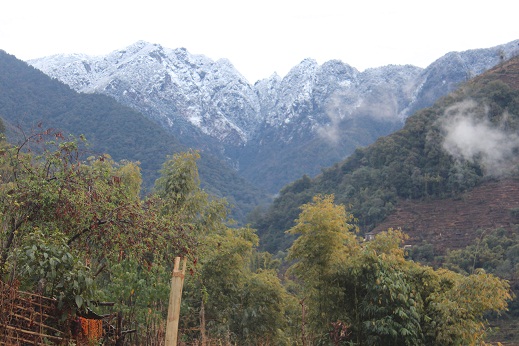
it had a population of 2,846 persons living in 585 individual households. It is at the northeast belt of the Khotang district. Currently, there is a high school, Shree surya Ma. Vi, and four primary schools. People run their own hydropower. The majority of people are Koyee Rai. It is the only place where Koyee people speak their mother language, Koyee. This language is also known as ''Sungdele Bhasa''. Most people depend on farming. The highest hill in Khotang district, Loure, is situated in Sungdel.
References
External links
UN map of the municipalities of Khotang District
Populated places in Khotang District {{Khotang-geo-stub