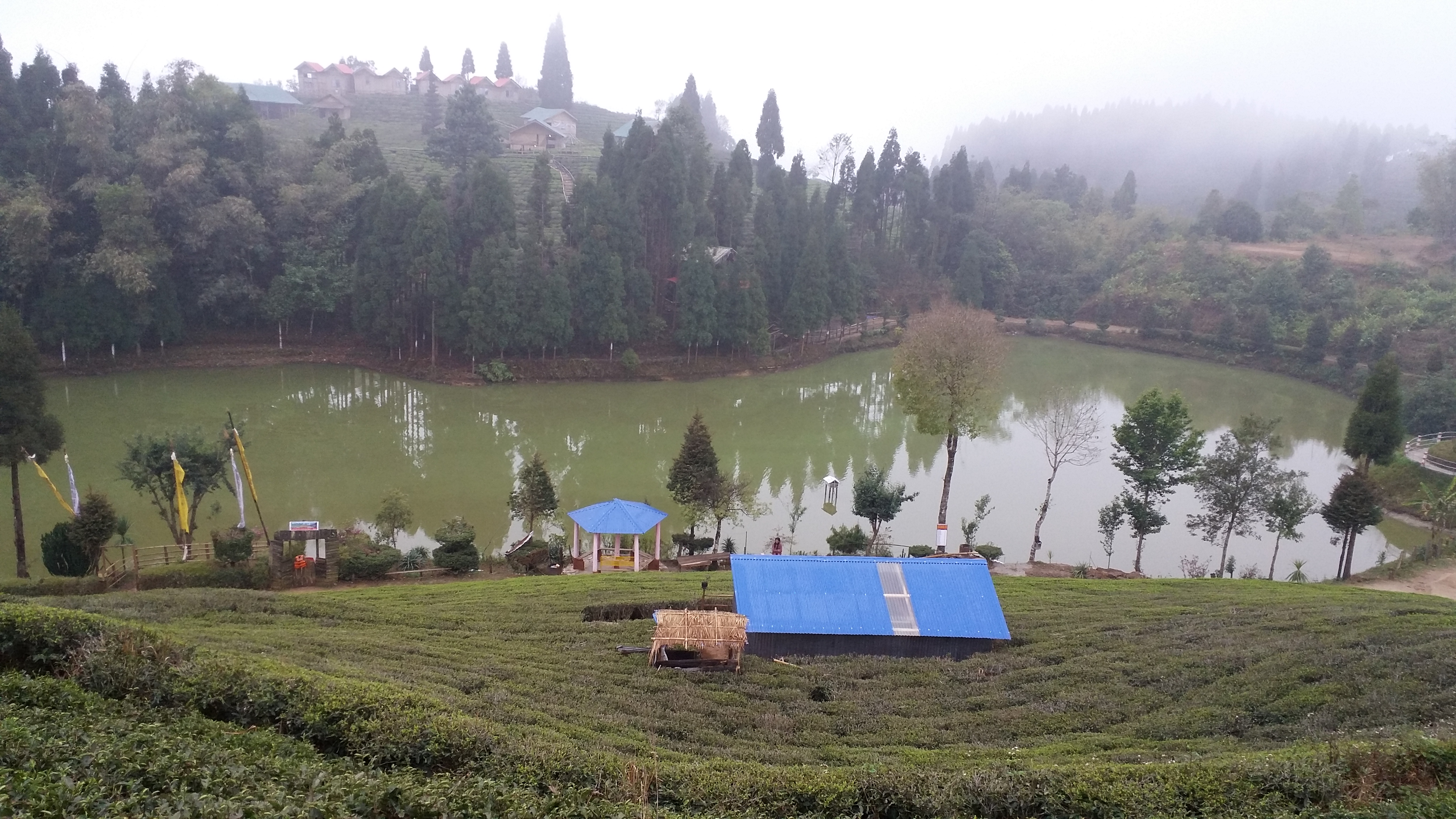
Sri Antu on:
[Wikipedia]
[Google]
[Amazon]
Shree Antu is a 

 A view tower has been constructed atop the Sri Antu Hill at an altitude of 2328 m above sea level.
Sri Antu shares a border with
UN map of the municipalities of Ilam District
Populated places in Ilam District {{IlamNP-geo-stub
Village
A village is a clustered human settlement or community, larger than a hamlet but smaller than a town (although the word is often used to describe both hamlets and smaller towns), with a population typically ranging from a few hundred to ...
/ Valley
A valley is an elongated low area often running between Hill, hills or Mountain, mountains, which will typically contain a river or stream running from one end to the other. Most valleys are formed by erosion of the land surface by rivers ...
within Suryodaya Municipality
Suryodaya Municipality is a municipality located in Koshi Pradesh of Nepal in Ilam district. Suryodaya is the Nepali translation for “Sunrise".
It was formed by merging three village development committees i.e. Phikal Bazar, Panchakanya and K ...
in Ilam District
Ilam district ( ne, इलाम जिल्ला) is one of 14 districts of Province No. 1 of eastern Nepal. It is a Hill district and covers . The 2011 census counted 290,254 population. The municipality of Ilam is the district headquar ...
in the Province No. 1
Province No. 1 (proposed names: Kirat Autonomous State, Kirat, Limbuwan, Khambuwan Rashtriya Morcha, Nepal, Khambuwan, Mount Everest, Sagarmatha, Virata, Birat and Koshi River, Koshi) is the easternmost of the seven Provinces of Nepal, province ...
of eastern Nepal
Nepal (; ne, नेपाल ), formerly the Federal Democratic Republic of Nepal ( ne,
सङ्घीय लोकतान्त्रिक गणतन्त्र नेपाल ), is a landlocked country in South Asia. It is mai ...
. At the time of the 2011 Nepal census
Nepal conducted a widespread national census in 2011 by the Nepal Central Bureau of Statistics. Working with the 58 municipalities and the 3915 Village Development Committees at a district level, they recorded data from all the municipalities an ...
it had a population of 4,981.
Shree Antu is a popular tourist destination best known as the place to observe sunrise and is known for its tea gardens.


 A view tower has been constructed atop the Sri Antu Hill at an altitude of 2328 m above sea level.
Sri Antu shares a border with
 West Bengal
West Bengal (, Bengali: ''Poshchim Bongo'', , abbr. WB) is a state in the eastern portion of India. It is situated along the Bay of Bengal, along with a population of over 91 million inhabitants within an area of . West Bengal is the fourt ...
, India
India, officially the Republic of India (Hindi: ), is a country in South Asia. It is the seventh-largest country by area, the second-most populous country, and the most populous democracy in the world. Bounded by the Indian Ocean on the so ...
. Mostly Cool and breezy, this Village contains eye catching natural resources and attractive tourist destination for trekking, hiking or viewing sceneries.
Known for tea, cardamom, garlic etc, this place serves as very good producer of organic natural elements. Antu Pokhari, Bhanjyang, Chiruwa and lavishing tea gardens are some of its exotic places.
References
External links
*UN map of the municipalities of Ilam District
Populated places in Ilam District {{IlamNP-geo-stub