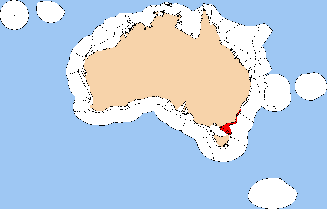
Southeast Shelf Transition on:
[Wikipedia]
[Google]
[Amazon]
 The Southeast Shelf Transition is a biogeographic region of
 The Southeast Shelf Transition is a biogeographic region of
 Australia
Australia, officially the Commonwealth of Australia, is a Sovereign state, sovereign country comprising the mainland of the Australia (continent), Australian continent, the island of Tasmania, and numerous List of islands of Australia, sma ...
's coastal and continental shelf
A continental shelf is a portion of a continent that is submerged under an area of relatively shallow water, known as a shelf sea. Much of these shelves were exposed by drops in sea level during glacial periods. The shelf surrounding an island ...
waters. It covers a portion of Australia's southeastern coast, from southern New South Wales
)
, nickname =
, image_map = New South Wales in Australia.svg
, map_caption = Location of New South Wales in AustraliaCoordinates:
, subdivision_type = Country
, subdivision_name = Australia
, established_title = Before federation
, es ...
to eastern Victoria, including the islands of the Kent Group
The Kent Group are a grouping of six granite islands located in Bass Strait, north-west of the Furneaux Group in Tasmania, Australia. Collectively, the group is comprised within the Kent Group National Park.
The islands were named Kent's Group ...
and Furneaux Group at the eastern end of the Bass Strait
Bass Strait () is a strait separating the island state of Tasmania from the Australian mainland (more specifically the coast of Victoria, with the exception of the land border across Boundary Islet). The strait provides the most direct waterwa ...
. It is a provincial level bioregion in the Integrated Marine and Coastal Regionalisation of Australia (IMCRA) system, and is a transitional region between the warm temperate Central Eastern Shelf Province
The Central Eastern Shelf Province is a biogeographic region of Australia's coastal and continental shelf waters. It includes the warm temperate coastal waters of eastern Australia. It is a provincial level bioregion in the Integrated Marine and ...
to the northwest and the cool temperate Bass Strait Shelf and Tasmanian Shelf provinces to the west and south."A Guide to the Integrated Marine and Coastal Regionalisation of Australia Version 4.0". Department of Environment and Heritage, Government of Australia. June 2006. ISBN 0 642 552274. It corresponds to the Cape Howe marine ecoregion in the WWF's Marine Ecoregions of the World system.
Geography
The Southeast Shelf Province extends along Australia's southeastern coast from south ofWollongong
Wollongong ( ), colloquially referred to as The Gong, is a city located in the Illawarra region of New South Wales, Australia. The name is believed to originate from the Dharawal language, meaning either 'five islands/clouds', 'ground near wate ...
in New South Wales to Wilsons Promontory
Wilsons Promontory, is a peninsula that forms the southernmost part of the Australian mainland, located in the state of Victoria.
South Point at is the southernmost tip of Wilsons Promontory and hence of mainland Australia. Located at nearb ...
in Victoria, and south to Cape Portland at Tasmania's northeastern tip, enclosing the Furneaux and Kent
Kent is a county in South East England and one of the home counties. It borders Greater London to the north-west, Surrey to the west and East Sussex to the south-west, and Essex to the north across the estuary of the River Thames; it faces ...
groups of islands at the eastern end of the Bass Strait
Bass Strait () is a strait separating the island state of Tasmania from the Australian mainland (more specifically the coast of Victoria, with the exception of the land border across Boundary Islet). The strait provides the most direct waterwa ...
. It adjoins the Bass Strait Shelf Province on the southwest, and the Tasmanian Shelf Province on the south. On the east it extends to the edge of the continental shelf
A continental shelf is a portion of a continent that is submerged under an area of relatively shallow water, known as a shelf sea. Much of these shelves were exposed by drops in sea level during glacial periods. The shelf surrounding an island ...
.
The transition marks the southernmost influence of the warm East Australian Current
The East Australian Current (EAC) is a warm, southward, western boundary current that is formed from the South Equatorial Current (SEC) crossing the Coral Sea and reaching the eastern coast of Australia. At around 15° S near the Australian coa ...
, which brings warmer water as far as the eastern Bass Strait.
Meso-scale bioregions
The province contains three meso-scale bioregions: * Twofold Shelf * Batemans Shelf * FlindersEcology
The biota of the bioregion is dominated by warm temperate species characteristic of the Central Eastern Province, with a smaller number of cool-temperate species from the Bass Strait Shelf and Tasmanian provinces, and a few tropical species from theNortheast Shelf Province
The Northeast Shelf Province is a biogeographic region of Australia's coastal and continental shelf waters. It includes the tropical coastal waters of the central and southern Great Barrier Reef in northeastern Australia. It is a provincial leve ...
. There is a major disjunction of species' ranges at Cape Howe, which marks the southernmost range of several warm water species and the northern extent of several coold temperate species.
References
{{reflist Biogeography of New South Wales Biogeography of Victoria (Australia) Biogeography of Tasmania Ecoregions of Australia Marine ecoregions IMCRA provincial bioregions Temperate Australasia Coastline of New South Wales Coastline of Tasmania Coastline of Victoria (Australia)