Solva (other) on:
[Wikipedia]
[Google]
[Amazon]
Solva ( cy, Solfach) is a village, community and


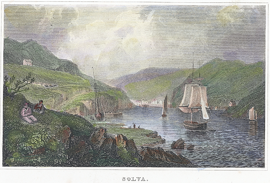
 The rocks at the entrance to Solva Harbour made it one of the most sheltered anchorages between Fishguard and
"Solva taken over for Under Milkwood filming"
''BBC News'', 23 June 2014.
Image:Solfach - Clifftop Walk.jpg, Clifftop walk Solva
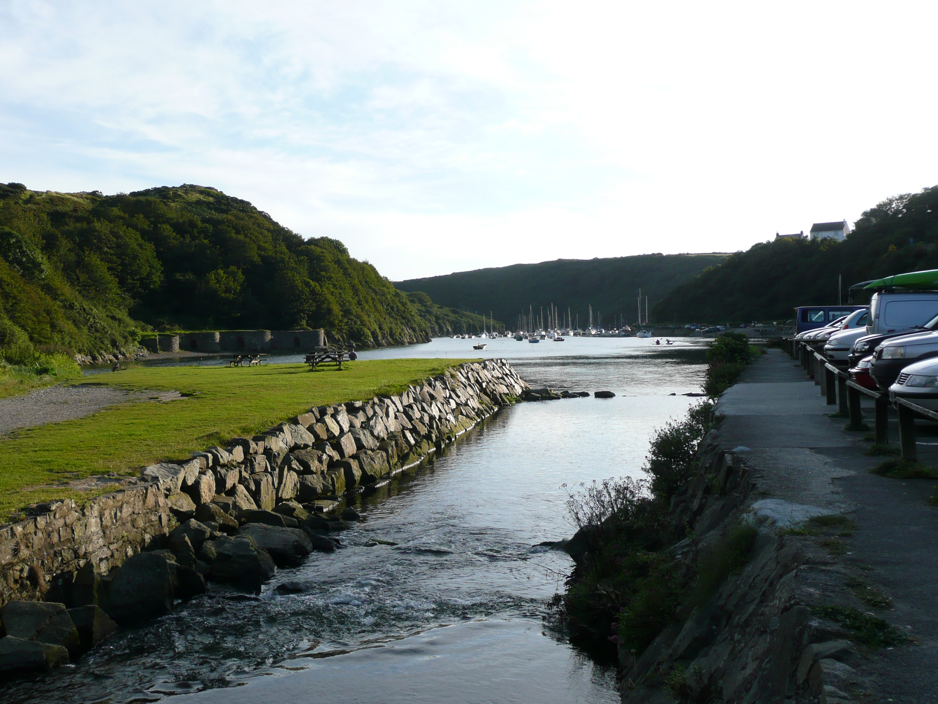
Image:Solva Harbour 2.JPG, Summer evening at low tide in Solva
Image:Solva harbour 3.jpg, Kayaking in caves at the mouth of Solva Harbour
Image:Solva Colours.JPG, Colourful houses in Solva
Solva Websitewww.geograph.co.uk : photos of Solva and surrounding area
{{Authority control Villages in Pembrokeshire Ports and harbours of Wales Communities in Pembrokeshire Coast of Pembrokeshire Populated coastal places in Wales
electoral ward
A ward is a local authority area, typically used for electoral purposes. In some countries, wards are usually named after neighbourhoods, thoroughfares, parishes, landmarks, geographical features and in some cases historical figures connected to t ...
in Pembrokeshire
Pembrokeshire ( ; cy, Sir Benfro ) is a Local government in Wales#Principal areas, county in the South West Wales, south-west of Wales. It is bordered by Carmarthenshire to the east, Ceredigion to the northeast, and the rest by sea. The count ...
, Wales. The village comprises principally Lower Solva and Upper Solva. The community also includes Middle Mill and Whitchurch.
Location
Solva lies on the north side of St Bride's Bay, in North Pembrokeshire in the Pembrokeshire Coast National Park and on the Pembrokeshire Coast Path. It lies on a deep valley at the mouth of the River Solva. In the valley is Lower Solva, consisting of a long street ending at the smallharbour
A harbor (American English), harbour (British English; see spelling differences), or haven is a sheltered body of water where ships, boats, and barges can be docked. The term ''harbor'' is often used interchangeably with ''port'', which is a ...
. Most of the modern development has been in Upper Solva, on the cliff top to the west of the harbour.
History


Milford Haven
Milford Haven ( cy, Aberdaugleddau, meaning "mouth of the two Rivers Cleddau") is both a town and a community in Pembrokeshire, Wales. It is situated on the north side of the Milford Haven Waterway, an estuary forming a natural harbour that has ...
; it was marked on a 1578 parish map of Pembrokeshire as ''Dolvath Haven''. On a 1748 map it is named ''Solvach''.
Solva became the main trading centre of St Bride's Bay in the medieval period, and was important for lime burning. A prominent row of lime kilns is preserved at the harbour edge. By the end of the 18th century Solva had begun to expand, and could accommodate vessels of 500 tons, or up to 1,000 in an emergency. Some 30 vessels were registered to the port at this time, though this number reduced during the 19th century. The fading coastal trade was replaced by tourism, and the harbour became a leisure boating centre.
In 1943 the RAF established an airfield, named RAF St Davids, but which now lies within Solva community. The area was the subject of an archaeological survey in 2000.
The village was the location for Wales's first butterfly farm, Solva Nectarium, which opened in 1979.
Demographics
The population of the community was 865 at the 2011 Census. As of 2019, it is estimated that the population has increased to 869. According to the United Kingdom Census 2011, 30.7% of the community of Solva could speak Welsh. The 2011 Census noted that 96.3% of the population was born in the United Kingdom; 54.7% of the population was born in Wales and 39.2% of the population was born in England.Geology
Solva Harbour is a good example of a ria — a flooded coastal valley orinlet
An inlet is a (usually long and narrow) indentation of a shoreline, such as a small arm, bay, sound, fjord, lagoon or marsh, that leads to an enclosed larger body of water such as a lake, estuary, gulf or marginal sea.
Overview
In marine geogra ...
. Local rocks contain fossils from the Cambrian
The Cambrian Period ( ; sometimes symbolized C with bar, Ꞓ) was the first geological period of the Paleozoic Era, and of the Phanerozoic Eon. The Cambrian lasted 53.4 million years from the end of the preceding Ediacaran Period 538.8 million ...
period, and the village gives its name to the Solva Group, a rock sequence.
Governance
Anelectoral ward
A ward is a local authority area, typically used for electoral purposes. In some countries, wards are usually named after neighbourhoods, thoroughfares, parishes, landmarks, geographical features and in some cases historical figures connected to t ...
of the same name exists. This ward extends to Brawdy and in fact some of the community was transferred there. The total population of the ward at the 2011 census was 1,877.
Traditional events
Every year onEaster Monday
Easter Monday refers to the day after Easter Sunday in either the Eastern or Western Christian traditions. It is a public holiday in some countries. It is the second day of Eastertide. In Western Christianity, it marks the second day of the Octa ...
Solva hosts a Duck Race for charity. The ducks are released into the River Solva near Middle Mill and float down stream to Solva harbour. The winner is the first to cross under the footbridge in lower Solva car park.
Each summer, Solva hosts a regatta
Boat racing is a sport in which boats, or other types of watercraft, race on water. Boat racing powered by oars is recorded as having occurred in ancient Egypt, and it is likely that people have engaged in races involving boats and other wate ...
which features rowing for adults and children.
Solva now hosts its own festival each year, this being held at the end of July or the beginning of August. The festival is called 'The Edge Festival Solva', and profits go to community-based projects.
Amenities and attractions
The local cliff coast is popular with walkers, and the classic cliff exposures ofCambrian
The Cambrian Period ( ; sometimes symbolized C with bar, Ꞓ) was the first geological period of the Paleozoic Era, and of the Phanerozoic Eon. The Cambrian lasted 53.4 million years from the end of the preceding Ediacaran Period 538.8 million ...
rocks attract amateur and professional geologists.
Solva Woollen Mill, located at the nearby village of Middle Mill, claims to be the oldest continuously working woollen mill in Pembrokeshire. Today the mill mostly manufactures carpets and rugs. There is a tearoom and a shop, and visitors are able to see the looms at work.
Listed structures
There are 37 listed structures in the community, including the church (of Whitchurch parish) of Saint Aidan.Notable people
* The musician David Gray moved with his parents to Solva at the age of 8, and attended Solva Community School. His parents ran the "Window on Wales" craft shop in the village. * Ex-professional footballer Simon Davies, who played forFulham
Fulham () is an area of the London Borough of Hammersmith & Fulham in West London, England, southwest of Charing Cross. It lies on the north bank of the River Thames, bordering Hammersmith, Kensington and Chelsea. The area faces Wandsworth ...
and represented Wales, was brought up in Solva. His career started as a teenager at Solva AFC, and it was here that he was talent-spotted.
* Meic Stevens, the notable Welsh singer/songwriter, was born in Solva, and spent much of his early life here. In 2002 he released a song and album called ''Ysbryd Solfa'' ("The Spirit of Solfa") which contained songs about his childhood in Solva during the 1940s and early 1950s.
* Frances Hodgkins painted in Solva in 1936 and 1938, commenting in a letter to a friend in 1936:
TV and film
In June 2014 Solva was used as a location for the filming ofDylan Thomas
Dylan Marlais Thomas (27 October 1914 – 9 November 1953) was a Welsh poet and writer whose works include the poems "Do not go gentle into that good night" and "And death shall have no dominion", as well as the "play for voices" ''Under ...
's '' Under Milk Wood''.''BBC News'', 23 June 2014.
References
Further reading
*Grime, Anna. ''A Living Thing: Solva Woollen Mill, 104 years on.'' Pembrokeshire Life September 2011: 18-19Images of Solva
External links
*Solva Website
{{Authority control Villages in Pembrokeshire Ports and harbours of Wales Communities in Pembrokeshire Coast of Pembrokeshire Populated coastal places in Wales