Shuro-obod District on:
[Wikipedia]
[Google]
[Amazon]
 The district has an area of about and is divided administratively into seven jamoats. They are as follows:Jamoat-level basic indicators
United Nations Development Programme in Tajikistan, accessed 11 October 2020
Tajik
Tajik, Tadjik, Tadzhik or Tajikistani may refer to:
* Someone or something related to Tajikistan
* Tajiks, an ethnic group in Tajikistan, Afghanistan and Uzbekistan
* Tajik language, the official language of Tajikistan
* Tajik (surname)
* Tajik cu ...
: Ноҳияи Шамсиддин Шоҳин
, image_skyline = Shuro-obod City TJ.jpg
, image_caption = Shuroobod City
, image_map = Location of Shamsiddin Shohin District in Tajikistan.png
, mapsize1 =
, map_caption = Shamsiddin Shohin District Location in Tajikistan
, image_dot_map =
, dot_mapsize =
, dot_map_caption=
, dot_x =
, dot_y =
, pushpin_map =
, pushpin_mapsize=
, pushpin_label_position =
, pushpin_map_caption =
, subdivision_type = Country
A country is a distinct part of the world, such as a state, nation, or other political entity. It may be a sovereign state or make up one part of a larger state. For example, the country of Japan is an independent, sovereign state, while the ...
, subdivision_name =
, subdivision_type1 = Region
In geography, regions, otherwise referred to as zones, lands or territories, are areas that are broadly divided by physical characteristics (physical geography), human impact characteristics (human geography), and the interaction of humanity and t ...
, subdivision_name1 = Khatlon Region
Khatlon Region ( tg, Вилояти Хатлон, ''Viloyati Xatlon''), one of the four provinces of Tajikistan ( tg, вилоят, ''Viloyat''), is the most populous of the four first level administrative regions. It is situated in the southwest ...
, seat_type = Capital
, seat = Shuroobod
, established_title =
, established_date =16 Mar 1938
, government_type =
, leader_title =
, leader_name =
, area_magnitude =
, area_total_sq_mi =
, area_total_km2 = 2300
, area_land_sq_mi =
, area_land_km2 =
, area_urban_sq_mi =
, area_urban_km2 =
, area_metro_km2 =
, area_metro_sq_mi =
, population_footnotes =
, population_note =
, population_as_of = 2020
, population_total=55,500
, population_density_km2 =auto
, population_density_sq_mi =
, population_metro =
, population_density_metro_km2 =
, population_density_metro_sq_mi =
, population_urban =
, population_density_urban_km2 =
, population_density_urban_sq_mi =
, population_density_blank1_km2 =
, population_density_blank1_sq_mi =
, timezone =
, utc_offset =+5
, timezone_DST =
, utc_offset_DST =
, coordinates =
, elevation_footnotes=
, elevation_m =
, elevation_ft =
, postal_code_type =
, postal_code =
, area_code = +992-3319
, blank1_name_sec2 =
, blank1_info_sec2 =
, website =
, footnotes =
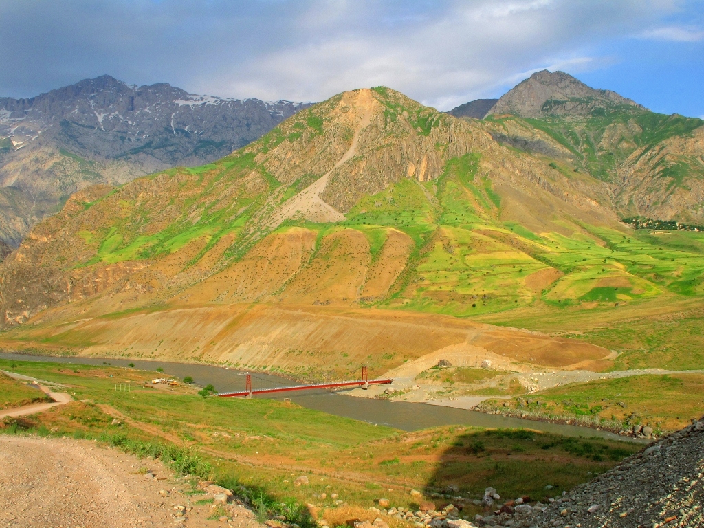
Shamsiddin Shohin District (russian: Район Шамсиддин Шохин; tg, Ноҳияи Шамсиддин Шоҳин ''Nohiyai Shamsiddin Shohin'', before 2016 ''Shuroobod District'' tg, Ноҳияи Шуро-обод), is a district
A district is a type of administrative division that, in some countries, is managed by the local government. Across the world, areas known as "districts" vary greatly in size, spanning regions or counties, several municipalities, subdivisions o ...
in Khatlon Region
Khatlon Region ( tg, Вилояти Хатлон, ''Viloyati Xatlon''), one of the four provinces of Tajikistan ( tg, вилоят, ''Viloyat''), is the most populous of the four first level administrative regions. It is situated in the southwest ...
, southeastern Tajikistan
Tajikistan (, ; tg, Тоҷикистон, Tojikiston; russian: Таджикистан, Tadzhikistan), officially the Republic of Tajikistan ( tg, Ҷумҳурии Тоҷикистон, Jumhurii Tojikiston), is a landlocked country in Centr ...
. Its capital is the village Shuroobod.
Shuroobod District was renamed Shamsiddin Shohin
Shamsiddin Mohammed Shohin ( tg, Шамсиддини Шоҳи) was a Tajik poet born around 1865-1866 in Bukhara
Bukhara (Uzbek language, Uzbek: /, ; tg, Бухоро, ) is the List of cities in Uzbekistan, seventh-largest city in Uzbekistan, ...
in memory of this Tajik poet.
Administrative divisions
 The district has an area of about and is divided administratively into seven jamoats. They are as follows:Jamoat-level basic indicators
United Nations Development Programme in Tajikistan, accessed 11 October 2020
Geography
Shamsiddin Shohin District is bordered in the north byDarvoz District tg, بخش دروازه
, nickname =
, motto =
, image_skyline =
, imagesize =
, image_caption =
, image_flag =
, flag_size =
, image_seal = ...
and Khovaling District, in the west by Mu'minobod District and Hamadoni District tg, Ноҳияи Ҳамадони
, image_map =Location of Hamadoni District in Tajikistan.png
, mapsize =
, map_caption =
, image_map1 =
, mapsize1 =
, map_caption1 =
, image_dot_map =
, dot_mapsize =
, dot_map_capti ...
, all in Khatlon Region
Khatlon Region ( tg, Вилояти Хатлон, ''Viloyati Xatlon''), one of the four provinces of Tajikistan ( tg, вилоят, ''Viloyat''), is the most populous of the four first level administrative regions. It is situated in the southwest ...
. In the east and south, across the river Panj
Panj () is a city in southern Tajikistan which is situated on the Afghan border, some south of the capital Dushanbe. It is located along the north bank of the river Panj, from which it derives its name. The population of the town is 12,500 (Janu ...
, it borders Afghanistan. It is located in the foothills of the Hazrati Shoh mountains.
References
Districts of Khatlon Region Districts of Tajikistan {{Tajikistan-geo-stub