Shire Of Yarriambiack on:
[Wikipedia]
[Google]
[Amazon]
The Shire of Yarriambiack is a
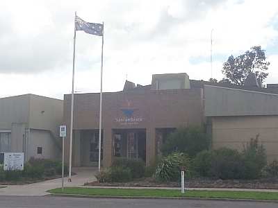
 The council meets in the council chambers at the council headquarters in the Warracknabeal Municipal Offices, which is also the location of the council's administrative activities. It also provides customer services at both its administrative centre in Warracknabeal, and its service centres in Hopetoun and Rupanyup.
Yarriambiack Shire Council official websiteMetlink local public transport mapLink to Land Victoria interactive maps
{{DEFAULTSORT:Yarriambiack, Shire of Local government areas of Victoria (Australia) Grampians (region) Wimmera
local government area
A local government area (LGA) is an administrative division of a country that a local government is responsible for. The size of an LGA varies by country but it is generally a subdivision of a State (administrative division), state, province, divi ...
of Victoria
Victoria most commonly refers to:
* Victoria (Australia), a state of the Commonwealth of Australia
* Victoria, British Columbia, provincial capital of British Columbia, Canada
* Victoria (mythology), Roman goddess of Victory
* Victoria, Seychelle ...
, Australia
Australia, officially the Commonwealth of Australia, is a Sovereign state, sovereign country comprising the mainland of the Australia (continent), Australian continent, the island of Tasmania, and numerous List of islands of Australia, sma ...
, located in the north-western part of the state. It covers an area of and, in June 2018, had a population of 6,658, having fallen from 7,438 in 2008. It includes the towns of Hopetoun, Murtoa
Murtoa is a wheat district town in Victoria, Australia, situated around Lake Marma on the Wimmera Highway, north-west of the state capital, Melbourne. The town is in the Shire of Yarriambiack local government area. At the , Murtoa had a populat ...
, Rupanyup
Rupanyup ( ) is a small town in rural Victoria, Australia. As of the , it had a population of 536. The name Rupanyup is an Aboriginal word meaning 'branch hanging over water'.Warracknabeal
Warracknabeal ( ) is a wheatbelt town in the Australian state of Victoria. Situated on the banks of the Yarriambiack Creek, 330 km north-west of Melbourne, it is the business and services centre of the northern Wimmera and southern Mallee d ...
. It was formed in 1995 from the amalgamation of the Shire of Warracknabeal
The Shire of Warracknabeal was a local government area about west-northwest of Bendigo and north of Horsham, in western Victoria, Australia. The shire covered an area of , and existed from 1891 until 1995.
History
The Warracknabeal area was ...
, Shire of Karkarooc, and parts of the Shire of Dunmunkle
The Shire of Dunmunkle was a local government area about west of Bendigo and east of Horsham, in western Victoria, Australia. The shire was bounded by the Yarriambiack Creek on the western boundary and the Richardson River on the east. The s ...
and Shire of Wimmera
The Shire of Wimmera was a local government area in the Wimmera region of western Victoria, Australia. The municipality covered an area of , and existed from 1862 until 1995. Although its shire offices were located in Horsham, Horsham itself ...
.
The Shire is governed and administered by the Yarriambiack Shire Council; its seat of local government
The seat of government is (as defined by ''Brewer's Politics'') "the building, complex of buildings or the city from which a government exercises its authority".
In most countries, the nation’s capital is also seat of its government, thus that ...
and administrative centre is located at the council headquarters in Warracknabeal, it also has service centres located in Hopetoun and Rupanyup. The Shire is named after Yarriambiack Creek
The Yarriambiack Creek, an inland intermittent watercourse of the Wimmera catchment, is located in the Wimmera region of the Australian state of Victoria. Rising on the northern slopes of the Great Dividing Range, the Yarriambiack Creek flows gen ...
, a geographical feature that meanders through the LGA from the Wimmera River
The Wimmera River, an inland intermittent river of the Wimmera catchment, is located in the Grampians and Wimmera regions of the Australian state of Victoria. Rising in the Pyrenees, on the northern slopes of the Great Dividing Range, the Wimmer ...
, through Warracknabeal, to Lake Coorong
Lake Coorong is an eutrophic lake located in the Wimmera region of western Victoria, Australia. The lake is located adjacent to the township of . After more than a decade of drought, in early 2011 the lake filled as a result of flooding in the ...
at Hopetoun.
Council
Current composition
The council is composed of three wards and seven councillors, with three councillors elected to represent the Warracknabeal Ward and two councillors per remaining ward elected to represent each of the other wards.Administration and governance
 The council meets in the council chambers at the council headquarters in the Warracknabeal Municipal Offices, which is also the location of the council's administrative activities. It also provides customer services at both its administrative centre in Warracknabeal, and its service centres in Hopetoun and Rupanyup.
Main towns in shire
In 2021 census the shire had a population of 6,556.See also
* List of places on the Victorian Heritage Register in the Shire of YarriambiackReferences
External links
Yarriambiack Shire Council official website
{{DEFAULTSORT:Yarriambiack, Shire of Local government areas of Victoria (Australia) Grampians (region) Wimmera