Sea, Lake, And Overland Surge From Hurricanes on:
[Wikipedia]
[Google]
[Amazon]
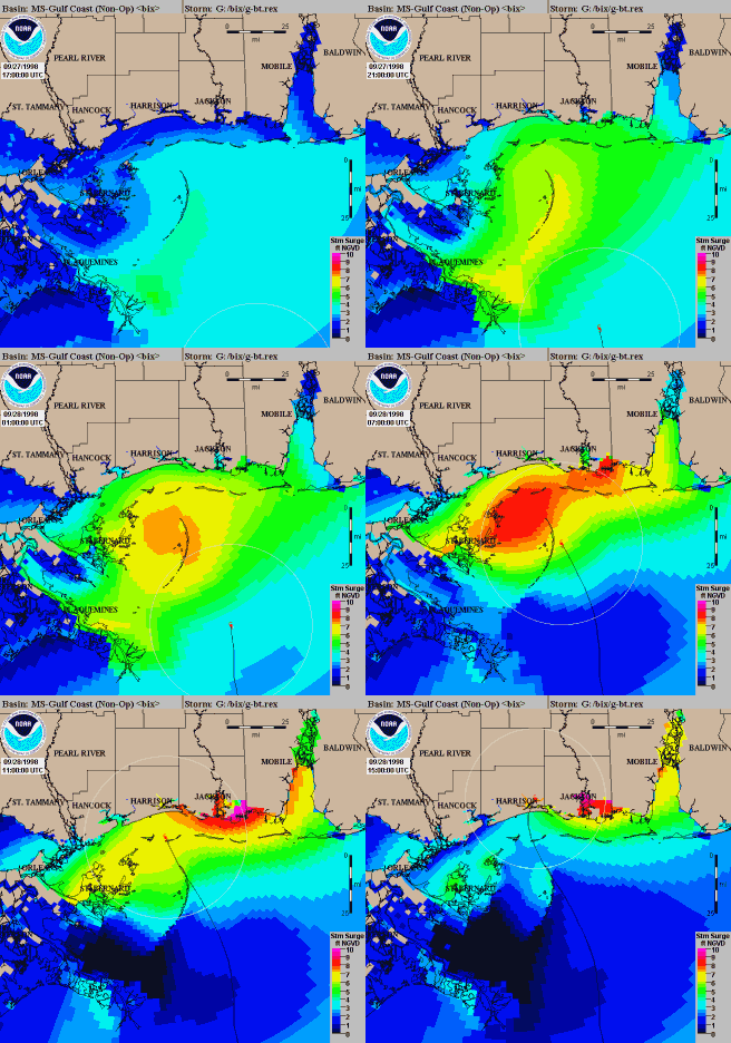
 Sea, Lake, and Overland Surge from Hurricanes (SLOSH) is a computerized model developed by the
FEMA/Surge map server
* Tropical cyclone meteorology Numerical climate and weather models Scientific simulation software {{Atmospheric, Oceanographic and Climate Models
 Sea, Lake, and Overland Surge from Hurricanes (SLOSH) is a computerized model developed by the
 Federal Emergency Management Agency
The Federal Emergency Management Agency (FEMA) is an agency of the United States Department of Homeland Security (DHS), initially created under President Jimmy Carter by Presidential Reorganization Plan No. 3 of 1978 and implemented by two Exec ...
(FEMA), United States Army Corps of Engineers
The United States Army Corps of Engineers (USACE) is the military engineering branch of the United States Army. A direct reporting unit (DRU), it has three primary mission areas: Engineer Regiment, military construction, and civil wo ...
(USACE), and the National Weather Service
The National Weather Service (NWS) is an Government agency, agency of the Federal government of the United States, United States federal government that is tasked with providing weather forecasts, warnings of hazardous weather, and other weathe ...
(NWS), to estimate storm surge
A storm surge, storm flood, tidal surge, or storm tide is a coastal flood or tsunami-like phenomenon of rising water commonly associated with low-pressure weather systems, such as cyclones. It is measured as the rise in water level above the ...
depths resulting from historical, hypothetical, or predicted hurricane
A tropical cyclone is a rapidly rotating storm system with a low-pressure area, a closed low-level atmospheric circulation, strong winds, and a spiral arrangement of thunderstorms that produce heavy rain and squalls. Depending on its ...
s.See: External links. The model functions by taking into account a storm's pressure, size, forward speed, forecast track, wind speeds, and topographical data.
SLOSH is used to evaluate the threat from storm surge
A storm surge, storm flood, tidal surge, or storm tide is a coastal flood or tsunami-like phenomenon of rising water commonly associated with low-pressure weather systems, such as cyclones. It is measured as the rise in water level above the ...
, and emergency managers use this data to determine which areas must be evacuated. SLOSH output is used by the National Hurricane Program (NHP) when conducting Hurricane Evacuation Studies as a hazard analysis tool for assisting with the creation of state and local hurricane evacuation plans or zones. SLOSH model results are combined with roadway network and traffic flow information, rainfall amounts, river flow, or wind-driven waves to determine a final analysis of at-risk areas.
References
External links
FEMA/Surge map server
* Tropical cyclone meteorology Numerical climate and weather models Scientific simulation software {{Atmospheric, Oceanographic and Climate Models