Salamis Bay on:
[Wikipedia]
[Google]
[Amazon]
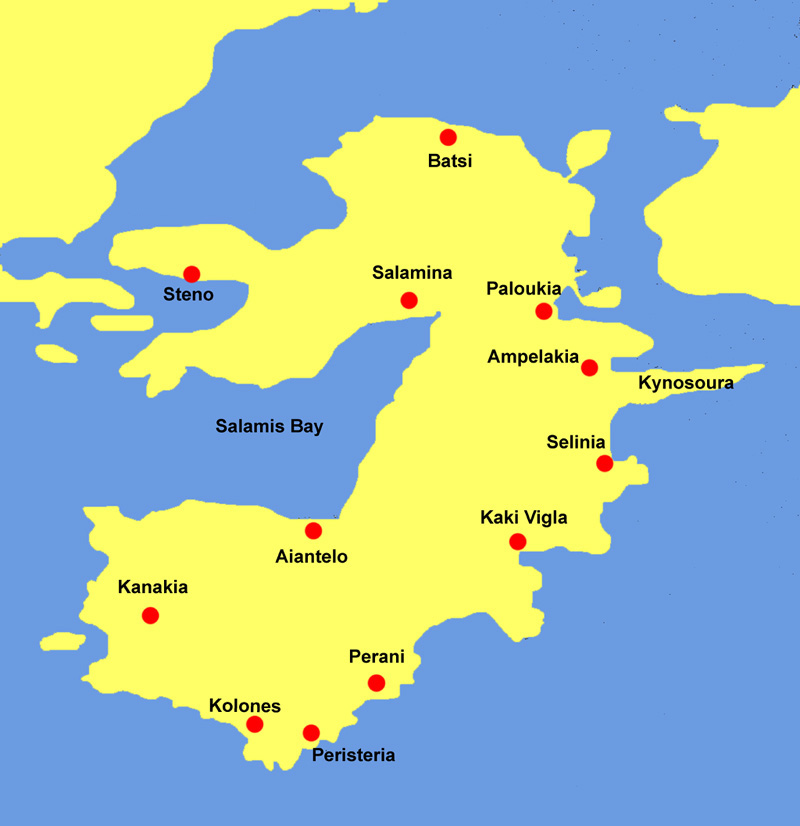
 Salamis Bay ( el, Όρμος Σαλαμίνος) is a
Salaminas Bay on GTP Travel Pages
(in English and Greek) Saronic Gulf Bays of Greece Salamis Island Landforms of Islands (regional unit) {{Attica-geo-stub
 Salamis Bay ( el, Όρμος Σαλαμίνος) is a
 bay
A bay is a recessed, coastal body of water that directly connects to a larger main body of water, such as an ocean, a lake, or another bay. A large bay is usually called a Gulf (geography), gulf, sea, sound (geography), sound, or bight (geogra ...
on the west coast of Salamis Island
Salamis ( ; el, Σαλαμίνα, Salamína; grc, label=Ancient and Katharevousa, Σαλαμίς, Salamís) is the largest Greek island in the Saronic Gulf, about off-coast from Piraeus and about west of central Athens. The chief city, Sala ...
, Greece
Greece,, or , romanized: ', officially the Hellenic Republic, is a country in Southeast Europe. It is situated on the southern tip of the Balkans, and is located at the crossroads of Europe, Asia, and Africa. Greece shares land borders with ...
. It connects with the Saronic Gulf
The Saronic Gulf (Greek: Σαρωνικός κόλπος, ''Saronikós kólpos'') or Gulf of Aegina in Greece is formed between the peninsulas of Attica and Argolis and forms part of the Aegean Sea. It defines the eastern side of the isthmus of Co ...
to the west. Its maximum length is approximately 9 km from northeast to west. Cape Petriti forms its southwestern end. The main town of the island, Salamina, is on the northeastern end of the bay. The village Aianteio is on its south coast.
The bay is surrounded by steep hills.
External links
Salaminas Bay on GTP Travel Pages
(in English and Greek) Saronic Gulf Bays of Greece Salamis Island Landforms of Islands (regional unit) {{Attica-geo-stub