Sahar Elevated Access Road on:
[Wikipedia]
[Google]
[Amazon]
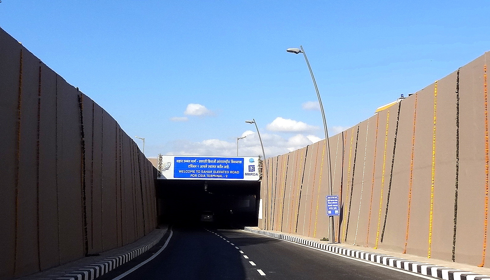
The Sahar Elevated Access Road, abbreviated to SEAR, is a dedicated, elevated,


 The six-lane, signal-free approach road originates near Hanuman Nagar junction in Vile Parle on the Western Express Highway (WEH), and ends at the forecourts of Terminal T2 of the
 Carrying out construction activities on one of Mumbai's busiest roads, with minimum interference to traffic, was a major challenge. There was no opportunity for diversion of traffic as the deck-width of the bridge was as wide as the road-width below. Frequent VIP movements accessing the airport further compounded the problem. Also, the corridor passes by the Post & Telegraph colony and a few 5-star hotels which were apprehensive about the project. The issues were sorted through negotiations and environmentally friendly construction practices.
The work on the tunnel at the Western Express Highway end of the corridor was carried out only at night because the location lies within the landing and taking off ''funnel'' of the adjacent airport runway. Work at the site was halted several times by the airport authorities due to emergency landings on the runway. Space constraints at the casting yard were dealt with by designing the pre-cast and cantilever segments so they could be stacked in two piers. The pedestrian and vehicular underpasses on the WEH were constructed in planned phases to minimize disturbance to traffic, allowing completion of the project on time.
express
Express or EXPRESS may refer to:
Arts, entertainment, and media Films
* '' Express: Aisle to Glory'', a 1998 comedy short film featuring Kal Penn
* '' The Express: The Ernie Davis Story'', a 2008 film starring Dennis Quaid
Music
* ''Express'' ...
access road
A frontage road (also known as an access road, outer road, service road, feeder road, or parallel road) is a local road running parallel to a higher-speed, limited-access road. A frontage road is often used to provide access to private drivew ...
in Mumbai
Mumbai (, ; also known as Bombay — the official name until 1995) is the capital city of the Indian state of Maharashtra and the ''de facto'' financial centre of India. According to the United Nations, as of 2018, Mumbai is the second- ...
that connects the Western Express Highway
The Western Express Highway, abbreviated to WEH (officially Ali Yavar Jung Marg after the former Governor of Maharashtra), is a major north–south 8-10 lane arterial road in Mumbai, India, stretching from the suburb of Mira Road to Bandra. T ...
(WEH) near Hanuman Nagar junction in Vile Parle
Vile Parle (, also known as Parle, pronounced "Parle" or "Parla"), is a neighbourhood and also the name of the railway station in the Western suburb of Mumbai. Vile Parle has a significantly strong base of Marathi and Gujarati population. It se ...
, with the forecourts of Terminal T2 of the Chhatrapati Shivaji International Airport
Chhatrapati Shivaji Maharaj International Airport is an international airport serving Mumbai and the Mumbai Metropolitan Region (MMR). It is the second busiest airport in the country in terms of total and international passenger traffic aft ...
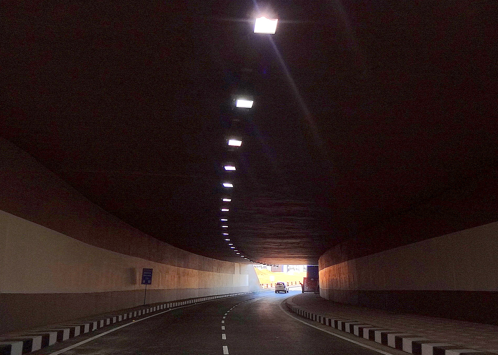
. The road improves access and travel times between the WEH and the airport. The 2.2 km long access road has 4 entry and 2 exit points. The road also includes an underpass for vehicles travelling on the WEH and a pedestrian subway; as well as an underpass, a tunnel, and ramps connecting the highway to the terminal which bypasses the congested roadways below.
The corridor was developed by the Mumbai Metropolitan Region Development Authority
Mumbai Metropolitan Region Development Authority (MMRDA) is a body of the Government of Maharashtra that is responsible for preparation oRegional Plan for MMRand the infrastructure development of the Mumbai Metropolitan Region. The MMRDA was se ...
(MMRDA) under its Mumbai Urban Infrastructure Project (MUIP). The project cost of , approved by the Jawaharlal Nehru National Urban Renewal Mission
Jawaharlal Nehru National Urban Renewal Mission (JNNURM) was a massive city-modernization scheme launched by the Government of India under the Ministry of Urban Development. It envisaged a total investment of over $20 billion over seven years. ...
(JnNURM), was paid by the Central Government
A central government is the government that is a controlling power over a unitary state. Another distinct but sovereign political entity is a federal government, which may have distinct powers at various levels of government, authorized or dele ...
, the Government of Maharashtra
The Government of Maharashtra is the state governing authority for the state of Maharashtra, India. It is a democratically elected government with 288 MLAs elected to the Vidhan Sabha for a five-year term.
Maharashtra has a Maharashtra Legisla ...
, the MMRDA, and the Mumbai International Airport Limited (MIAL).
In July 2018, parts of the relatively new road were found damaged with potholes due to poor maintenance and seasonal monsoon rains, resulting in slow traffic.
Route description
Chhatrapati Shivaji International Airport
Chhatrapati Shivaji Maharaj International Airport is an international airport serving Mumbai and the Mumbai Metropolitan Region (MMR). It is the second busiest airport in the country in terms of total and international passenger traffic aft ...
. From the WEH, the road heads east till the elevated section takes it over the Sahar Road. The corridor continues east over the Indian Airlines Project Road till it reaches the current main approach of the International terminal, where the corridor disperses into ramps which lead to the arrival and departure of the Terminal forecourts.
The road is 2.2 km long and has three lanes in each direction. On the WEH end, the project comprises of elevated road, a tunnel with ramps measuring , three vehicular underpasses each at , and of six-lane at-grade roadway. The plan also includes a pedestrian underpass on the WEH. The road will also have four ramps measuring on the airport end.
The road reduces travel time from the highway to the airport to five minutes from the 30 to 45 minutes it previously took.
History
Background
Despite the proposed Terminal 2's proximity with Mumbai's arterialWestern Express Highway
The Western Express Highway, abbreviated to WEH (officially Ali Yavar Jung Marg after the former Governor of Maharashtra), is a major north–south 8-10 lane arterial road in Mumbai, India, stretching from the suburb of Mira Road to Bandra. T ...
, commuters approaching the terminal had to travel via the congested roads of eastern Andheri
Andheri ( �n̪d̪ʱeɾiː is a locality in the western part of the city of Mumbai in India. Udayanagari, the name of a hill near the Mahakali caves, inspired the name Andheri. On the former islet of Versova, also known as Vasave, there was ano ...
(viz. Sahar Road) before reaching the airport's forecourt. Commuters had to cross Sambhaji Nagar, Rajaram Wadi, NAD Colony, Dr Babasaheb Ambedkar Road, Bamanwada, Sahar Post and Telegraph Colony, GVK Residential Colony and slow-moving traffic on Sahar road to reach the international terminal.
The impending shift of domestic air traffic would also make the situation worse during the daytime and the evening-peak traffic hours. To avoid these traffic bottlenecks, an elevated direct corridor by-passing the crowded Chakala
Chakala is a locality in the suburb of Andheri in Mumbai. It had a station on the Salsette–Trombay Railway, which was dismantled after the rail line closed down in 1934. It is served by the Western Express Highway and Chakala stations on Line ...
, Sahar Sahar may refer to: People
* Sahar (name), Arabic feminine name or Hebrew unisex name
* Sahar (singer), Iranian singer, musician and dancer.
* Sahar Aslam, former Scottish international cricketer.
* Sahar Ansari, Urdu poet and linguist from Karachi ...
Road, and the Jog flyover areas of Andheri (East) was envisioned. The elevated road was constructed to provide direct access to the international terminal, as well as reduce traffic on the WEH, especially at the Andheri-Kurla road junction. The SEAR had a tunnel incorporated into the design; it enables motorists on the WEH to access the SEAR with ease.
Construction
The project was commissioned in January 2008, and the original deadline for completing the entire project was January 2010. The corridor was developed by the MMRDA under its Mumbai Urban Infrastructure Project (MUIP) scheme withJawaharlal Nehru National Urban Renewal Mission
Jawaharlal Nehru National Urban Renewal Mission (JNNURM) was a massive city-modernization scheme launched by the Government of India under the Ministry of Urban Development. It envisaged a total investment of over $20 billion over seven years. ...
(JnNURM) funding. The project was funded by the Central Government
A central government is the government that is a controlling power over a unitary state. Another distinct but sovereign political entity is a federal government, which may have distinct powers at various levels of government, authorized or dele ...
, the State Government
A state government is the government that controls a subdivision of a country in a federal form of government, which shares political power with the federal or national government. A state government may have some level of political autonomy, or ...
, the MMRDA, and the Mumbai International Airport Limited (MIAL). The Sahar Elevated Access Road was constructed jointly by the MMRDA and the MIAL. The cost of construction for the MMRDA was , higher than the earlier estimated . The road was built in two parts: the first was a 1.8 km stretch from the WEH to the Hyatt Regency (on Sahar Airport Road), and the second was a 1.5 km stretch from the Hyatt Regency to the airport. The first section cost and was built by the MMRDA, while the second cost and was built by MIAL.
The 1,300-metre long elevated road consists of 30 spans of precast concrete segments erected using a specially fabricated launching girder and strand jack. The pillars measure at the base. The deck superstructure is composed of a precast central spine and two cantilever wings on either side connected to the central spine by concrete stitching and transverse pre-stressing methods. The pedestrian, and two and three-wheeler underpasses on the Western Express Highway were constructed with pre-cast box cells. The approaches on either sides were built with reinforced earth walls. The pedestrian and vehicular underpass on Western Express Highway in Vile Parle is 45 metres long, and the MIAL underpass on Justice MC Chhagla Road is 48 metres long. A tunnel was constructed at the junction of the corridor with the WEH using the cut and cover method with concrete contiguous piles.
The Sahar Elevated Access Road and the new terminal at BOM opened on 12 February 2014.
Impediments
References
{{coord missing, Maharashtra Roads in Mumbai Expressways in Maharashtra Transport infrastructure completed in 2014 2014 establishments in Maharashtra