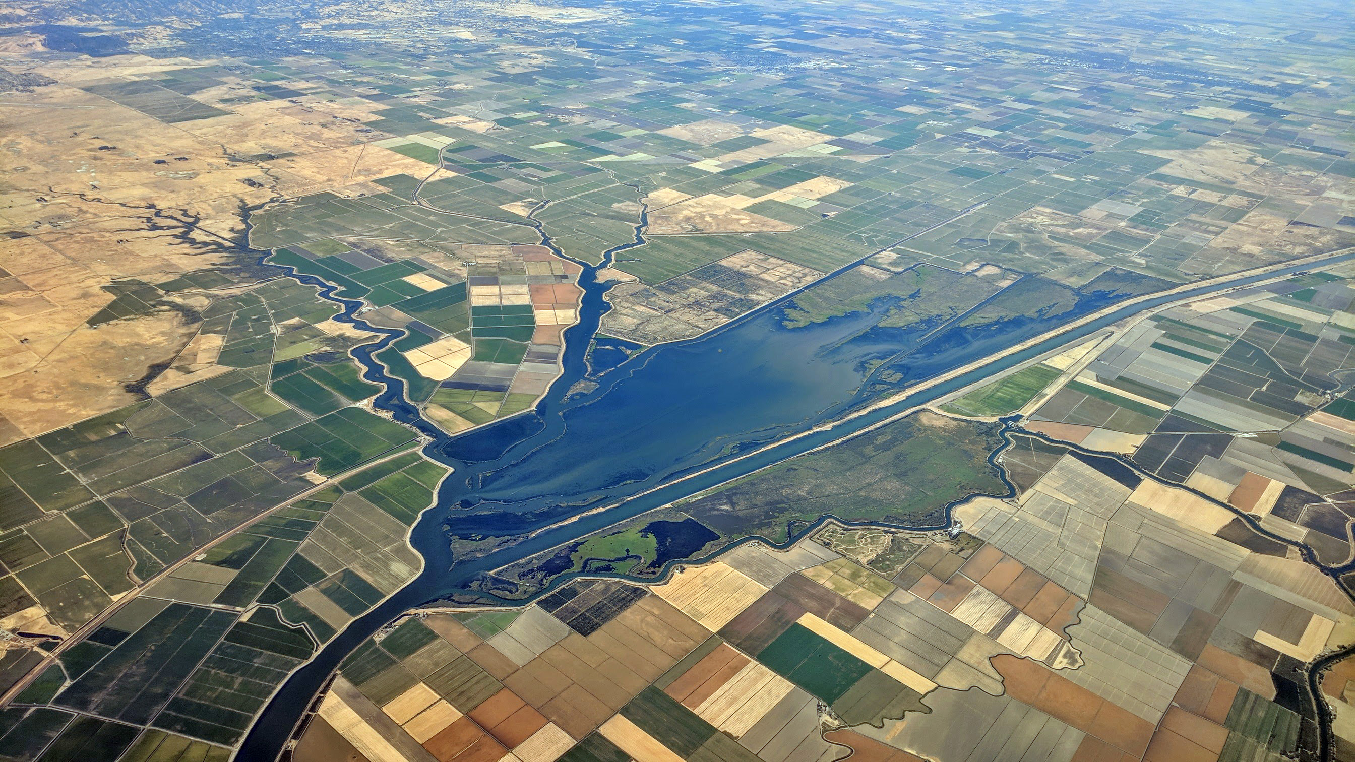
Ryer Island on:
[Wikipedia]
[Google]
[Amazon]
 Ryer Island is an island in the Sacramento-San Joaquin River Delta surrounded by Miner Slough and Steamboat Slough at their confluence with the
David L. Durham, ''California's Geographic Names: A Gazetteer of Historic and Modern Names of This State''. p. 693. Quill Driver Books. (1998) .
 Ryer Island is an island in the Sacramento-San Joaquin River Delta surrounded by Miner Slough and Steamboat Slough at their confluence with the
 Sacramento River
The Sacramento River ( es, Río Sacramento) is the principal river of Northern California in the United States and is the largest river in California. Rising in the Klamath Mountains, the river flows south for before reaching the Sacramento–S ...
, 6.5 miles north-northeast of Rio Vista. It is in Solano County, California
Solano County () is a county located in the U.S. state of California. As of the 2020 census, the population was 453,491. The county seat is Fairfield.
Solano County comprises the Vallejo–Fairfield, CA Metropolitan Statistical Area, which is ...
, and managed by Reclamation District 501. The island is named in honor of a California pioneer, Dr. Washington M. Ryer, and his family. A map prepared at the time of statehood shows the area divided by the west fork of the Sacramento River, with the western half identified as Priest Island and the eastern half identified as Sutter Island.
The California Department of Transportation
The California Department of Transportation (Caltrans) is an executive department of the U.S. state of California. The department is part of the cabinet-level California State Transportation Agency (CalSTA). Caltrans is headquartered in Sacrame ...
(Caltrans) operates two vehicle ferry services to the island, connecting the following state highways:
* , towards Rio Vista
* , towards Ryde
Ryde is an English seaside town and civil parish on the north-east coast of the Isle of Wight. The built-up area had a population of 23,999 according to the 2011 Census and an estimate of 24,847 in 2019. Its growth as a seaside resort came af ...
Highway 220 then terminates at Highway 84 on Ryer Island, while the latter leaves the island north on a bridge, and towards West Sacramento
West Sacramento (also known as West Sac) is a city in Yolo County, California, United States. The city is separated from Sacramento by the Sacramento River, which also separates Sacramento and Yolo counties. It is a fast-growing community; the p ...
.
See also
*List of islands of California
This list of islands of California is organized into sections, generally arranged from north to south. The islands within each section are listed in alphabetical order.
The Geographic Names Information System (GNIS) lists 527 named islands in the ...
* Ryer Island Ferry
The Ryer Island Ferry is a ferry that operates between Rio Vista and Ryer Island, crossing Cache Slough in the Sacramento–San Joaquin River Delta in Solano County, California. The California Department of Transportation (Caltrans) operates t ...
* Howard Landing Ferry The J-Mack Ferry (also called J-Mac Ferry, Steamboat Slough Ferry, or Grand Island Ferry) is a cable ferry that operates between Ryde and Ryer Island, crossing Steamboat Slough in the Sacramento-San Joaquin River Delta in Solano County, Californi ...
References
External links
* Islands of the Sacramento–San Joaquin River Delta Islands of Northern California Islands of Solano County, California Islands of the San Francisco Bay Area {{SolanoCountyCA-geo-stub