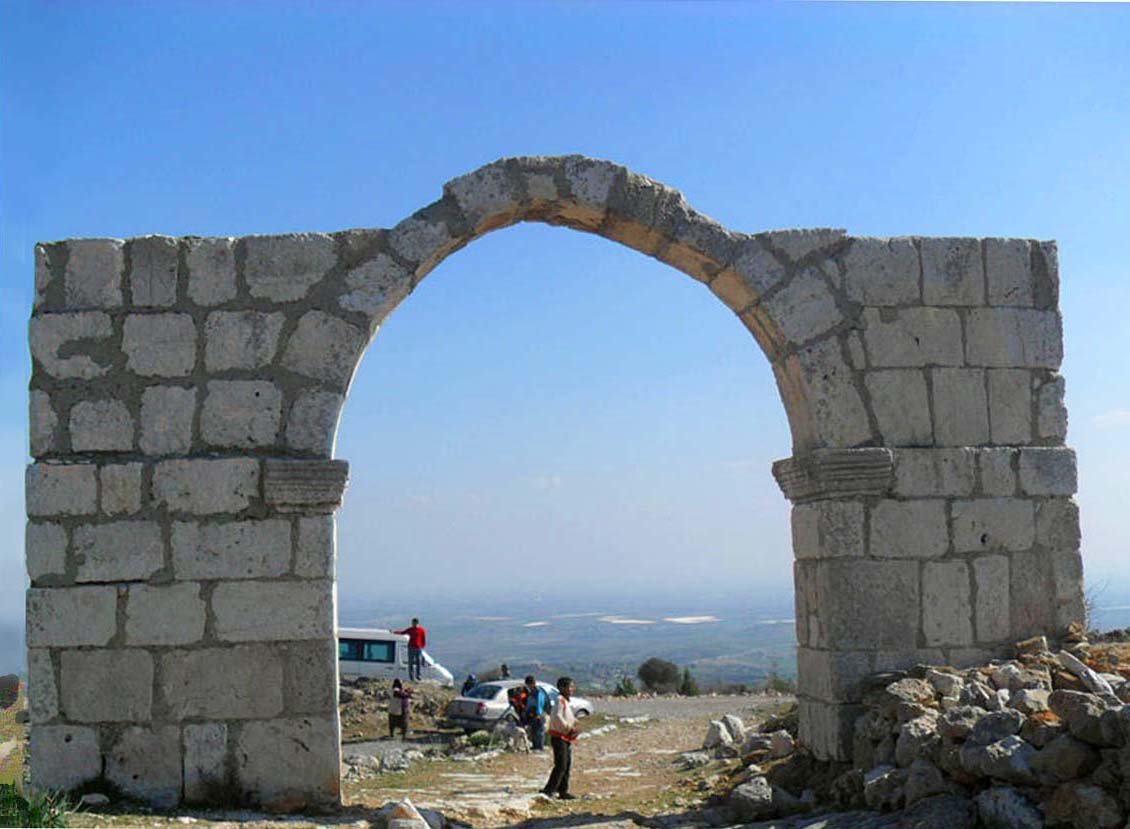
Roman road in Cilicia on:
[Wikipedia]
[Google]
[Amazon]
 The Roman road in Cilicia ( tr, Roma yolu) is a part of a
 The road is thought to be a part of the main road connecting
Mersin page
/ref> The inner width is .
 The Roman road in Cilicia ( tr, Roma yolu) is a part of a
 Roman road
Roman roads ( la, viae Romanae ; singular: ; meaning "Roman way") were physical infrastructure vital to the maintenance and development of the Roman state, and were built from about 300 BC through the expansion and consolidation of the Roman Re ...
in Mersin Province
Mersin Province ( tr, ), formerly İçel Province ( tr, ), is a province in southern Turkey, on the Mediterranean coast between Antalya and Adana. The provincial capital and the biggest city in the province is Mersin, which is composed of f ...
, Turkey
Turkey ( tr, Türkiye ), officially the Republic of Türkiye ( tr, Türkiye Cumhuriyeti, links=no ), is a transcontinental country located mainly on the Anatolian Peninsula in Western Asia, with a small portion on the Balkan Peninsula ...
.
Geography
 The road is thought to be a part of the main road connecting
 Cilicia
Cilicia (); el, Κιλικία, ''Kilikía''; Middle Persian: ''klkyʾy'' (''Klikiyā''); Parthian: ''kylkyʾ'' (''Kilikiyā''); tr, Kilikya). is a geographical region in southern Anatolia in Turkey, extending inland from the northeastern coa ...
to Capadocia
Cappadocia or Capadocia (; tr, Kapadokya), is a historical region in Central Anatolia, Turkey. It largely is in the provinces Nevşehir, Kayseri, Aksaray, Kırşehir, Sivas and Niğde.
According to Herodotus, in the time of the Ionian Revo ...
during antiquity. The northern terminus was likely in the town of Bahçeli, a part of the ancient city of Tyanna
Tyana ( grc, Τύανα), earlier known as Tuwana ( Hieroglyphic Luwian: ; Akkadian: ) and Tuwanuwa ( Hittite: ) was an ancient city in the Anatolian region of Cappadocia, in modern Kemerhisar, Niğde Province, Central Anatolia, Turkey. It was ...
in Niğde Province
Niğde Province ( tr, ) is a province in the southern part of Central Anatolia, Turkey. Population is 341,412 (2013 est) of which 141,360 live in the city of Niğde. The population was 348,081 in 2000 and 305,861 in 1990. It covers an area of 7, ...
. The southern terminus was in Tarsus, a major district center in Mersin Province and an important ancient city. The modern highway distance between these two locations is . But presently only a small section of the road has been unearthed. The unearthed road starts from a hill at about around Sağlıklı
Sağlıklı is a neighbourhood in the municipality and district of Tarsus, Mersin Province, Turkey. Its population is 1,212 (2022). It is to Tarsus and to Mersin. Sağlıklı is famed for the Roman road
Roman roads ( la, viae Romanae ; sin ...
village which is from Tarsus, and continues about to the north. The average altitude of the road is to . At the southern end of the unearthed section, where Tarsus is in the view, there is a gate which was either an arch gate or a border check point of Cilicia. There is also a very short road in Tarsus urban fabric called Ancient road
Historic roads (historic trails in USA and Canada) are paths or routes that have historical importance due to their use over a period of time. Examples exist from prehistoric times until the early 20th century. They include ancient trackway ...
which has been discovered only recently. But whether the two roads are connected is unclear.
History
The road is thought to have been constructed in the 1st century AD by theRoman Empire
The Roman Empire ( la, Imperium Romanum ; grc-gre, Βασιλεία τῶν Ῥωμαίων, Basileía tôn Rhōmaíōn) was the post- Republican period of ancient Rome. As a polity, it included large territorial holdings around the Mediter ...
. But according to a restoration inscription next to the road, it was rebuilt or repaired during the reign of Caracalla
Marcus Aurelius Antoninus (born Lucius Septimius Bassianus, 4 April 188 – 8 April 217), better known by his nickname "Caracalla" () was Roman emperor from 198 to 217. He was a member of the Severan dynasty, the elder son of Emperor S ...
in the 3rd century. The original gate, dated to 5th century, was destroyed at some point, and the present gate was reconstructed much later.
Technical details
The road is stone pavement and there are stoneparapet
A parapet is a barrier that is an extension of the wall at the edge of a roof, terrace, balcony, walkway or other structure. The word comes ultimately from the Italian ''parapetto'' (''parare'' 'to cover/defend' and ''petto'' 'chest/breast'). ...
s on each side of the road. The width of the road excluding the parapet is about .
The outer dimensions of the cut stone gate is 8.8 m. wide x 5.2 m. high ( 28.98 ft high x 17 ft wide)./ref> The inner width is .
References