Rockland St Mary on:
[Wikipedia]
[Google]
[Amazon]
Rockland St Mary is a village in 
 Rockland St Mary dates back to the
/ref> which were made in Rockland and transported by river from the
/ref> Although all trace of the tile-making industry has gone Rockland Staithe still exists, providing mooring for pleasure craft opposite ''The New Inn'' at the east end of the village. It leads to Rockland Broad which is itself linked to the
4 mile walk
from the EDP
6 mile walk
from the EDP {{Authority control Villages in Norfolk South Norfolk Civil parishes in Norfolk
South Norfolk
South Norfolk is a local government district in Norfolk, England. Its council is based in Long Stratton. The population of the Local Authority District was 124,012 as taken at the 2011 Census.
History
The district was formed on 1 April 197 ...
which lies about 6 miles (9½ km) southeast of Norwich
Norwich () is a cathedral city and district of Norfolk, England, of which it is the county town. Norwich is by the River Wensum, about north-east of London, north of Ipswich and east of Peterborough. As the seat of the See of Norwich, with ...
between Surlingham
Surlingham is a village and civil parish in the South Norfolk district of Norfolk situated on the Broads in eastern United Kingdom. It lies approximately 6½ miles (10½ km) south-east of Norwich on the south bank of the River Yare between Bram ...
, Bramerton
Bramerton is a village in South Norfolk 4¾ miles (7½ km) south-east of Norwich, just north of the main A146 Norwich-Lowestoft road and on the south bank of the River Yare.
Geography
In the 2001 census it contained 158 households and a popu ...
, Claxton Claxton may refer to:
Places
*Claxton, County Durham, England
*Claxton, Norfolk, England
*Claxton, North Yorkshire, England
*Claxton, Georgia, USA
** the Claxton meteorite of 1984, which fell in Georgia, United States (see meteorite falls)
* Claxto ...
and Hellington
Hellington is a hamlet and civil parish in the South Norfolk district of the county of Norfolk, England. In the 2001 census, it contained 24 households and a population of 69.
It is centred on a crossroads south of Rockland St. Mary and around ...
. In the 2001 census it contained 325 households and a population of 824, falling to 810 at the 2011 Census. Although Rockland is part of South Norfolk District, those parts of the village lying adjacent to the river and broads fall under the administration of the Broads Authority
The Broads Authority is the agency which has statutory responsibility for the Broads in England. Originally, the Nature Conservancy Council (now Natural England), pressed for a special authority to manage the Broads which had been neglected for ...
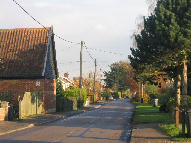
. The Street (pictured) runs east to west through the centre of the village.

History
 Rockland St Mary dates back to the
 Anglo-Saxon
The Anglo-Saxons were a Cultural identity, cultural group who inhabited England in the Early Middle Ages. They traced their origins to settlers who came to Britain from mainland Europe in the 5th century. However, the ethnogenesis of the Anglo- ...
period with the village mentioned in the Domesday Book
Domesday Book () – the Middle English spelling of "Doomsday Book" – is a manuscript record of the "Great Survey" of much of England and parts of Wales completed in 1086 by order of King William I, known as William the Conqueror. The manusc ...
as Rokelunda. The name derives from Old Norse for 'Rook Grove'. In medieval times Norwich was noted for its black-glazed roofing tilesDiscover the Heart of the Broads/ref> which were made in Rockland and transported by river from the
staithe
A wharf, quay (, also ), staith, or staithe is a structure on the shore of a harbour or on the bank of a river or canal where ships may dock to load and unload cargo or passengers. Such a structure includes one or more berths (mooring locatio ...
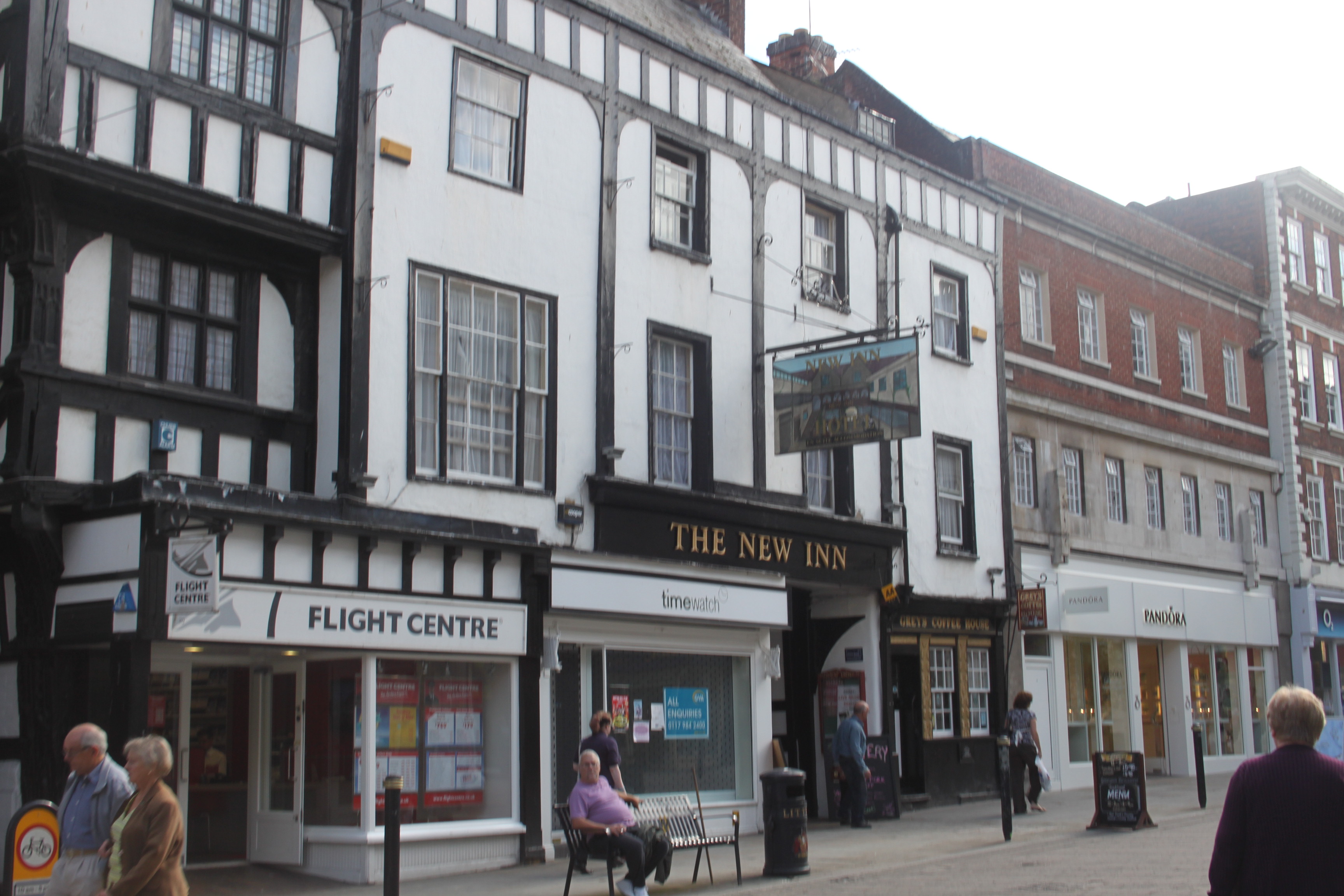
.Discover the Heart of the Broads/ref> Although all trace of the tile-making industry has gone Rockland Staithe still exists, providing mooring for pleasure craft opposite ''The New Inn'' at the east end of the village. It leads to Rockland Broad which is itself linked to the
River Yare
The River Yare is a river in the English county of Norfolk. In its lower reaches it is one of the principal navigable waterways of The Broads and connects with the rest of the network.
The river rises south of Dereham to the west to the villag ...
by two dykes: the Short Dyke and the Fleet Dyke. The school has occupied the same site since the 1840s, the current buildings date from the 1880s and were built using bricks baked in the village. During World War II
World War II or the Second World War, often abbreviated as WWII or WW2, was a world war that lasted from 1939 to 1945. It involved the vast majority of the world's countries—including all of the great powers—forming two opposin ...
a V-2 rocket
The V-2 (german: Vergeltungswaffe 2, lit=Retaliation Weapon 2), with the technical name ''Aggregat 4'' (A-4), was the world’s first long-range guided ballistic missile. The missile, powered by a liquid-propellant rocket engine, was developed ...
hit a field near the school. This caused several minor injuries and one major injury. A new extension was opened in September 2004 by MP Richard Bacon which was built from Suffolk bricks.

Today
As well as the ''New Inn'', the village contains Rockland Stores and Post Office and a doctors' surgery. Rockland St. Mary Primary School provides education for around 90 children. The village also has two halls, the Margaret Mac, and the Parish Hall.St Mary's Church
St Mary's church has a noticeably tapered tower, Tudor windows and a Victorian interior. It also contains a bronze memorial to those who both served and died inWorld War I
World War I (28 July 1914 11 November 1918), often abbreviated as WWI, was one of the deadliest global conflicts in history. Belligerents included much of Europe, the Russian Empire, the United States, and the Ottoman Empire, with fightin ...
. The churchyard supposedly contains the overgrown remains of Rockland St Margaret.
Public access
The village is served by bus route 85 via Our Bus which provides nine services a day into Norwich via Bramerton andKirby Bedon
Kirby Bedon is a hamlet in South Norfolk which lies approximately 3½ miles (5½ km) south-east of Norwich on the road to Bramerton. It covers an area of and had a population of 186 in 77 households at the 2001 census, the population incre ...
.
National Cycle Route 1
The cycle-path is located in the United Kingdom.
Route
Dover to Canterbury
Dover , Deal , Sandwich , Canterbury
Links with National Cycle Route 2, Regional route 16, and Regional route 17 in Dover. Leaves Dover passing Dover Castle. S ...
passes through the east of the village on its route from Norwich via Whitlingham
Whitlingham is a small churchless parish and hamlet at the mouth of the River Wensum in Norfolk, England. It is located 3 miles (5 km) east of Norwich, on the south bank of the River Yare, reached from Trowse along Whitlingham Lane.
Churc ...
and Surlingham, and out to Loddon Loddon may refer to:
*Loddon, Norfolk in England, UK
*Shire of Loddon in Victoria, Australia (since 1995)
**Bridgewater On Loddon, Victoria in Australia
*River Loddon, flows into the River Thames near Reading
*Loddon River, flows north from south of ...
and Beccles
Beccles ( ) is a market town and civil parish in the English county of Suffolk.OS Explorer Map OL40: The Broads: (1:25 000) : . The town is shown on the milestone as from London via the A145 and A12 roads, north-east of London as the crow fli ...
via Claxton. Long distance footpath
A long-distance trail (or long-distance footpath, track, way, greenway) is a longer recreational trail mainly through rural areas used for hiking, backpacking, cycling, horse riding or cross-country skiing. They exist on all continents exc ...
, Wherryman's Way
Wherryman's Way is a long-distance footpath in the English county of Norfolk.
Route
Wherryman's Way is long, running between Norwich and Great Yarmouth. It follows the course of the River Yare where possible, with some significant stretches a ...
lies close to the village
Governance
Rockland St Mary is part of theelectoral ward
A ward is a local authority area, typically used for electoral purposes. In some countries, wards are usually named after neighbourhoods, thoroughfares, parishes, landmarks, geographical features and in some cases historical figures connected to t ...
called Rockland. The population of this ward at the 2011 Census was 2,839.
References
External links
*4 mile walk
from the EDP
6 mile walk
from the EDP {{Authority control Villages in Norfolk South Norfolk Civil parishes in Norfolk