Quiraing on:
[Wikipedia]
[Google]
[Amazon]
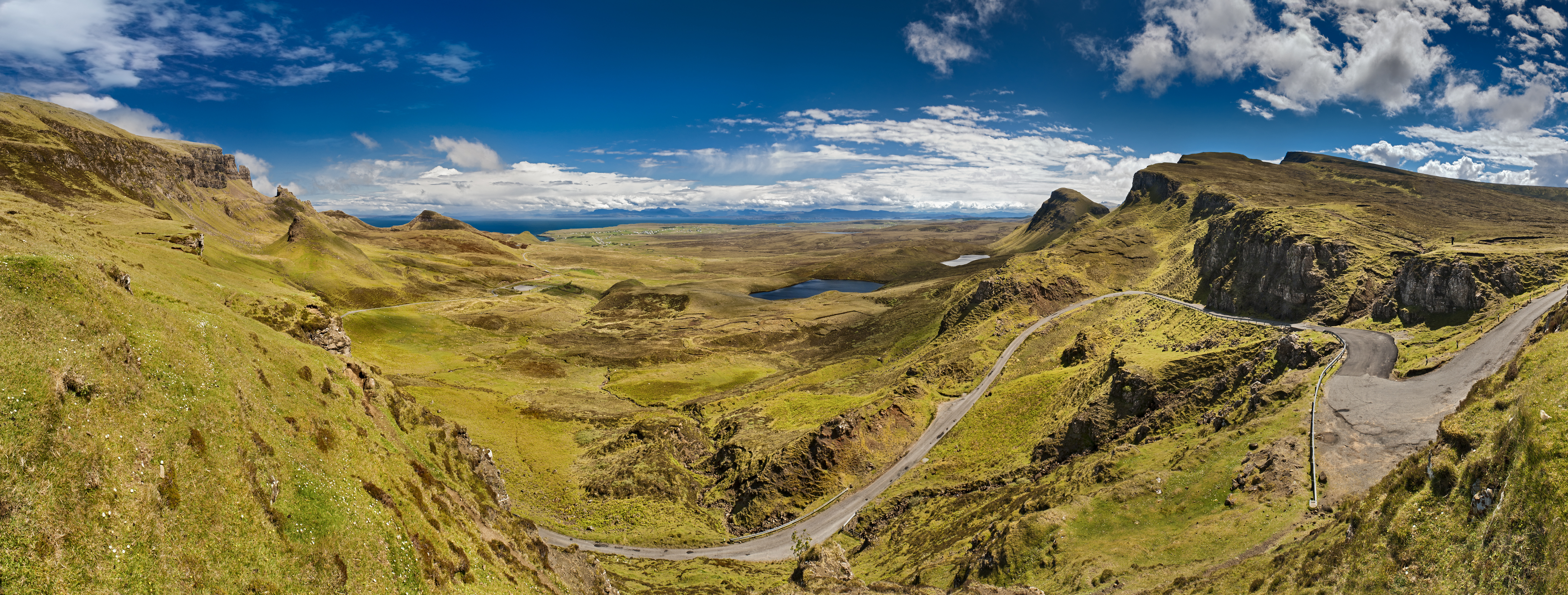
The Quiraing ( gd, A' Chuith-Raing) is a 
File:"The Prison" rock formation in Quiraing, Isle of Skye.jpg, "The Prison" from the main pathway.
File:"The Needle" rock formation in Quiraing, Isle of Skye.jpg, "The Needle" from "The Prison"
landslip
Landslides, also known as landslips, are several forms of mass wasting that may include a wide range of ground movements, such as rockfalls, deep-seated slope failures, mudflows, and debris flows. Landslides occur in a variety of environments, ...
on the eastern face of , the northernmost summit of the Trotternish
Trotternish or Tròndairnis (Scottish Gaelic) is the northernmost peninsula of the Isle of Skye, in Scotland. Its most northerly point, Rubha Hùinis, is the most northerly point of Skye.
One of the peninsula's better-known features is the Trot ...
on the Isle of Skye
The Isle of Skye, or simply Skye (; gd, An t-Eilean Sgitheanach or ; sco, Isle o Skye), is the largest and northernmost of the major islands in the Inner Hebrides of Scotland. The island's peninsulas radiate from a mountainous hub dominated ...
, Scotland
Scotland (, ) is a country that is part of the United Kingdom. Covering the northern third of the island of Great Britain, mainland Scotland has a border with England to the southeast and is otherwise surrounded by the Atlantic Ocean to the ...
. The whole of the Trotternish Ridge escarpment
An escarpment is a steep slope or long cliff that forms as a result of faulting or erosion and separates two relatively level areas having different elevations.
The terms ''scarp'' and ''scarp face'' are often used interchangeably with ''escar ...
was formed by a great series of landslips; the Quiraing is the only part of the slip still moving – the road at its base, near Flodigarry
Flodigarry ( gd, Flòdaigearraidh) is a scattered settlement on the north east side of the Trotternish peninsula on the island of Skye, and is in the Scottish council area of Highland
Highlands or uplands are areas of high elevation such as a ...
, requires repairs each year.
Parts of the distinctive landscape have earned particular names. The Needle is a jagged landmark pinnacle, a remnant of landslipping. Northwest of it is The Table, a flat grassy area slipped down from the summit plateau, with vistas of the Torridon Hills
The Torridon Hills surround Torridon village in the Northwest Highlands of Scotland. The name is usually applied to the mountains to the north of Glen Torridon. They are among the most dramatic and spectacular peaks in the British Isles and made ...
and the mountains of Wester Ross
Wester Ross () is an area of the Northwest Highlands of Scotland in the council area of Highland. The area is loosely defined, and has never been used as a formal administrative region in its own right, but is generally regarded as lying to the ...
. Southwest is the Prison, a pyramidal rocky peak which can look like a medieval keep
A keep (from the Middle English ''kype'') is a type of fortified tower built within castles during the Middle Ages by European nobility. Scholars have debated the scope of the word ''keep'', but usually consider it to refer to large towers in c ...
when viewed from the right angle – the ascent of this is an airy scramble.
The name Quiraing comes from Old Norse
Old Norse, Old Nordic, or Old Scandinavian, is a stage of development of North Germanic languages, North Germanic dialects before their final divergence into separate Nordic languages. Old Norse was spoken by inhabitants of Scandinavia and t ...
, which means 'Round Fold'. Within the fold is The Table, an elevated plateau hidden amongst the pillars. It is said that the fold was used to conceal cattle from Viking
Vikings ; non, víkingr is the modern name given to seafaring people originally from Scandinavia (present-day Denmark, Norway and Sweden),
who from the late 8th to the late 11th centuries raided, pirated, traded and se ...
raiders.

External links
* {{Skye Mountains and hills of the Isle of Skye Landslides in the United Kingdom