Parkhurst, Queensland on:
[Wikipedia]
[Google]
[Amazon]
Parkhurst is a
 Parkhurst has a number of
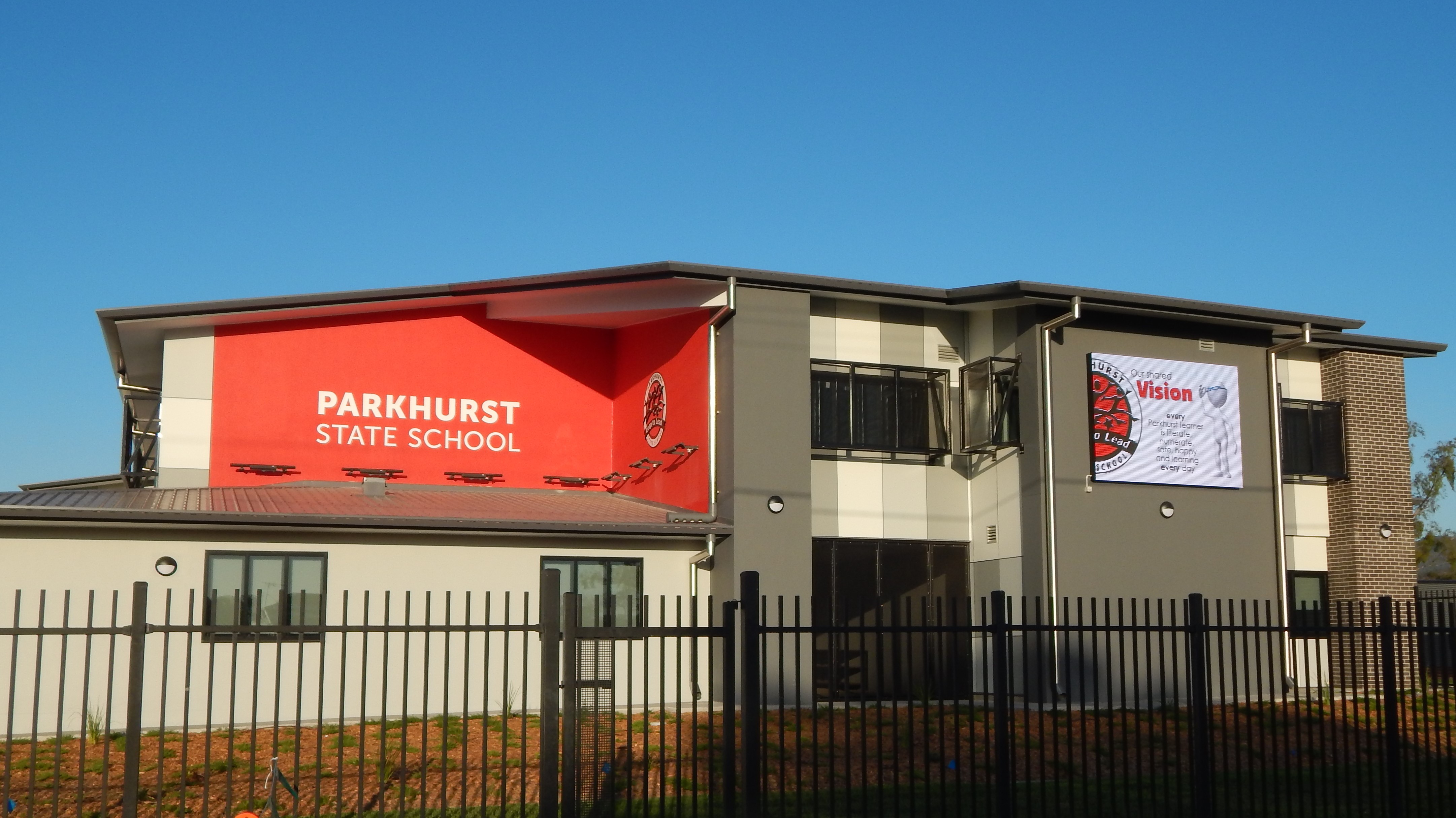
 Parkhurst State School is a government primary (Prep-6) school for boys and girls at 11 Mason Avenue (). In 2014, the school had an enrolment of 308 students with 25 teachers (21 full-time equivalent). At that time, approximately half the children lived outside the suburb and came by school bus from the more rural areas to the north. In 2018, the school had an enrolment of 404 students with 28 teachers (27 full-time equivalent) and 22 non-teaching staff (14 full-time equivalent). It includes a
 Parkhurst Early Learning Centre is a
suburb
A suburb (more broadly suburban area) is an area within a metropolitan area, which may include commercial and mixed-use, that is primarily a residential area. A suburb can exist either as part of a larger city/urban area or as a separate ...
of Rockhampton
Rockhampton is a city in the Rockhampton Region of Central Queensland, Australia. The population of Rockhampton in June 2021 was 79,967, Estimated resident population, 30 June 2018. making it the fourth-largest city in the state outside of the ...
in the Rockhampton Region
The Rockhampton Region is a local government area (LGA) in Central Queensland, Australia, located on the Tropic of Capricorn about north of Brisbane. Rockhampton is the region's major city; the region also includes the Fitzroy River, Mount ...
, Queensland
)
, nickname = Sunshine State
, image_map = Queensland in Australia.svg
, map_caption = Location of Queensland in Australia
, subdivision_type = Country
, subdivision_name = Australia
, established_title = Before federation
, established_ ...
, Australia. In the , Parkhurst had a population of 2,476 people.
Geography
Parkhurst is bounded to the north by Ramsay Creek and to the west by Ramsay Creek and then the Fitzroy River. To the south it is bounded by Limestone Creek (the creek, not the suburb) and byRockhampton–Yeppoon Road
Rockhampton–Yeppoon Road is a non-continuous road route in the Rockhampton Region, Rockhampton and Shire of Livingstone, Livingstone local government areas of Queensland, Australia. Most of the route is designated as State Route 4 (Regional ...
.
A section of the Bruce Highway
The Bruce Highway is a major highway in Queensland, Australia. Commencing in the state capital, Brisbane, it passes through areas close to the eastern coast on its way to Cairns in Far North Queensland. The route is part of the Australian Na ...
passes through the centre of the suburb from south to north, while the North Coast railway line also passes through the suburb from south to north, to the west of the highway. The proposed Rockhampton Ring Road
Rockhampton Ring Road is a proposed highway from on the Capricorn Highway south-west of to on the Bruce Highway to the north-east of Rockhampton, in Queensland, Australia. The road will be two lanes from the Capricorn Highway to a connecti ...
will pass through Parkhurst on its way to join the Bruce Highway'
The Parkhurst Industrial Estate is in the south-west of the suburb, while the residential land is in the west near the river and in the north-east of the suburb. Most of Parkhurst remains farmland, but Rockhampton's urban sprawl
Urban sprawl (also known as suburban sprawl or urban encroachment) is defined as "the spreading of urban developments (such as houses and shopping centers) on undeveloped land near a city." Urban sprawl has been described as the unrestricted growt ...
has led to further residential developments being established throughout Parkhurst including the Northridge, Rosedale, Paramount Park, Riverside and Edenbrook estates.
The increasing population at Parkhurst and in areas further north such as Rockyview and Glendale has led to the construction of the Parkhurst Town Centre
Parkhurst Town Centre is a shopping centre located in the suburb of Parkhurst on the northern outskirts of Rockhampton, Queensland, Australia.
The shopping centre was constructed on the corner of the Bruce Highway and Boundary Road.
Due to C ...
, a new shopping centre anchored by a Woolworths supermarket. Construction of the centre commenced in August 2015. Woolworths was the first store in open in the centre on 15 November 2016.
The land near the river is prone to flooding. Rockhampton's water treatment facility is located near the river.
Road infrastructure
The Rockhampton-Yeppoon Road (as Yeppoon Road) runs along the south-eastern boundary.History
The Glenmore Homestead is one of the earliest in the Rockhampton area, being established in the late 1850s. Land was opened up for settlement and small farms were established. Parkhurst Provisional School accepted its first enrolments on 11 June 1900. In 1909 it became Parkhurst State School. At the , the suburb recorded a population of 1,385. In the , Parkhurst had a population of 2,476 people.Heritage listings
 Parkhurst has a number of
 heritage-listed
This list is of heritage registers, inventories of cultural properties, natural and man-made, tangible and intangible, movable and immovable, that are deemed to be of sufficient heritage value to be separately identified and recorded. In many ...
sites, including:
* Belmont Road: Glenmore Homestead
Glenmore Homestead is a heritage-listed homestead at Belmont Road, Parkhurst, Rockhampton Region, Queensland, Australia. It was built from to . The homestead and associated buildings once belonged to pastoral run on the Fitzroy River, seven ...
Education
 Parkhurst State School is a government primary (Prep-6) school for boys and girls at 11 Mason Avenue (). In 2014, the school had an enrolment of 308 students with 25 teachers (21 full-time equivalent). At that time, approximately half the children lived outside the suburb and came by school bus from the more rural areas to the north. In 2018, the school had an enrolment of 404 students with 28 teachers (27 full-time equivalent) and 22 non-teaching staff (14 full-time equivalent). It includes a
 special education
Special education (known as special-needs education, aided education, exceptional education, alternative provision, exceptional student education, special ed., SDC, or SPED) is the practice of educating students in a way that accommodates th ...
program.
There are no secondary schools in Parkhurst. The nearest government secondary school is Glenmore State High School in neighbouring Kawana to the south.
Amenities
 Parkhurst Early Learning Centre is a
 child care
Child care, otherwise known as day care, is the care and supervision of a child or multiple children at a time, whose ages range from two weeks of age to 18 years. Although most parents spend a significant amount of time caring for their child(r ...
centre and kindergarten
Kindergarten is a preschool educational approach based on playing, singing, practical activities such as drawing, and social interaction as part of the transition from home to school. Such institutions were originally made in the late 18th cent ...
in Bean Street established in 1995. It also provides before-school care, after-school care, and vacation care.
There are a number of parks in the area:
* Alexandra Street Park ()
* Bill Neven Park ()
* Boundary Road Park ()
* John Hegvold Park ()
* Joseph Harrison Park ()
* Nuttall Street ()
* Parkhurst Tennis Club ()
* Ramsay Creek Park ()
* Thomas Hilcher Park ()
* Wade Street Park ()
Attractions
Parkhurst is home to theRockhampton Heritage Village
The Rockhampton Heritage Village is a tourist attraction and multipurpose venue located in Rockhampton, Queensland, Australia.
Situated on corner of the Bruce Highway and Boundary Road in the suburb of Parkhurst, it was officially opened by Ro ...
. Located at 296 Boundary Road, this open air museum
An open-air museum (or open air museum) is a museum that exhibits collections of buildings and artifacts out-of-doors. It is also frequently known as a museum of buildings or a folk museum.
Definition
Open air is “the unconfined atmosphere†...
showcases a range of historic buildings with exhibitions of artefacts from Rockhampton's history. The museum is a venue for local markets and has a large function venue built in the style of a traditional woolshed.
Limestone Creek Environmental Park offers a range of walking tracks in and around Limestone Creek through an open eucalypt forest where wildlife can be seen. It is popular with bird watchers and photographers.
References
Further reading
*External links
* {{Rockhampton Region Suburbs of Rockhampton