Puntapin Rock on:
[Wikipedia]
[Google]
[Amazon]


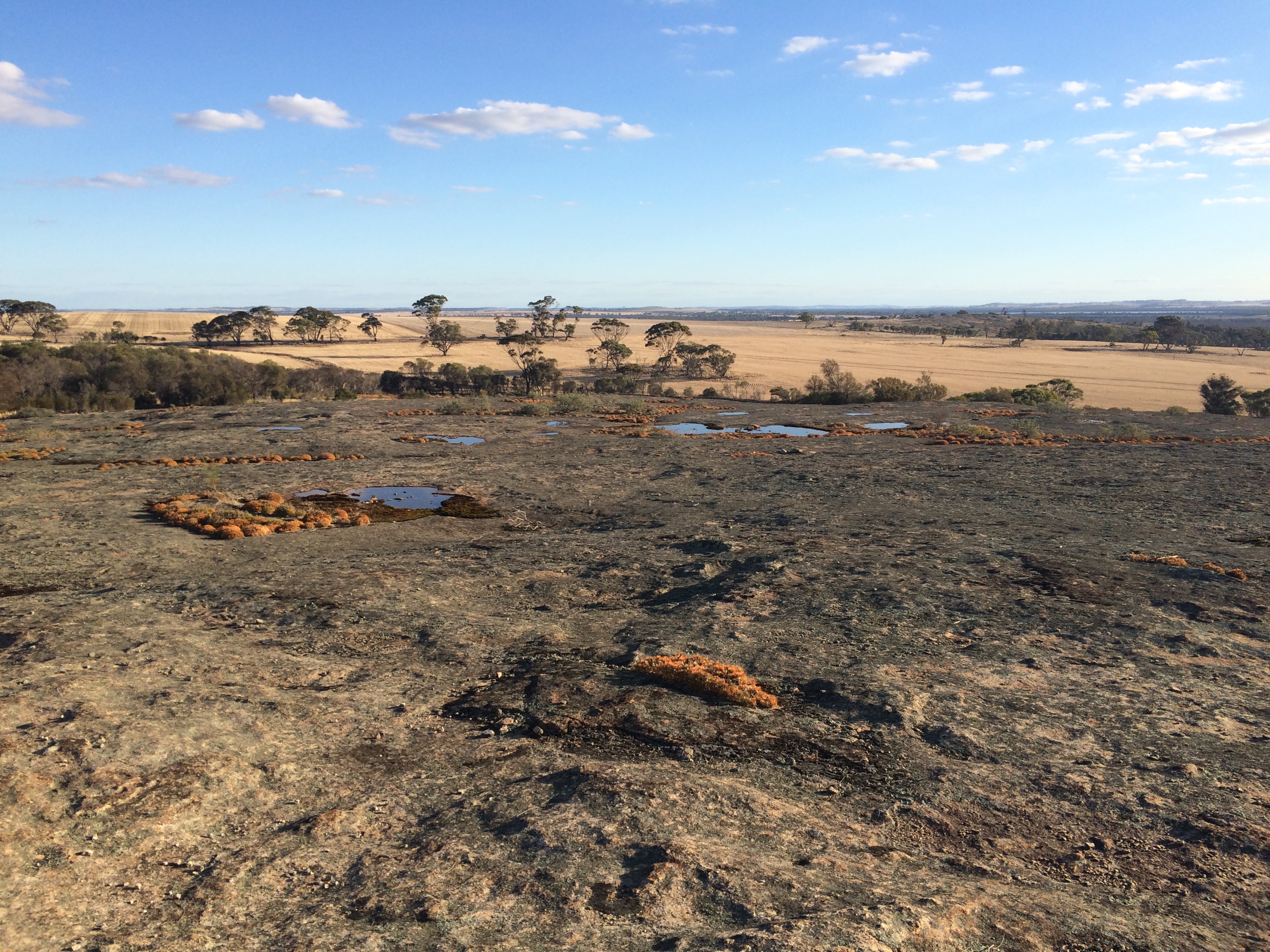
 Puntapin Rock is a granite rock formation located approximately south east of Wagin and approximately west of Dumbleyung in the western Wheatbelt region of Western Australia. It is a prominent feature in the area, rising out of the surrounding flat plains.
The rock has an elevation of and an exposed surface of . It is found in the
 Yilgarn Block
The Yilgarn Craton is a large craton that constitutes the bulk of the Western Australian land mass. It is bounded by a mixture of sedimentary basins and Proterozoic fold and thrust belts. Zircon grains in the Jack Hills, Narryer Terrane have be ...
and composed of granite, a partially recrystallized archean adamellite
Quartz monzonite is an intrusive, felsic, igneous rock that has an approximately equal proportion of orthoclase and plagioclase feldspars. It is typically a light colored phaneritic (coarse-grained) to porphyritic granitic rock. The plagioclas ...
that is mostly homogeneous. The rock does have some deformed lighter coloured veining throughout.
Puntapin Dam was built on the north side of Puntapin Rock in 1929 with a catchment area of to replace Badgarning Dam, found west of Wagin, that had been completed in 1912 but continually leaked. A concrete tank with a capacity of was constructed on top of the rock at some time after it was built. The population of Wagin were dependent on this dam for water supply until 1956 when the town was connected to Wellington Dam
Wellington Dam Hydro Power Station is a hydroelectric power station near Collie, Western Australia, Collie, Western Australia. It has one water turbine with a generating capacity of of electricity. The Wellington Dam Hydro Power Station was one ...
. Water from the Puntapin Dam is still mixed into the supply from Wellington.
The area now serves as a tourist attraction and public picnic area, and the Water Authority of Western Australia
The Water Authority of Western Australia, also known as WAWA, was a statutory authority of the state government that was responsible for the water supply, sewerage, and main drainage within Western Australia between 1985 and 1996.
History
The W ...
has allowed access to the rock's summit. The base of the rock has been equipped with picnic tables,
toilets, signage and walk trails.
The traditional owners of the area are the Noongar peoples. The granite dome, with its numerous gnamma
A panhole is a depression or basin eroded into flat or gently sloping cohesive rock.Twidale, C.R., and Bourne, J.A., 2018''Rock basins (gnammas) revisited. ''Géomorphologie: Relief, Processus, Environnement, Articles sous presse, Varia, mis en l ...
holes, is a natural water catchment area used by the Noongar as well as the early sandalwood cutters and kangaroo hunters. The rock is part of a dreaming trail that extends from the south coast near Augusta to the Great Victoria Desert country to the north east. Other features along the trail include Mulka's Cave
The Humps is a granite rock formation known as a "stepped bornhardt inselberg". It is located within The Humps Nature Reserve approximately east of Perth and north east of Hyden, Western Australia, Hyden in the eastern Wheatbelt (Western Au ...
, Wave Rock
Wave Rock ( nys, Katter Kich) is a natural rock formation that is shaped like a tall breaking Wind wave, ocean wave. The "wave" is about high and around long. It forms the north side of a solitary hill, which is known as "Hyden Rock". This ...
, Jilakin Rock
Jilakin Rock is a granite
Granite () is a coarse-grained ( phaneritic) intrusive igneous rock composed mostly of quartz, alkali feldspar, and plagioclase. It forms from magma with a high content of silica and alkali metal oxides that sl ...
, Jitarning Rock and Dumbleyung Lake
Dumbleyung Lake, also widely known as Lake Dumbleyung, is a salt lake (geography), salt lake in the Great Southern (Western Australia), Great Southern region of Western Australia. The lake has a length of and a width of ; it covers a total area ...
.
See also
*Granite outcrops of Western Australia
Granite outcrops of Western Australia are weathered landforms that occur throughout the state of Western Australia, composed primarily of the rock type granite. All recognised types of this landform can be observed, commonly as bornhardts, but a ...
References
{{coord, 33, 19, 19, S, 117, 23, 54, E, display=title Wheatbelt (Western Australia) Rock formations of Western Australia Dams in Western Australia Places of Noongar significance