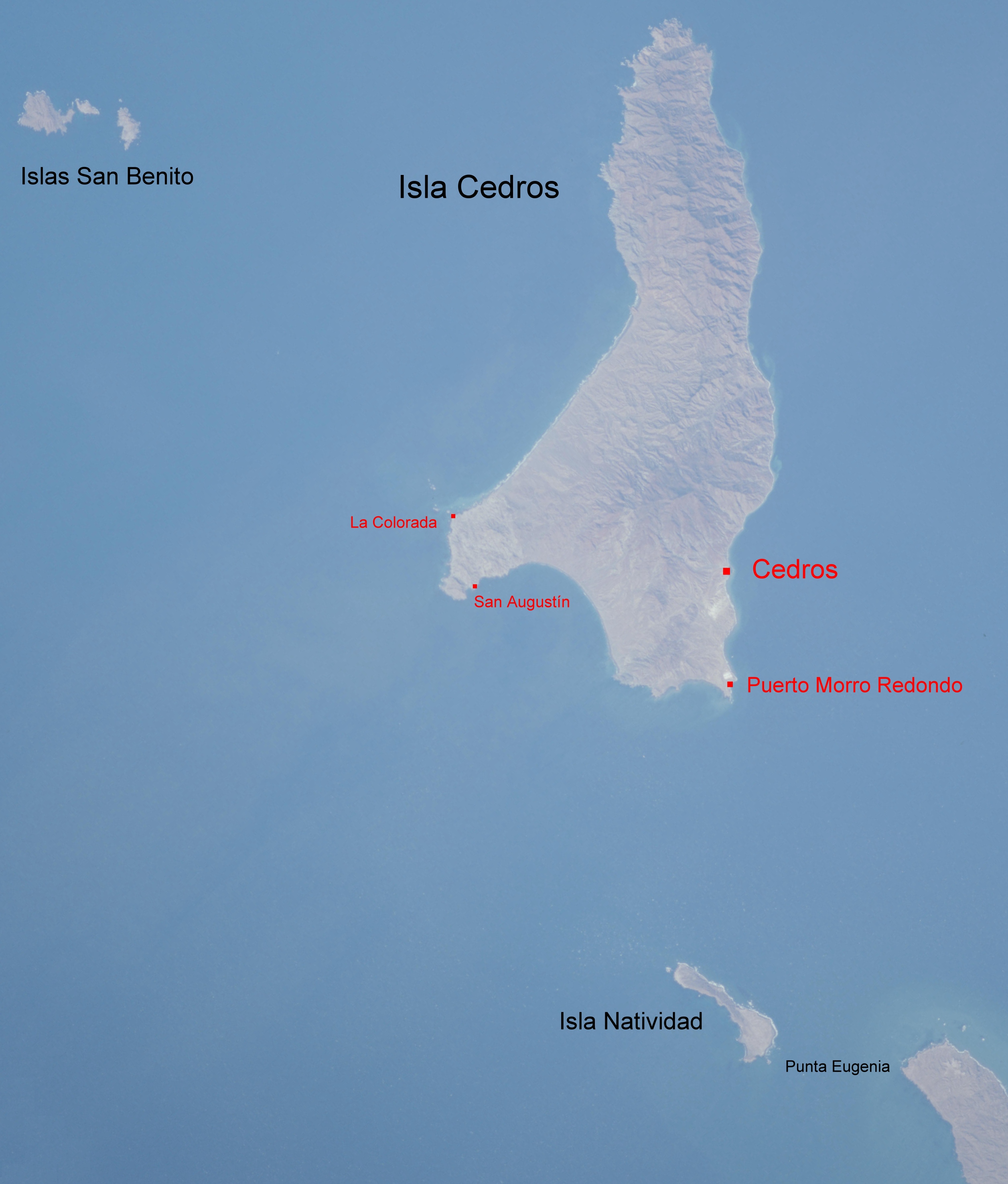
Punta Eugenia, Mexico on:
[Wikipedia]
[Google]
[Amazon]
 Punta Eugenia is a
 Punta Eugenia is a
 headland
A headland, also known as a head, is a coastal landform, a point of land usually high and often with a sheer drop, that extends into a body of water. It is a type of promontory. A headland of considerable size often is called a cape.Whittow, John ...
in the Mulegé Municipality
Mulegé is a city in Mulegé Municipality, Baja California Sur, situated on the Gulf of California. Located on the Gulf of California, the population was 3,821 according to the Mexican census of 2010.
History
Indigenous peoples had lived in t ...
. It marks the Western tip of the Vizcaíno Peninsula, thus being the westernmost point on the mainland of the state of Baja California Sur
Baja California Sur (; 'South Lower California'), officially the Free and Sovereign State of Baja California Sur ( es, Estado Libre y Soberano de Baja California Sur), is the least populated state and the 31st admitted state of the 32 federal ent ...
. It belongs to the larger area of El Vizcaíno Biosphere Reserve; it is separated from the mainland of the Baja Peninsula by the Vizcaíno Desert. Infrastructural developments, like the completion of the Vizcaíno-Bahía Tortugas Highway recently allowed for better integration of the traditionally secluded area (Punta Eugenia can be accessed from Bahía Tortugas
Baja California Sur (; 'South Lower California'), officially the Free and Sovereign State of Baja California Sur ( es, Estado Libre y Soberano de Baja California Sur), is the least populated state and the 31st admitted state of the 32 federal ent ...
by a dirt road
A dirt road or track is a type of unpaved road not paved with asphalt, concrete, brick, or stone; made from the native material of the land surface through which it passes, known to highway engineers as subgrade material. Dirt roads are suitable ...
). Touristically, the area of Punta Eugenia is still largely unexploited. The settlement Punta Eugenia, with 19 inhabitants in 2017, is traditionally populated by native and seasonally recruited fishermen and their families. Fishing industry in the Vizcaíno region annually produces thousands of tons of various species, that are mostly exported to Asia and the North American market.
To the Northwest of Punta Eugenia lie Isla Natividad
Isla Natividad is an island in the Pacific Ocean 6 km west off Punta Eugenia, the northwestern headland of the Mexican state of Baja California Sur. 200 meters off its northwestern end lies Roca María at , with an area of 0.074 km2 ...
, Cedros Island and the Islas San Benito. The pattern of ocean current
An ocean current is a continuous, directed movement of sea water generated by a number of forces acting upon the water, including wind, the Coriolis effect, breaking waves, cabbeling, and temperature and salinity differences. Depth contours, s ...
s and eddies
In fluid dynamics, an eddy is the swirling of a fluid and the reverse current created when the fluid is in a turbulent flow regime. The moving fluid creates a space devoid of downstream-flowing fluid on the downstream side of the object. Fluid beh ...
around Punta Eugenia has been shown to be a significant phylogeographic break in the distribution of fish
Fish are aquatic, craniate, gill-bearing animals that lack limbs with digits. Included in this definition are the living hagfish, lampreys, and cartilaginous and bony fish as well as various extinct related groups. Approximately 95% of li ...
species.
Climate
Punta Eugenia has mild desert climate. Temperature extremes range from on 11 October 1983 to on 9 February 1981. On 4 December 1994, Punta Eugenia received of rain, the wettest day on record.References
Headlands of Mexico Landforms of Baja California Sur Mulegé Municipality {{BajaCaliforniaSur-geo-stub