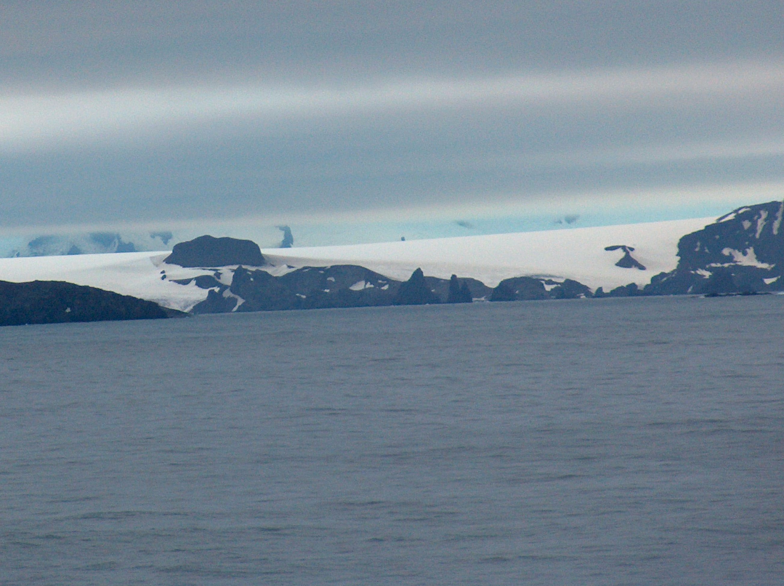
Pavlikeni Point on:
[Wikipedia]
[Google]
[Amazon]


 Pavlikeni Point (Nos Pavlikeni \'nos pa-vli-'ke-ni\) projects 600 m from the north coast of
''Pavlikeni Point: Short Stories''
Sofia: Bulgarian Bestseller Publishing House, 2008. 360 pp. (in Bulgarian)
Antarctica: Livingston Island and Greenwich, Robert, Snow and Smith Islands
Scale 1:120000 topographic map. Troyan: Manfred W├Črner Foundation, 2009.
Pavlikeni Point.
SCAR
Bulgarian Antarctic Gazetteer.
basic data
in English)
Pavlikeni Point.
Copernix satellite image Headlands of Greenwich Island {{GreenwichIsland-geo-stub


 Pavlikeni Point (Nos Pavlikeni \'nos pa-vli-'ke-ni\) projects 600 m from the north coast of
 Greenwich Island
Greenwich Island (variant historical names ''Sartorius Island'', ''Berezina Island'') is an island long and from (average ) wide, lying between Robert Island and Livingston Island in the South Shetland Islands. Surface area . The name Greenwic ...
in the South Shetland Islands
The South Shetland Islands are a group of Antarctic islands with a total area of . They lie about north of the Antarctic Peninsula, and between southwest of the nearest point of the South Orkney Islands. By the Antarctic Treaty of 195 ...
, Antarctica
Antarctica () is Earth's southernmost and least-populated continent. Situated almost entirely south of the Antarctic Circle and surrounded by the Southern Ocean, it contains the geographic South Pole. Antarctica is the fifth-largest contine ...
and is snow-free in summer. It is named after the Bulgarian town of Pavlikeni
Pavlikeni ( bg, ą¤ą░ą▓ą╗ąĖą║ąĄąĮąĖ ) is a town in Veliko Tarnovo Province, Northern Bulgaria, about 41 kilometers from the city of Veliko Tarnovo. It is the administrative centre of the homonymous Pavlikeni Municipality. As of December 2010, the ...
.
Location
The point is located at , which is 3.4 km east ofDuff Point
Duff Point is a point on Archar Peninsula forming the western extremity of Greenwich Island, in the South Shetland Islands, Antarctica. The name ''Duffs Straits'' was applied to McFarlane Strait by James Weddell in 1820ŌĆō23, after Captain Norwic ...
, 950 m west of Kabile Island
Kabile Island ( bg, ąŠčüčéčĆąŠą▓ ąÜą░ą▒ąĖą╗ąĄ, ostrov Kabile, ) is an Antarctic island extending in southŌĆōnorth direction and wide, situated off the north coast of Greenwich Island in the South Shetland Islands, Antarctica. It has a surface a ...
, 9.1 km west of Ag├╝edo Point
Ag├╝edo Point is the point forming the north extremity of Greenwich Island in the South Shetland Islands, Antarctica and the west side of the entrance to Guayaquil Bay. The adjacent ice-free area of Flamingo Beach on the west covers ,L.L. Ivanov ...
, 1.55 km west-northwest of Miletich Point
Miletich Point (ąØąŠčü ą£ąĖą╗ąĄčéąĖčć łnos mi'letit╩ā ''Nos Miletich'') is the rocky point forming the west side of the entrance to Haskovo Cove on Greenwich Island, South Shetland Islands in Antarctica. Situated 800 m north of the summit of C ...
and 1.13 km north of Hrabar Nunatak
Hrabar Nunatak (Nunatak Hrabar \'nu-na-tak 'hra-b&r\) is a 160m rocky peak on the north coast of Greenwich Island in the South Shetland Islands, Antarctica, and overlooking Yakoruda Glacier to the south. The peak is "named after the Bulgarian sc ...
(Bulgarian mapping in 2009).
Pavlikeni Point in fiction
Pavlikeni Point features in the recent book ''Pavlikeni Point: Short Stories'' by the Bulgarian writer Dimitar Tomov.Tomov, D''Pavlikeni Point: Short Stories''
Sofia: Bulgarian Bestseller Publishing House, 2008. 360 pp. (in Bulgarian)
Maps
* L.L. IvanovAntarctica: Livingston Island and Greenwich, Robert, Snow and Smith Islands
Scale 1:120000 topographic map. Troyan: Manfred W├Črner Foundation, 2009.
Notes
References
Pavlikeni Point.
SCAR
Composite Antarctic Gazetteer
The Composite Gazetteer of Antarctica (CGA) of the Scientific Committee on Antarctic Research (SCAR) is the authoritative international gazetteer containing all Antarctic toponyms published in national gazetteers, plus basic information about t ...
Bulgarian Antarctic Gazetteer.
Antarctic Place-names Commission
The Antarctic Place-names Commission was established by the Bulgarian Antarctic Institute in 1994, and since 2001 has been a body affiliated with the Ministry of Foreign Affairs of Bulgaria.
The Commission approves Bulgarian place names in ...
. (details in Bulgarianbasic data
in English)
External links
Pavlikeni Point.
Copernix satellite image Headlands of Greenwich Island {{GreenwichIsland-geo-stub