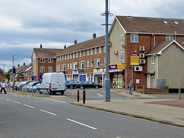
Owton Manor on:
[Wikipedia]
[Google]
[Amazon]
 Owton is an area of south-western
 Owton is served by three local churches: St James Church of England, St Patrick's Roman Catholic Church an
Owton Manor Baptist Church
 Owton is an area of south-western
 Hartlepool
Hartlepool () is a seaside and port town in County Durham, England. It is the largest settlement and administrative centre of the Borough of Hartlepool. With an estimated population of 90,123, it is the second-largest settlement in County ...
in the Borough of Hartlepool
The Borough of Hartlepool is a unitary authority area in ceremonial County Durham, England. The borough's largest town is Hartlepool.
It borders the County Durham district as well as the boroughs of Redcar and Cleveland and Stockton-on-Tees ...
, County Durham
County Durham ( ), officially simply Durham,UK General Acts 1997 c. 23Lieutenancies Act 1997 Schedule 1(3). From legislation.gov.uk, retrieved 6 April 2022. is a ceremonial county in North East England.North East Assembly â€About North East E ...
, England. It is served by three shopping precincts, which include St. Patrick's shops, Wynyard Road shops and Owton Manor Lane shops. It is near the area of Rift House, village of Greatham Greatham may refer to:
*Greatham, County Durham
*Greatham, Hampshire
Greatham ( ) is a village and civil parish in the East Hampshire district of Hampshire, England. It is north of Liss, just off the A3 road.
The nearest railway station is ...
and less than 2 miles away from Seaton Carew
Seaton Carew is a seaside resort and civil parish in the Borough of Hartlepool in County Durham, England. It had an estimated population of 6,018. The area is named after a Norman French family called Carou who owned lands in the area and set ...
.
History
Owton Manor Estate was developed as a social housing estate in the 1960’s.Churches
 Owton is served by three local churches: St James Church of England, St Patrick's Roman Catholic Church an
Owton Manor Baptist Church
Households and People
Figures from the Hartlepool Borough Council 2019 Ward Profiles show Manor House Ward had a population of 8,586 people. 2,040 were aged 15 or under, 5,188 were aged between 16 and 64 and 1,358 were over 65.https://www.hartlepool.gov.uk/download/downloads/id/7031/hartlepool_ward_profiles.pdf Streets in the area are grouped by the first letter into blocks named after towns in Scotland, for example, the 'M Block' would be a gathering of M-Streets. The houses are predominantly social housing, 56.3% with 4.9% privately rented and 33.6% owner occupied.Economic
31.6% of those of working age are receiving benefits 38.1% of pupils are eligible for free school meals 56.8% of households have no car. 43.2% of households have no one working Average weekly income £430 (2007/2008) Ranked 152 out of 7932 wards in the national Index of Multiple Deprivation Ranked 5 out of 116 wards in the Tees Valley Index of Multiple DeprivationEducation
* Primary Schools which serve the area include Eskdale Academy, St. Teresa's, Grange and Rossmere. The only secondary school serving the area is Manor Community Academy. * 27% of adults are classed as having low literacy skills * 69% of adults are classed as having low numeracy skills. * 53.7% of people aged 16 to 74 had no qualifications * 15.7% of people aged 16 to 74 had 1-4 GCSEs * 16.3% of people aged 16 to 74 had 5+GCSEs/1 A level * 3.8% of people aged 16 to 74 had 2+A levels * 4.1% of people aged 16 to 74 had a degree, HNC or Professional qualification. * Manor Community Academy was built on the site of the Manor Comprehensive School and opened in 2016.References
{{Reflist Hartlepool