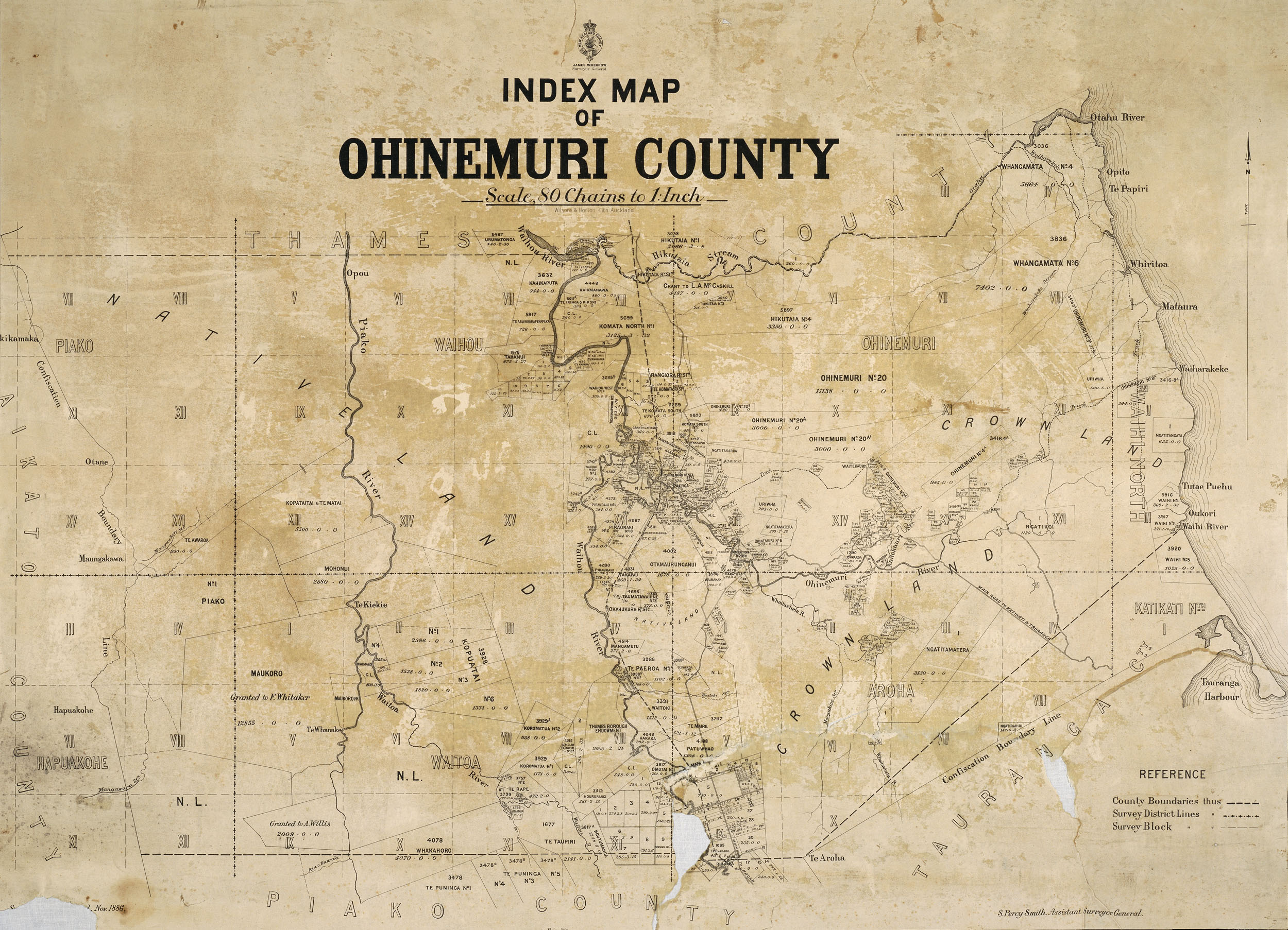
Ohinemuri County on:
[Wikipedia]
[Google]
[Amazon]
 Ohinemuri County was one of the
 Ohinemuri County was one of the
 counties of New Zealand
A system of counties of New Zealand was instituted after the country dissolved its provinces in 1876, and these counties were similar to other countries' systems, lasting with little change (except mergers and other localised boundary adjustmen ...
of the North Island
The North Island, also officially named Te Ika-a-Māui, is one of the two main islands of New Zealand, separated from the larger but much less populous South Island by the Cook Strait. The island's area is , making it the world's 14th-largest ...
.
The Ohinemuri County Council first met on 17 November 1885. It was formed from a portion of Thames County. A 1919 petition resulted in loss of the western part of the area to a new Hauraki Plains County in 1920.
The county was abolished through the 1989 local government reforms
The 1989 New Zealand local government reform was the most significant reform of local government in New Zealand in over a century. Some 850 local bodies were amalgamated into 86 local authorities, made up of regional and territorial levels.
Backg ...
.
The population was 1,516 in 1891, 3,056 in 1945 and 5,579 in 1986.
In 1923 Ohinemuri County covered and had a population of 2,678, with of gravel roads
A gravel road is a type of unpaved road surfaced with gravel that has been brought to the site from a quarry or stream bed. They are common in less-developed nations, and also in the rural areas of developed nations such as Canada and the Uni ...
, of mud roads and of tracks.
The 1911 Italianate
The Italianate style was a distinct 19th-century phase in the history of Classical architecture. Like Palladianism and Neoclassicism, the Italianate style drew its inspiration from the models and architectural vocabulary of 16th-century Italian R ...
county offices at 41 Belmont Road, Paeroa
Paeroa is a town in the Hauraki District of the Waikato Region in the North Island of New Zealand. Located at the base of the Coromandel Peninsula, it is close to the junction of the Waihou River and Ohinemuri River, and is approximately 20 kilo ...
, were used by the county until 1986. They are now used by Hauraki Māori Trust Board and protected by an A Category listing in Hauraki District
Hauraki District is a territorial authority within the Hauraki region of New Zealand. The seat of the council is at Paeroa.
The area covered by the district extends from the southwest coast of the Firth of Thames southeast towards Te Aroha, alth ...
Plan.

See also
* List of former territorial authorities in New Zealand § CountiesReferences
External links Te Aroha News report of first meeting
{{coord, -37.379447970552356, 175.66942414318163, display=title, region:NZ_type:landmark_source:dewiki
Counties of New Zealand
1885 establishments in New Zealand
1989 disestablishments in New Zealand