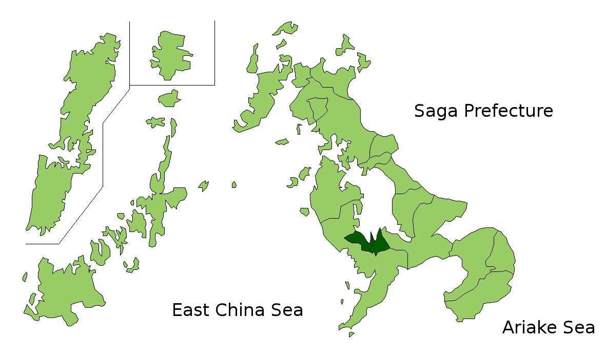
Nishisonogi District, Nagasaki on:
[Wikipedia]
[Google]
[Amazon]
 is a
is a
 is a
is a district
A district is a type of administrative division that, in some countries, is managed by the local government. Across the world, areas known as "districts" vary greatly in size, spanning regions or counties, several municipalities, subdivisions o ...
located in Nagasaki Prefecture
is a Prefectures of Japan, prefecture of Japan located on the island of Kyūshū. Nagasaki Prefecture has a population of 1,314,078 (1 June 2020) and has a geographic area of 4,130 Square kilometre, km2 (1,594 sq mi). Nagasaki Prefecture borders ...
, Japan
Japan ( ja, 日本, or , and formally , ''Nihonkoku'') is an island country in East Asia. It is situated in the northwest Pacific Ocean, and is bordered on the west by the Sea of Japan, while extending from the Sea of Okhotsk in the north ...
.
As of January 1, 2009, the district has an estimated population
Population typically refers to the number of people in a single area, whether it be a city or town, region, country, continent, or the world. Governments typically quantify the size of the resident population within their jurisdiction using a ...
of 72,238 and a density
Density (volumetric mass density or specific mass) is the substance's mass per unit of volume. The symbol most often used for density is ''ρ'' (the lower case Greek letter rho), although the Latin letter ''D'' can also be used. Mathematical ...
of 1460 persons per km2. The total area is 49.54 km2.
Towns and villages
*Nagayo
is a List of towns in Japan, town located in Nishisonogi District, Nagasaki, Nishisonogi District, Nagasaki Prefecture, Japan.
Geography
Nagayo is located within the southern part of Nagasaki prefecture and resides at the south of Ōmura Bay. ...
*Togitsu
is a town located in Nishisonogi District, Nagasaki Prefecture, Japan. As of March 31, 2017, the town has an estimated population of 30,084 and a density of 1,500 persons per km². The total area is 20.73 km².
Neighbouring the town of ...
Mergers
* January 1, 1955 the village of Fukuda merged into the city ofNagasaki
is the capital and the largest city of Nagasaki Prefecture on the island of Kyushu in Japan.
It became the sole port used for trade with the Portuguese and Dutch during the 16th through 19th centuries. The Hidden Christian Sites in the ...
.
*On January 4, 2005 six towns, Iōjima, Kōyagi, Nomozaki, Sanwa, Sotome and Takashima merged into the city of Nagasaki.
*On March 1, 2005 the town of Tarami, along with the towns of Iimori, Konagai, Moriyama and Takaki, all from Kitatakaki District, merged into the expanded city of Isahaya
is a city located in Nagasaki Prefecture, Japan. The city was founded on September 1, 1940. As of November 1, 2022, the city has an estimated population of 132,385 and a population density of 389 persons per km². The total area is .
On March 1 ...
.
*On April 1, 2005 the old town of Saikai absorbed the towns of Ōseto, Ōshima, Sakito and Seihi to form the new city of Saikai.
*On January 4, 2006 the town of Kinkai merged into the city of Nagasaki
is the capital and the largest city of Nagasaki Prefecture on the island of Kyushu in Japan.
It became the sole port used for trade with the Portuguese and Dutch during the 16th through 19th centuries. The Hidden Christian Sites in the ...
.
Districts in Nagasaki Prefecture
{{Nagasaki-geo-stub