Nevado Tres Cruces National Park on:
[Wikipedia]
[Google]
[Amazon]
Nevado Tres Cruces National Park () is a
in Letsgochile.com The park is open from October to April.
 * Laguna Verde
Parque Nacional Nevado Tres Cruces
{{authority control Ramsar sites in Chile Protected areas of Atacama Region National parks of Chile Protected areas established in 1994
national park
A national park is a nature park, natural park in use for conservation (ethic), conservation purposes, created and protected by national governments. Often it is a reserve of natural, semi-natural, or developed land that a sovereign state dec ...
located in the Atacama Region of Chile
Chile, officially the Republic of Chile, is a country in the western part of South America. It is the southernmost country in the world, and the closest to Antarctica, occupying a long and narrow strip of land between the Andes to the east a ...
, east of Copiapó
Copiapó () is a city and commune in northern Chile, located about 65 kilometers east of the coastal town of Caldera. Founded on December 8, 1744, it is the capital of Copiapó Province and Atacama Region.
Copiapó lies about 800 km north ...
. It includes Laguna Santa Rosa, Laguna del Negro Francisco, and a part of the Salar de Maricunga. The park is divided into two zones, the northern zone encompassing the southern portion of Salar de Maricunga and Laguna Santa Rosa, and the southern area the Laguna del Negro Francisco. The park is named after Nevado Tres Cruces
Nevado Tres Cruces is a massif of volcanic origin in the Andes Mountains on the border of Argentina and Chile. It has two main summits, Tres Cruces Sur at and Tres Cruces Centro at and a third minor summit, Tres Cruces Norte . Tres Cruces Sur ...
, which dominates the landscape of the area. The park is managed by the Corporación Nacional Forestal
The National Forest Corporation or CONAF (Corporación Nacional Forestal) is a Chilean private, non-profit organization, through which the Chilean state contributes to the development and sustainable management of the country's forest resources. C ...
(National Forest Corporation; CONAF), which offers two refuges in the area: one at the south of Negro Francisco Lagoon and other at the west of Santa Rosa Lagoon.Nevado Tres Cruces National Park articlein Letsgochile.com The park is open from October to April.

Environment
The park lies in the northern end of theSouthern Andean steppe
The Southern Andean steppe is a montane grasslands and shrublands ecoregion occurring along the border of Chile and Argentina in the high elevations of the southern Andes mountain range.
Setting
This ecoregion is found from in the north to in t ...
.
Salar de Maricunga
This salt flat spans 8,300 hectares at an altitude of 3,700 meters (12,139 ft). The world's highest volcano, and the highest peak in Chile,Ojos del Salado
Nevado Ojos del Salado is a dormant complex volcano in the Andes on the Argentina–Chile border. It is the highest volcano on Earth and the highest peak in Chile. The upper reaches of Ojos del Salado consist of several overlapping lava domes, ...
, (6,893meters/22,615 ft.) is located in its vicinity. The salar is 180 km northeast of the city of Copiapó
Copiapó () is a city and commune in northern Chile, located about 65 kilometers east of the coastal town of Caldera. Founded on December 8, 1744, it is the capital of Copiapó Province and Atacama Region.
Copiapó lies about 800 km north ...
in the Andes
The Andes, Andes Mountains or Andean Mountains (; ) are the longest continental mountain range in the world, forming a continuous highland along the western edge of South America. The range is long, wide (widest between 18°S – 20°S ...
mountains.
Laguna Santa Rosa
Located just south of the Salar de Maricunga, the lagoon is known for itsAndean flamingo
The Andean flamingo (''Phoenicoparrus andinus'') is a species of flamingo native to the Andes mountains of South America. Until 2014, it was classified in genus ''Phoenicopterus''. It is closely related to James's flamingo, and the two make up th ...
s, which reside on the lagoon year-round. Laguna Santa Rosa, along with Laguna del Negro Francisco, is a Wetland of International Importance under the Ramsar Convention
The Ramsar Convention on Wetlands of International Importance Especially as Waterfowl Habitat is an international treaty for the conservation and sustainable use of Ramsar sites (wetlands). It is also known as the Convention on Wetlands. It i ...
.
Laguna del Negro Francisco
Located 210 km northeast of Copiapó at 4,126 meters (13,537 ft.) above sea level, the lagoon is encircled by the foothills of the Andes. It offers a view towardCopiapó
Copiapó () is a city and commune in northern Chile, located about 65 kilometers east of the coastal town of Caldera. Founded on December 8, 1744, it is the capital of Copiapó Province and Atacama Region.
Copiapó lies about 800 km north ...
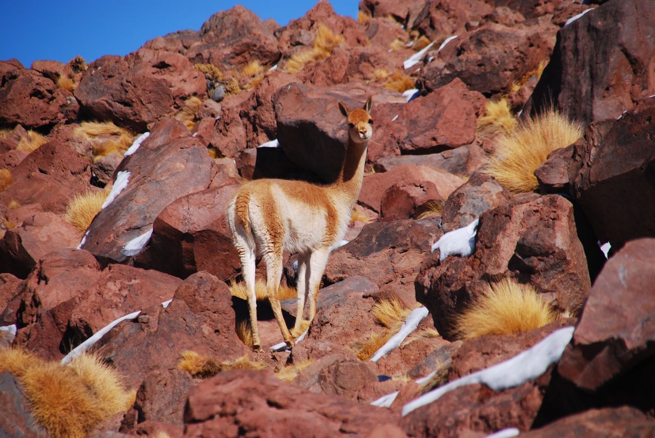
volcano. As a nationally protected area, there is an abundance of fauna, such as flamingoes
Flamingos or flamingoes are a type of wading bird in the family Phoenicopteridae, which is the only extant family in the order Phoenicopteriformes. There are four flamingo species distributed throughout the Americas (including the Caribbean) ...
and vicuñas.
See also
 * Laguna Verde
References
Parque Nacional Nevado Tres Cruces
{{authority control Ramsar sites in Chile Protected areas of Atacama Region National parks of Chile Protected areas established in 1994