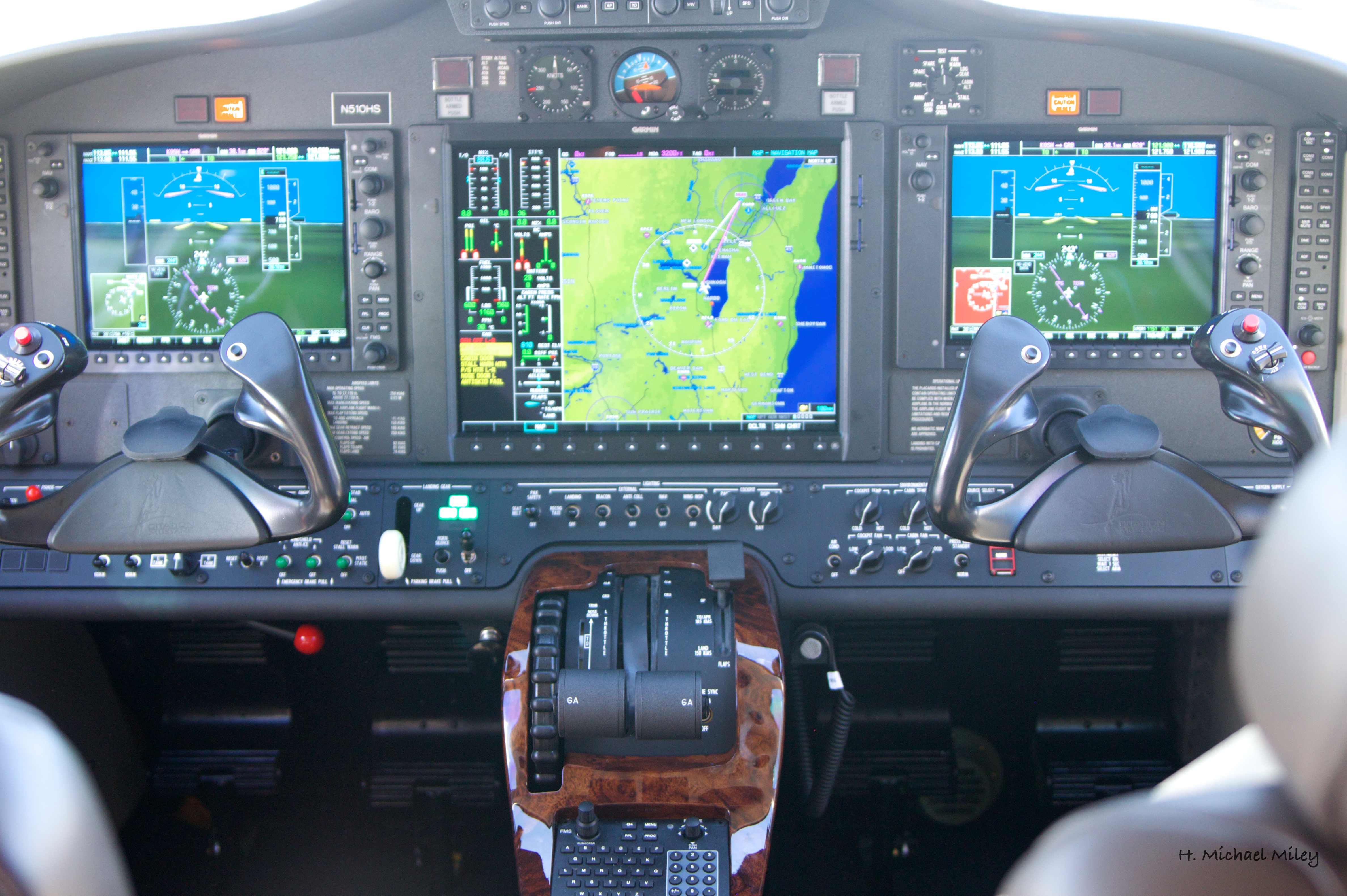
Moving Map Display on:
[Wikipedia]
[Google]
[Amazon]


 A moving map display (MMD) / projected map display (PMD) is a type of


 A moving map display (MMD) / projected map display (PMD) is a type of
 navigation
Navigation is a field of study that focuses on the process of monitoring and controlling the motion, movement of a craft or vehicle from one place to another.Bowditch, 2003:799. The field of navigation includes four general categories: land navig ...
system output that, instead of numerically displaying the current geographical coordinates determined by the navigation unit or an heading and distance indication of a certain waypoint
A waypoint is a point or place on a route or line of travel, a stopping point, an intermediate point, or point at which course is changed, the first use of the term tracing to 1880. In modern terms, it most often refers to coordinates which spe ...
, displays the unit's current location at the center of a map
A map is a symbolic depiction of interrelationships, commonly spatial, between things within a space. A map may be annotated with text and graphics. Like any graphic, a map may be fixed to paper or other durable media, or may be displayed on ...
. As the unit moves around and new coordinates are therefore determined, the map moves to keep its position at the center of the display.
Mechanical moving map displays using paper charts were first introduced in the 1950s, and became common in some roles during the 1960s. Mechanically moved paper maps were replaced by projected map displays and digital maps during the 1970s and 80s, with resolution and detail improving along with computer imagery and the computer memory
Computer memory stores information, such as data and programs, for immediate use in the computer. The term ''memory'' is often synonymous with the terms ''RAM,'' ''main memory,'' or ''primary storage.'' Archaic synonyms for main memory include ...
systems that held the data.
A symbol representing the location of the GPS device carried by a person or inside a vehicle, remains stationary on the display screen while a map or chart image moves beneath the symbol. The display thus portrays the physical movement of the device on the displayed map or chart. The portrayal typically shows a simulated overhead view of the device location on the moving map, but some devices also simulate a three-dimensional view from the perspective of the device. Many devices also provide an option for the map or chart image to remain stationary on the display while the location symbol moves to represent physical device movement. Some moving map display systems also provide a method of displaying the elevation of the device above sea level or the earth's surface.
A common example of a moving map display today is the map display on a smart phone
A smartphone is a mobile phone with advanced computing capabilities. It typically has a touchscreen interface, allowing users to access a wide range of applications and services, such as web browsing, email, and social media, as well as multi ...
or tablet screen, with an app using GPS to determine the device's current position and display it on map data from the device's internal storage or from the Internet
The Internet (or internet) is the Global network, global system of interconnected computer networks that uses the Internet protocol suite (TCP/IP) to communicate between networks and devices. It is a internetworking, network of networks ...
in real time. This use of phones and tablets has expanded very rapidly for navigation in car travel, hiking, and aviation. Moving map applications are now included in the base software for most phones and tablets, and include many helpful options like directions to destination, business hours, and more.
Aviation moving map apps include extensive in-flight information such as other nearby aircraft. Weather and other data is also available and may be depicted on the moving map. Some sophisticated apps, even including 3D display options for this purpose are available free, without subscription fees.https://play.google.com/store/apps/details?id=com.ds.avare Example of free open source Android app. This trend has enabled even inexpensive aircraft with no electrical system to have very advanced Avionics
Avionics (a portmanteau of ''aviation'' and ''electronics'') are the Electronics, electronic systems used on aircraft. Avionic systems include communications, Air navigation, navigation, the display and management of multiple systems, and the ...
in flight. Many pilots of the most expensive jets and helicopters also use such apps to supplement expensive certified avionics.
See also
*GPS navigation device
A satellite navigation (satnav) device or GPS device is a device that uses satellites of the Global Positioning System (GPS) or similar global navigation satellite systems (GNSS).
A satnav device can determine the user's geographic coordinat ...
* In-flight entertainment, Moving-map systems
* Fresnel lens
A Fresnel lens ( ; ; or ) is a type of composite compact lens (optics), lens which reduces the amount of material required compared to a conventional lens by dividing the lens into a set of concentric annular sections.
The simpler Dioptrics, d ...
* Microform
A microform is a scaled-down reproduction of a document, typically either photographic film or paper, made for the purposes of transmission, storage, reading, and printing. Microform images are commonly reduced to about 4% or of the original d ...
References
{{Aeronautical charts Transport software