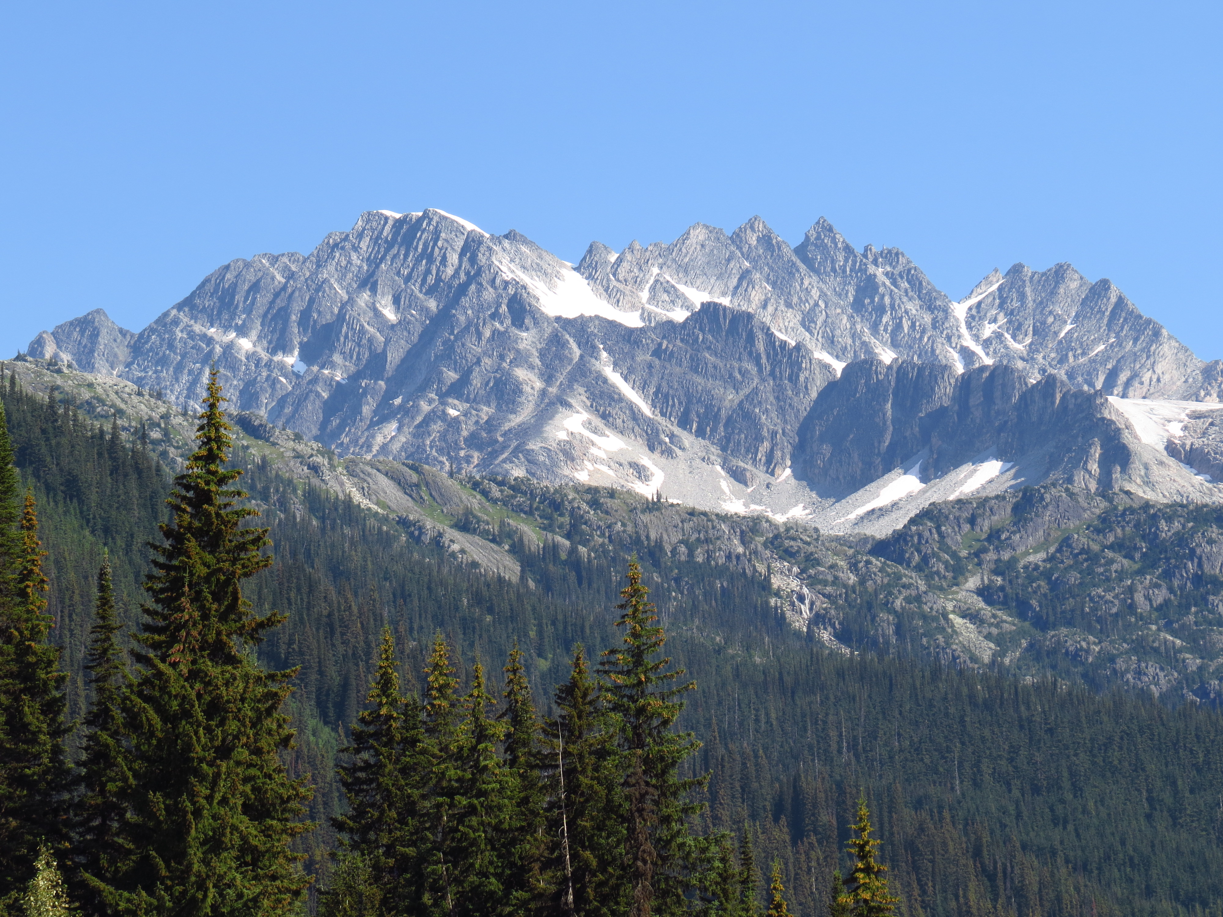
Mount Rogers (British Columbia) on:
[Wikipedia]
[Google]
[Amazon]
Mount Rogers, is a

Mount Rogers
* Mt. Rogers photo
Flickr
{{DEFAULTSORT:Rogers Three-thousanders of British Columbia Selkirk Mountains Kootenay Land District
massif
In geology, a massif ( or ) is a section of a planet's crust that is demarcated by faults or flexures. In the movement of the crust, a massif tends to retain its internal structure while being displaced as a whole. The term also refers to a ...
located in Glacier National Park in the Selkirk Mountains
The Selkirk Mountains are a mountain range spanning the northern portion of the Idaho Panhandle, eastern Washington, and southeastern British Columbia which are part of a larger grouping of mountains, the Columbia Mountains. They begin at Mica Pe ...
of British Columbia
British Columbia (commonly abbreviated as BC) is the westernmost province of Canada, situated between the Pacific Ocean and the Rocky Mountains. It has a diverse geography, with rugged landscapes that include rocky coastlines, sandy beaches, ...
, Canada
Canada is a country in North America. Its ten provinces and three territories extend from the Atlantic Ocean to the Pacific Ocean and northward into the Arctic Ocean, covering over , making it the world's second-largest country by tot ...
. Mount Rogers is situated at the north end of the Hermit Range, and is the highest point of the range. Its nearest higher peak is Mount Sir Donald
Mount Sir Donald is a mountain summit located in the Rogers Pass area of Glacier National Park in the Selkirk Mountains of British Columbia, Canada. Its good rock quality and classic Matterhorn shape make it popular for alpine rock climbers, a ...
, to the southeast. The peak is prominently visible from eastbound Highway 1, the Trans-Canada Highway
The Trans-Canada Highway ( French: ; abbreviated as the TCH or T-Can) is a transcontinental federal–provincial highway system that travels through all ten provinces of Canada, from the Pacific Ocean on the west coast to the Atlantic Ocean o ...
at Rogers Pass. The Rogers massif includes five individually-named summits: Rogers Peak, Grant Peak, Fleming Peak, Swiss Peak, and Truda Peaks. Numerous glaciers radiate from all sides, including the Rogers Glacier, Swiss Glacier, Tupper Glacier, and Hermit Glacier.
History
Mount Rogers was named after Major A.B. Rogers, an American surveyor working for the Canadian Pacific Railway, and the discoverer of Rogers Pass. Thefirst ascent
In mountaineering, a first ascent (abbreviated to FA in guide books) is the first successful, documented attainment of the top of a mountain or the first to follow a particular climbing route. First mountain ascents are notable because they en ...
of the mountain was made on July 31, 1896 by Phillip S. Abbott, George T. Little, and Charles S. Thompson.
The mountain's name was officially adopted in 1932 when approved by the Geographical Names Board of Canada
The Geographical Names Board of Canada (GNBC) is a national committee with a secretariat in Natural Resources Canada, part of the Government of Canada, which authorizes the names used and name changes on official federal government maps of Canada ...
.
Climate
Based on theKöppen climate classification
The Köppen climate classification is one of the most widely used climate classification systems. It was first published by German-Russian climatologist Wladimir Köppen (1846–1940) in 1884, with several later modifications by Köppen, notabl ...
, Mount Rogers has a subarctic climate
The subarctic climate (also called subpolar climate, or boreal climate) is a climate with long, cold (often very cold) winters, and short, warm to cool summers. It is found on large landmasses, often away from the moderating effects of an ocean, ge ...
with cold, snowy winters, and mild summers. Winter temperatures can drop below −20 °C with wind chill factors below −30 °C. Precipitation runoff
Runoff, run-off or RUNOFF may refer to:
* RUNOFF, the first computer text-formatting program
* Runoff or run-off, another name for bleed, printing that lies beyond the edges to which a printed sheet is trimmed
* Runoff or run-off, a stock market ...
from the mountain drains into tributaries of the Beaver River.

See also
*Geography of British Columbia
British Columbia is the westernmost province of Canada, bordered by the Pacific Ocean. With an area of it is Canada's third-largest province. The province is almost four times the size of the United Kingdom and larger than every United States ...
* Geology of British Columbia
The geology of British Columbia is a function of its location on the leading edge of the North American continent. The mountainous physiography and the diversity of rock types and ages hint at the complex geology, which is still undergoing revis ...
References
External links
* Weather forecastMount Rogers
* Mt. Rogers photo
Flickr
{{DEFAULTSORT:Rogers Three-thousanders of British Columbia Selkirk Mountains Kootenay Land District