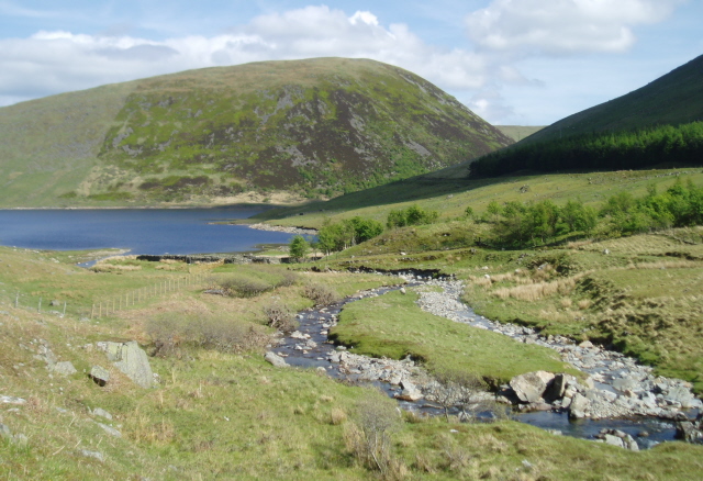
Megget Water on:
[Wikipedia]
[Google]
[Amazon]
 Megget Water is a river in the parish of
RCAHMS record of Henderland, Megget WaterCANMORE/RCAHMS record of Boar Cleuch Flow, Megget WaterCANMORE/RCAHMS record of Glengaber Burn, Gold WorkingsCramalt tower:historical survey and excavations 1977-9Vision of Britain, Gazetteer entries for Peebles Shire
Rivers of the Scottish Borders 3Megget {{Scotland-river-stub
 Megget Water is a river in the parish of
 Yarrow
''Achillea millefolium'', commonly known as yarrow () or common yarrow, is a flowering plant in the family Asteraceae. Other common names include old man's pepper, devil's nettle, sanguinary, milfoil, soldier's woundwort, and thousand seal.
The ...
, Selkirkshire
Selkirkshire or the County of Selkirk ( gd, Siorrachd Shalcraig) is a historic county and registration county of Scotland. It borders Peeblesshire to the west, Midlothian to the north, Roxburghshire to the east, and Dumfriesshire to the south. ...
in the Scottish Borders
The Scottish Borders ( sco, the Mairches, 'the Marches'; gd, Crìochan na h-Alba) is one of 32 council areas of Scotland. It borders the City of Edinburgh, Dumfries and Galloway, East Lothian, Midlothian, South Lanarkshire, West Lothi ...
area of Scotland
Scotland (, ) is a country that is part of the United Kingdom. Covering the northern third of the island of Great Britain, mainland Scotland has a border with England to the southeast and is otherwise surrounded by the Atlantic Ocean to the ...
. The Water rises at Broad Law (2,760 ft), passes through Megget Reservoir
Megget Reservoir is an impounding reservoir in the Megget valley in Ettrick Forest, in the Scottish Borders. The reservoir is held back by the largest earth dam in Scotland. The reservoir collects water from the Tweedsmuir Hills, which is then co ...
and empties into St Mary's Loch
St Mary's Loch is the largest natural loch in the Scottish Borders, and is situated on the south side of the A708 road between Selkirk and Moffat, about south of Edinburgh.
Description
It is long and wide, and was created by glacial acti ...
. Places in the vicinity include Cappercleuch, Craigierig, Cramalt Tower, the Glengaber Burn, Meggethead Farm.
The Megget
Megget is a former chapelry or parish containing the valley of Megget Water, now forming the westernmost part of the parish of Yarrow, Selkirkshire in the Scottish Borders area of Scotland. The centre of the valley is 19 miles west of Selkirk.
...
area, formerly a parish united with Lyne, Scottish Borders
Lyne ( gd, An Lainn) is a small village and civil parish in the Scottish Borders area of Scotland, west of the market town of Peebles; it lies off the A72, in the old county of Peeblesshire and has an area of about .
The Lyne Water flows through ...
, is of geological and archaeological interest, through stone artifacts at Henderland in the lower Megget valley (now in Wilton Lodge Museum, Hawick
Hawick ( ; sco, Haaick; gd, Hamhaig) is a town in the Scottish Borders council area and historic county of Roxburghshire in the east Southern Uplands of Scotland. It is south-west of Jedburgh and south-south-east of Selkirk. It is one of ...
), and discoveries of gold.
See also
*Rivers of Scotland
This list of rivers in Scotland is organised geographically, taken anti-clockwise, from Berwick-upon-Tweed. Tributaries are listed down the page in an upstream direction. (L) indicates a left-bank tributary and (R) indicates a right-bank tribu ...
*List of places in the Scottish Borders
''Map of places in the Scottish Borders compiled from this list'':See the list of places in Scotland for places in other counties.
This list of places in the Scottish Borders includes towns, villages, hamlets, castles, golf courses, historic hous ...
*List of places in Scotland
This list of places in Scotland is a complete collection of lists of places in Scotland.
*List of burghs in Scotland
*List of census localities in Scotland
*List of islands of Scotland
**List of Shetland islands
**List of Orkney islands
**List o ...
References
* NMS (1992d), 'Megget Water (Yarrow parish):cup-marked stone', ''Discovery Excav Scot'', page 7 * Scottish Journal of Geology (The Geological Society): R.J.Chapman, R.C.Leake, J.D,Floyd: ''Regional variation in gold mineralization in the vicinity of the Glengaber Burn, Scottish Borders'' * ''Proc Soc Antiq Scot, III, 1981, 401-429'', Cramalt Tower:historical survey and excavations 1977–9, Alastair M T Maxwell-IrvingExternal links
RCAHMS record of Henderland, Megget Water
Rivers of the Scottish Borders 3Megget {{Scotland-river-stub