Median Snowfield on:
[Wikipedia]
[Google]
[Amazon]
Torbert Escarpment () is an
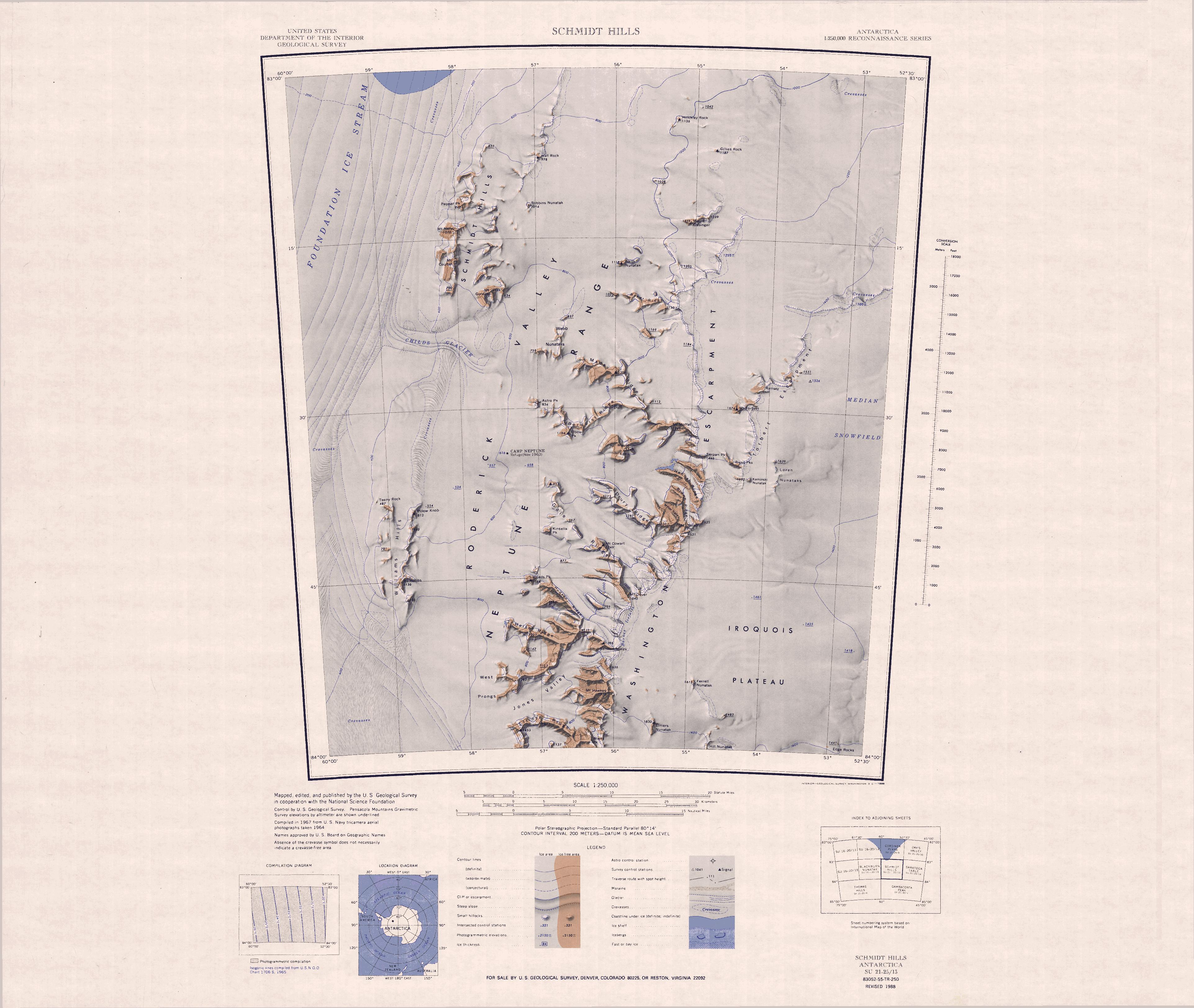
 The Torbert Escarpment faces west in the northeast of the Neptune Range.
It runs roughly north–south between the Median Snowfield to the east, and the north end of the
escarpment
An escarpment is a steep slope or long cliff that forms as a result of faulting or erosion and separates two relatively level areas having different elevations.
The terms ''scarp'' and ''scarp face'' are often used interchangeably with ''escar ...
, long, marking the west margin of Median Snowfield in the Neptune Range
The Neptune Range is a mountain range, long, lying WSW of Forrestal Range in the central part of the Pensacola Mountains in Antarctica. The range is composed of Washington Escarpment with its associated ridges, valleys and peaks, the Iroquois Pla ...
, Pensacola Mountains
The Pensacola Mountains are a large group of mountain ranges of the Transantarctic Mountains System, located in the Queen Elizabeth Land region of Antarctica.
Geography
They extend 450 km (280 mi) in a NE-SW direction. Subranges of the ...
, Antarctica.
Mapping and name
The Torbert Escarpment was mapped byUnited States Geological Survey
The United States Geological Survey (USGS), formerly simply known as the Geological Survey, is a scientific agency of the United States government. The scientists of the USGS study the landscape of the United States, its natural resources, ...
(USGS) from surveys and United States Navy
The United States Navy (USN) is the maritime service branch of the United States Armed Forces and one of the eight uniformed services of the United States. It is the largest and most powerful navy in the world, with the estimated tonnage ...
air photographs in 1956–66.
It was named by the United States Advisory Committee on Antarctic Names
The Advisory Committee on Antarctic Names (ACAN or US-ACAN) is an advisory committee of the United States Board on Geographic Names responsible for recommending commemorative names for features in Antarctica.
History
The committee was established ...
(US-ACAN) after Mount Torbert
Mount Torbert is the highest point of the Tordrillo Mountains, a small, primarily volcanic range, northwest of Anchorage, Alaska. It is a heavily glaciated peak, and is not itself a volcano, although nearby Mount Spurr and Crater Peak are acti ...
, the salient feature along its edge.
Location
 The Torbert Escarpment faces west in the northeast of the Neptune Range.
It runs roughly north–south between the Median Snowfield to the east, and the north end of the
 Washington Escarpment
Washington Escarpment () is the major west-facing escarpment of the Neptune Range, Pensacola Mountains in Antarctica, extending some 50 miles (80 km) and being the point of origin of a number of west-trending rock ridges. Mapped by United Stat ...
to the west.
Festures include, from south to north, Rivas Peaks, Mount Torbert and Ramsey Cliff.
Nearby features to the east include Kaminski Nunatak, Loren Nunataks and Median Snowfield.
Features
Features and nearby features include:Kaminski Nunatak
. A cone-shaped nunatak southeast of Rivas Peaks. Named by US-ACAN for Francis Kaminski, aerographer at Ellsworth Station, winter 1958.Loren Nunataks
. A line of low nunataks standing east of Rivas Peaks. Named by US-ACAN for Loren Brown, Jr., aviation machinist at Ellsworth Station, winter 1958.Rivas Peaks
. A line of rock peaks that jut westward for from the south part of Torbert Escarpment. Named by US-ACAN for Merced G. Rivas, radioman at Ellsworth Station, winter 1958.Mount Torbert
. A prominent, pyramidal rock peak, high, midway along Torbert Escarpment. Discovered and photographed on January 13, 1956 on the transcontinental nonstop plane flight by personnel of Umited States NavyOperation Deep Freeze
Operation Deep Freeze (OpDFrz or ODF) is codename for a series of United States missions to Antarctica, beginning with "Operation Deep Freeze I" in 1955–56, followed by "Operation Deep Freeze II", "Operation Deep Freeze III", and so on. (There w ...
I from McMurdo Sound
McMurdo Sound is a sound in Antarctica. It is the southernmost navigable body of water in the world, and is about from the South Pole.
Captain James Clark Ross discovered the sound in February 1841, and named it after Lt. Archibald McMurdo o ...
to Weddell Sea
The Weddell Sea is part of the Southern Ocean and contains the Weddell Gyre. Its land boundaries are defined by the bay formed from the coasts of Coats Land and the Antarctic Peninsula. The easternmost point is Cape Norvegia at Princess Martha ...
and return.
Named by US-ACAN for Lieutenant Commander John H. Torbert, United States Navy, pilot of the P2V-2N Neptune aircraft making this flight.
Ramsey Cliff
. A rock cliff along Torbert Escarpment, standing northeast of Mount Torbert. Named by US-ACAN for Robert E. Ramsey, storekeeper at Ellsworth Station, winter 1958.Median Snowfield
. A large snowfield in the Pensacola Mountains between Torbert Escarpment and the southern part of theForrestal Range
The Forrestal Range () is a largely snow-covered mountain range, about long, standing east of Dufek Massif and the Neptune Range in the Pensacola Mountains of Antarctica. Discovered and photographed on 13 January 1956 on a transcontinental patrol ...
.
This name given by US-ACAN reflects the position of the feature between the Neptune and Forrestal Ranges.
References
Sources
* * *{{Include-USGov , agency=United States Geological Survey Escarpments of Queen Elizabeth Land