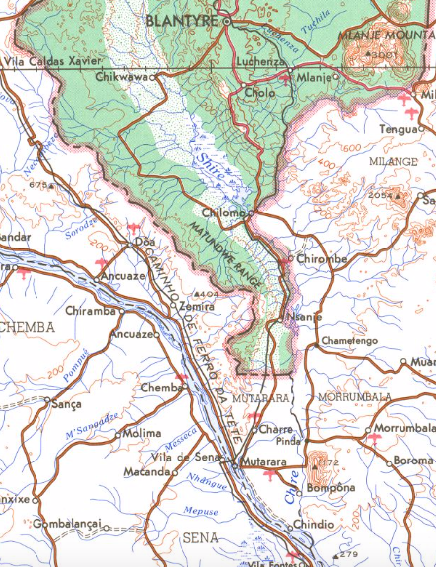
Matundwe Range on:
[Wikipedia]
[Google]
[Amazon]
 The Matundwe Range is a range of mountains in southernmost
 The Matundwe Range is a range of mountains in southernmost
 Malawi
Malawi (; or aláwi Tumbuka: ''Malaŵi''), officially the Republic of Malawi, is a landlocked country in Southeastern Africa that was formerly known as Nyasaland. It is bordered by Zambia to the west, Tanzania to the north and northeas ...
and adjacent Tete Province
Tete is a province of Mozambique. It has an area of 98,417 km² and a population of 2,648,941 (2017 census).
Tete is the capital of the province. The Cahora Bassa Dam is situated in this province.
Districts
On March 21, 2013, Mozambi ...
of Mozambique
Mozambique (), officially the Republic of Mozambique ( pt, Moçambique or , ; ny, Mozambiki; sw, Msumbiji; ts, Muzambhiki), is a country located in southeastern Africa bordered by the Indian Ocean to the east, Tanzania to the north, Malawi ...
. The range is located between the Zambezi
The Zambezi River (also spelled Zambeze and Zambesi) is the fourth-longest river in Africa, the longest east-flowing river in Africa and the largest flowing into the Indian Ocean from Africa. Its drainage basin covers , slightly less than hal ...
and Shire rivers just north of their confluence, and the Malawi-Mozambique border runs along the divide between the two rivers' watersheds.
The Shire River Valley is a southern extension of the East African Rift. The southern end of the Matundwe Range rises as a steep escarpment
An escarpment is a steep slope or long cliff that forms as a result of faulting or erosion and separates two relatively level areas having different elevations.
The terms ''scarp'' and ''scarp face'' are often used interchangeably with ''esca ...
along the west side of the Shire Valley lowlands, and descends more gently westwards towards the Zambezi. At the northern end of the range, the western face of the range has a steep escarpment.
Malawi's Matandwe Forest Reserve covers part of northern range. The reserve was established in 1931, and covers and area of 31,053 ha. The main plant community in the reserve is open-canopy miombo
The Miombo woodland is a tropical and subtropical grasslands, savannas, and shrublands biome (in the World Wide Fund for Nature scheme) located primarily in Central Africa. It includes four woodland savanna ecoregions (listed below) characterized b ...
woodland dominated by ''Brachystegia
''Brachystegia'' is a genus of tree of the subfamily Detarioideae that is native to tropical Africa.
Trees of the genus are commonly known as miombo, and are dominant in the miombo woodlands of central and southern tropical Africa. The Zambezi ...
'' species, particularly '' B. boehmii'', along with '' Uapaca kirkiana''.Mwafongo E (2019). ABC Matandwe Forest Reserve Vegetation Survey. Version 1.1. National Herbarium & Botanic Gardens of Malawi. Sampling event dataset https://doi.org/10.15468/hf7ryp accessed via GBIF.org on 2019-08-20. Mwabvi Wildlife Reserve lies west of the range at its northern end, in the valley of the Mwabvi River, a northward-flowing tributary of the Shire.
References
Forest reserves of Malawi Mountain ranges of Malawi Mountain ranges of Mozambique Zambezian and mopane woodlands {{Mozambique-geo-stub