Mackinnon Pass on:
[Wikipedia]
[Google]
[Amazon]
, photo = Milford Track Mackinnon Pass.jpg
, photo_size = 270px
, photo_alt =
, photo_caption = Looking up the Clinton River valley to Omanui / McKinnon Pass
, map = New Zealand Fiordland
, map_alt =
, map_caption = Location within
 The pass was known to local
Fiordland
Fiordland is a geographical region of New Zealand in the south-western corner of the South Island, comprising the westernmost third of Southland. Most of Fiordland is dominated by the steep sides of the snow-capped Southern Alps, deep lakes, ...
, map_relief =
, map_size =
, label = Omanui / McKinnon Pass
, label_position =
, elevation =
, elevation_m = 1156
, elevation_ft =
, elevation_ref =
, traversed = Milford Track
The Milford Track is a hiking route in New Zealand, located amidst mountains and temperate rain forest in Fiordland National Park in the southwest of the South Island. The 53.5 km (33.2 mi) hike starts at Glade Wharf at the head o ...
, length =
, length_km =
, length_mi =
, length_ref =
, grade_avg =
, grade_max =
, ascent =
, location = Fiordland
Fiordland is a geographical region of New Zealand in the south-western corner of the South Island, comprising the westernmost third of Southland. Most of Fiordland is dominated by the steep sides of the snow-capped Southern Alps, deep lakes, ...
, New Zealand
, range =
, grid_ref_UK =
, grid_ref_Ireland =
, coordinates =
, coordinates_ref =
, topo =
, embedded =
, child =
Omanui / McKinnon Pass (previously spelt Mackinnon Pass) is an alpine pass between Mount Hart and Mount Balloon in Fiordland
Fiordland is a geographical region of New Zealand in the south-western corner of the South Island, comprising the westernmost third of Southland. Most of Fiordland is dominated by the steep sides of the snow-capped Southern Alps, deep lakes, ...
, New Zealand. The pass is at an elevation of and is located southwest of Milford Sound / Piopiotahi
Milford Sound / Piopiotahi is a fiord in the south west of New Zealand's South Island within Fiordland National Park, Piopiotahi (Milford Sound) Marine Reserve, and the Te Wahipounamu World Heritage site. It has been judged the world's top tr ...
. The pass is the highest point of the famous Milford Track
The Milford Track is a hiking route in New Zealand, located amidst mountains and temperate rain forest in Fiordland National Park in the southwest of the South Island. The 53.5 km (33.2 mi) hike starts at Glade Wharf at the head o ...
connecting Lake Te Anau
Lake Te Anau is in the southwestern corner of the South Island of New Zealand. The lake covers an area of , making it the second-largest lake by surface area in New Zealand (after Lake Taupō) and the largest in the South Island. It is the larg ...
and the Clinton River valley with the Arthur River valley and Milford Sound / Piopiotahi.
History
 The pass was known to local
 Māori
Māori or Maori can refer to:
Relating to the Māori people
* Māori people of New Zealand, or members of that group
* Māori language, the language of the Māori people of New Zealand
* Māori culture
* Cook Islanders, the Māori people of the C ...
as Omanui meaning "the great running" or "the great escape".
Europeans did not discover the pass until October 1888 when Quintin McKinnon Quintin McPherson McKinnon, (1851–1892) was a Scottish New Zealand explorer and tour guide.
McKinnon was born in Argyllshire in Scotland and emigrated to New Zealand sometime in the 1870s. In 1879 he married Barbara Sinclair in Dunedin. They h ...
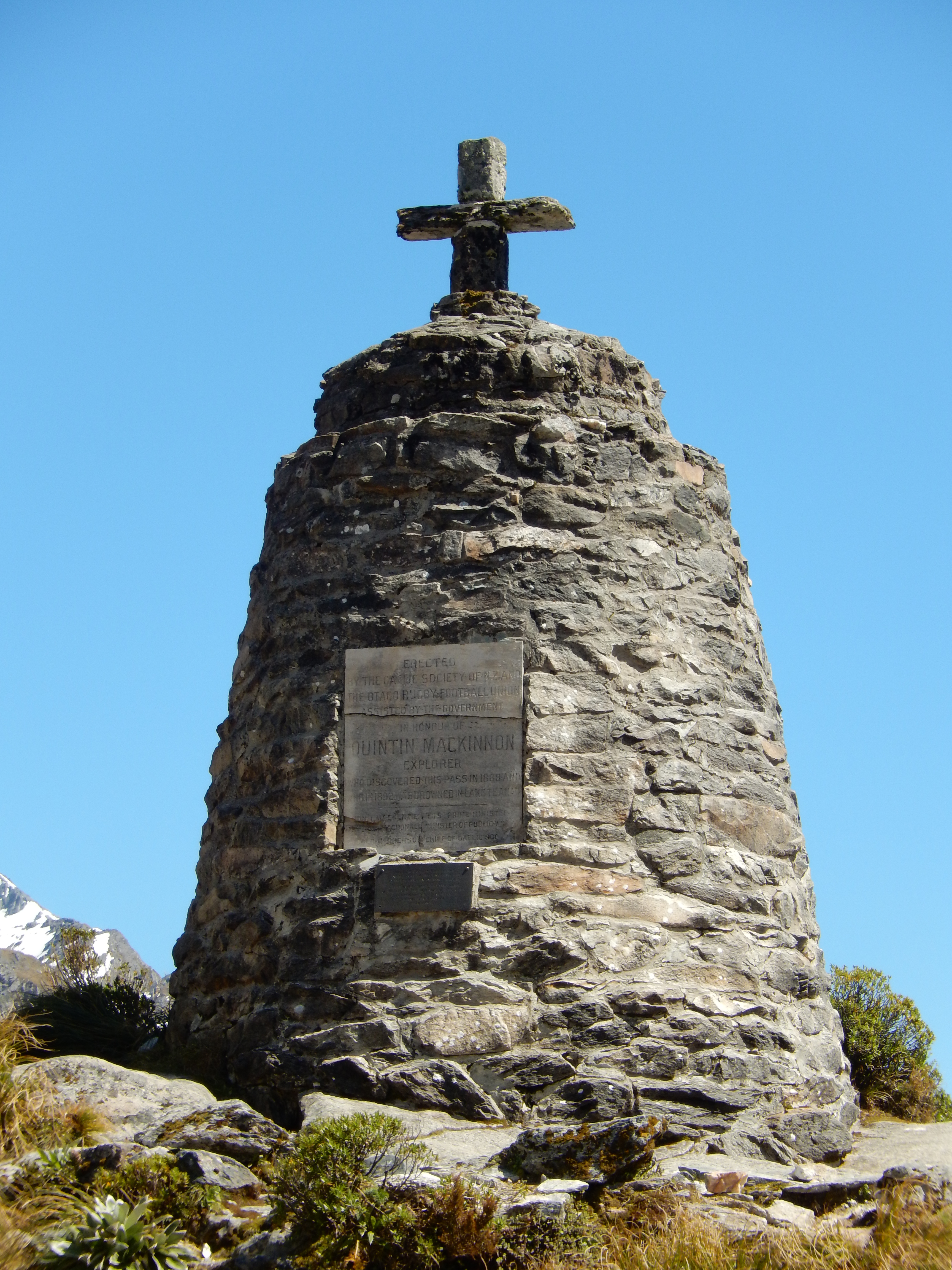
and Ernest Mitchell made their way over the pass from the Clinton Valley. McKinnon had been commissioned by the chief surveyor of Otago to find a route from Te Anau to Milford Sound. McKinnon and Mitchell spent a month slashing a track through the forest and eventually made their way across the pass to reach the existing track to Sutherland Falls. The McKinnon Memorial, a large cairn, is located at the pass commemorating the traverse of the route by McKinnon.
The pass was know for a number of years as Mackinnon Pass although it later was agreed that the correct spelling was McKinnon. The name was officially changed in July 2022, correcting the spelling and adding the Māori name to form the dual name Omanui / McKinnon Pass.
Today, the pass is crossed by thousands of hikers every year on the Milford Track
The Milford Track is a hiking route in New Zealand, located amidst mountains and temperate rain forest in Fiordland National Park in the southwest of the South Island. The 53.5 km (33.2 mi) hike starts at Glade Wharf at the head o ...
. There is a day shelter at the top of the pass for hikers to use as a rest point and for use in emergencies.
Views
Although often clouded in, the pass offers spectacular 360-degree views. The pass is on the ridge between the Mount Balloon to the east and the Mount Hart to the west.References
{{Reflist Tourist attractions in Southland, New Zealand Mountain passes of the Southern Alps Landforms of Fiordland