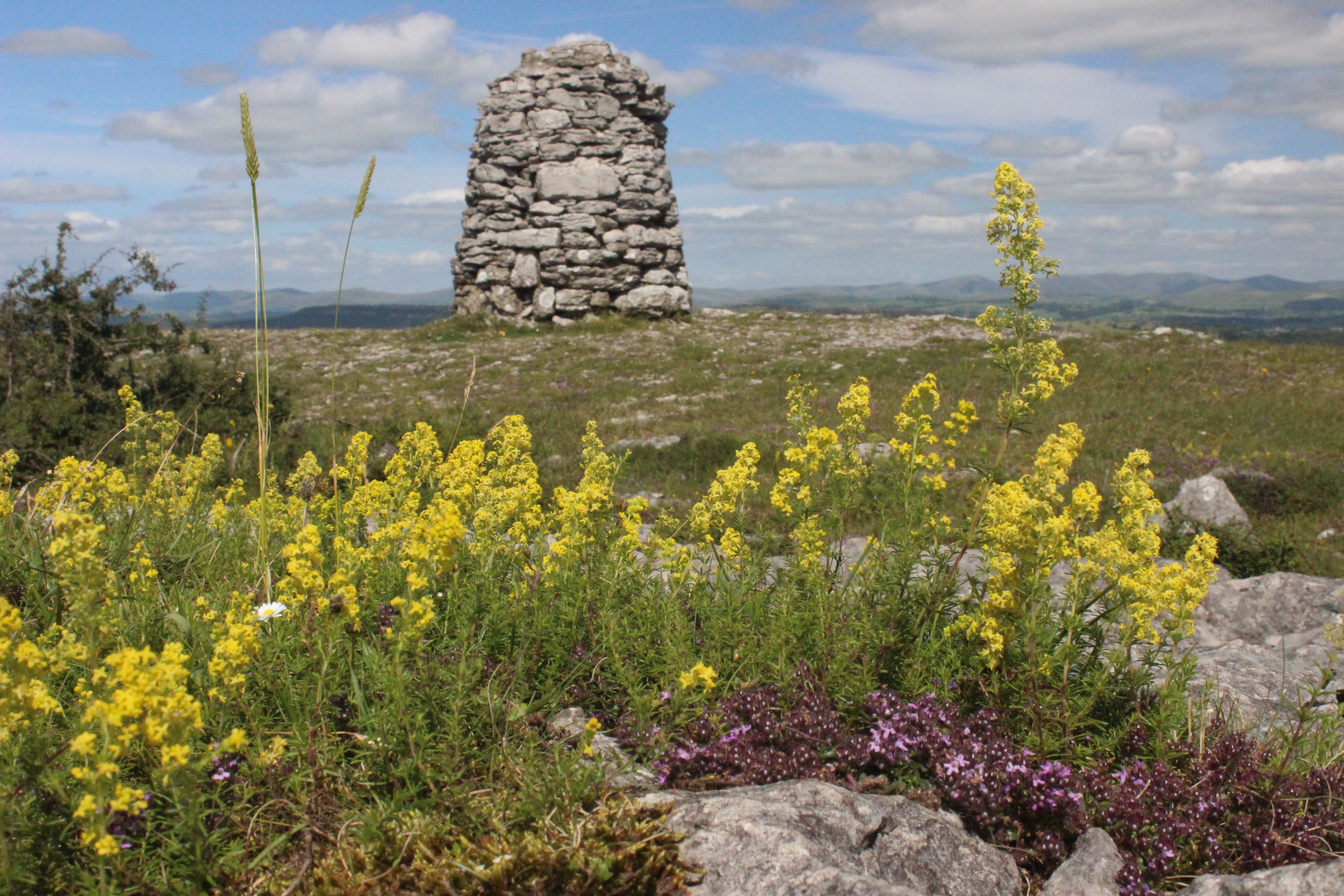
Lord's Seat (Whitbarrow) on:
[Wikipedia]
[Google]
[Amazon]
Whitbarrow is a hill in Cumbria, England. Designated a biological
 {{Marilyns N Eng
Fells of the Lake District
Marilyns of England
National nature reserves in England
Sites of Special Scientific Interest in Cumbria
Local nature reserves in Cumbria
Nature reserves of the Cumbria Wildlife Trust
Site of Special Scientific Interest
A Site of Special Scientific Interest (SSSI) in Great Britain or an Area of Special Scientific Interest (ASSI) in the Isle of Man and Northern Ireland is a conservation designation denoting a protected area in the United Kingdom and Isle of ...
and national nature reserve, it forms part of the Morecambe Bay Pavements
Morecambe Bay Pavements is a multi-site Special Area of Conservation comprising limestone pavements around Morecambe Bay in North-West England. It was designated in 2005 under the Habitats Directive. The SAC does not include any marine areas; Mo ...
Special Area of Conservation due to its supporting some of the best European examples of natural limestone habitats. Also known as Whitbarrow Scar (though properly that term applies to the cliffs lining its western edge), the hill lies about south-west of Kendal
Kendal, once Kirkby in Kendal or Kirkby Kendal, is a market town and civil parish in the South Lakeland district of Cumbria, England, south-east of Windermere and north of Lancaster. Historically in Westmorland, it lies within the dale of th ...
, just north of the A590 road, close to the village of Witherslack. Part of the site is a local nature reserve called Whitbarrow Scar.
It is a mixture of woodland, grassland and limestone pavement
A limestone pavement is a natural karst landform consisting of a flat, incised surface of exposed limestone that resembles an artificial pavement. The term is mainly used in the UK and Ireland, where many of these landforms have developed dist ...
. The hill is prominent from the A590 road with its steep limestone cliffs, laid down in the Carboniferous
The Carboniferous ( ) is a geologic period and system of the Paleozoic that spans 60 million years from the end of the Devonian Period million years ago ( Mya), to the beginning of the Permian Period, million years ago. The name ''Carbonifero ...
period some 350 million years ago. The main cliff faces are made up of rocks known as Dalton Beds, above which are Urswick Limestones, of which the limestone pavement (here and elsewhere around Morecambe Bay, including Hutton Roof Crags
Hutton Roof Crags is a hill in south-eastern Cumbria in north-west England, located near to the village of Hutton Roof. It has extensive areas of limestone pavement as well as grassland and woodland. The hill forms the Hutton Roof Crags Site ...
) has been formed.
Whitbarrow, like most of the Lake District
The Lake District, also known as the Lakes or Lakeland, is a mountainous region in North West England. A popular holiday destination, it is famous for its lakes, forests, and mountains (or ''fells''), and its associations with William Wordswor ...
, shows many signs of the last ice age, including glacial erratics (boulders left behind when the ice retreated), and the limestone pavement
A limestone pavement is a natural karst landform consisting of a flat, incised surface of exposed limestone that resembles an artificial pavement. The term is mainly used in the UK and Ireland, where many of these landforms have developed dist ...
itself, formed when ice left bare limestone exposed to the elements which eroded it and left us with the grikes and clints we see today. The limestone has been used for many purposes including building, agricultural fertiliser, and production of millstone
Millstones or mill stones are stones used in gristmills, for grinding wheat or other grains. They are sometimes referred to as grindstones or grinding stones.
Millstones come in pairs: a convex stationary base known as the ''bedstone'' and ...
s, but is now protected by law and it is an offence to remove any. Whitbarrow NNR is owned and managed by the Forestry Commission, Lake District National Park Authority
The Lake District National Park is a national park in North West England that includes all of the central Lake District, though the town of Kendal, some coastal areas, and the Lakeland Peninsulas are outside the park boundary.
The area was ...
and the Cumbria Wildlife Trust.
Much of Whitbarrow is covered in woodland, initially naturally and from 1919 following planting; the Forestry Commission now holds leases on parts of the hill. A variety of techniques are used to manage the woodland, including coppicing; the variety of methods adds to the range of wildlife resulting.
The summit of Whitbarrow Scar is known as Lord's Seat, and a anticlockwise walk to here from Witherslack, returning along the valley to the west, forms a chapter in '' The Outlying Fells of Lakeland'' by Alfred Wainwright. He describes it as "the most beautiful alkin this book; beautiful it is every step of the way. ... All is fair to the eye on Whitbarrow."
References
 {{Marilyns N Eng
Fells of the Lake District
Marilyns of England
National nature reserves in England
Sites of Special Scientific Interest in Cumbria
Local nature reserves in Cumbria
Nature reserves of the Cumbria Wildlife Trust