List Of Lava Domes on:
[Wikipedia]
[Google]
[Amazon]

 * Mount Keigetsu
*
 * Diky Greben
* Barkhatnaya Sopka
* Astrid Island:Alaid island?
*
 *
*
/ref> * Skerry Fell Fad,
 * Augustine Volcano,
 * Ben Lomond,
 *
*
Lava dome
In volcanology, a lava dome is a circular mound-shaped protrusion resulting from the slow extrusion of viscous lava from a volcano. Dome-building eruptions are common, particularly in convergent plate boundary settings. Around 6% of eruptions on ...
s are common features on volcanoes around the world. Lava domes are known to exist on plate margins as well as in intra-arc hotspots, and on heights above 6000 m and in the sea floor. Individual lava domes and volcanoes featuring lava domes are listed below.
Africa
Ethiopia
*Borawli
Borawli is a stratovolcano with lava domes, located in Administrative Zone 2 of the Afar Region, Ethiopia. It lies above the eastern shore of Lake Afrera.
See also
* List of volcanoes in Ethiopia
*List of stratovolcanoes
A list of stratovolc ...
, Afar Region
Asia
Afghanistan
Armenia
*Geghama mountains
Gegham mountains (or Gegham Ridge, ISO 9985: Geġam), hy, Գեղամա լեռնաշղթա (''Geghama lernasheghta'') are a range of mountains in Armenia. The range is a tableland-type watershed basin of Sevan Lake from east, inflows of rivers ...
Indonesia
*Wayang-Windu
Wayang-Windu is a twin volcano that consists of Mount Wayang ( Indonesian: ''Gunung Wayang'', "Mount Shadow") and Mount Windu. They are located just to the east of the town of Pangalengan in the Bandung Regency (''Kabupaten'' or ''District'') in ...
, Java
Java (; id, Jawa, ; jv, ꦗꦮ; su, ) is one of the Greater Sunda Islands in Indonesia. It is bordered by the Indian Ocean to the south and the Java Sea to the north. With a population of 151.6 million people, Java is the world's List ...
*Ranakah
Poco Ranakah is a volcano located in the south-central part of the island of Flores, Indonesia. Its tallest lava dome, Poco Mandasawu is the tallest mountain of the island. A new lava dome, named Anak Ranakah (the child of Ranakah) was formed the ...
, Flores
Flores is one of the Lesser Sunda Islands, a group of islands in the eastern half of Indonesia. Including the Komodo Islands off its west coast (but excluding the Solor Archipelago to the east of Flores), the land area is 15,530.58 km2, and th ...
Japan

 * Mount Keigetsu
*
* Mount Keigetsu
*Mount Hokuchin
is a lava dome located in the Daisetsuzan Volcanic Group of the Ishikari Mountains, Hokkaido, Japan.
See also
* List of volcanoes in Japan
* List of mountains in Japan
The following is a list of the mountains and hills of Japan, ordered by hei ...
*Mount Hakuun
is a lava dome located in the Daisetsuzan Volcanic Group of the Ishikari Mountains, Hokkaidō, Japan.
See also
* List of volcanoes in Japan
* List of mountains in Japan
The following is a list of the mountains and hills of Japan, ordered by he ...
* Mount Ryōun
* Mount Kuro
*Shikaribetsu Volcanic Group
is a volcanic group of lava domes surrounding Lake Shikaribetsu in Hokkaidō, Japan. The Shikaribetsu volcanic group is located in Daisetsuzan National Park. The volcanic group lies on the Kurile arc of the Pacific ring of fire.
The volcanic ...
*Mount Tarumae
is located in the Shikotsu-Toya National Park in Hokkaidō, Japan. It is located near both Tomakomai and Chitose towns and can be seen clearly from both. It is on the shores of Lake Shikotsu, a caldera lake. Tarumae is a 1,041 metre active and ...
, Hokkaidō
is Japan's second largest island and comprises the largest and northernmost prefecture, making up its own region. The Tsugaru Strait separates Hokkaidō from Honshu; the two islands are connected by the undersea railway Seikan Tunnel.
The la ...
* Mount Yoko
*Shinmoedake
Shinmoedake ( ja, 新燃岳) is a volcano in Kagoshima Prefecture, Kyūshū, Japan, and a part of the Mount Kirishima cluster of volcanoes. It is believed to have formed between 7,300 and 25,000 years ago.
Eruptions from Shinmoedake have been r ...
Philippines
* Musuan Peak,Mindanao
Mindanao ( ) ( Jawi: مينداناو) is the second-largest island in the Philippines, after Luzon, and seventh-most populous island in the world. Located in the southern region of the archipelago, the island is part of an island group of ...
, Bukidnon
Russia
 * Diky Greben
* Barkhatnaya Sopka
* Astrid Island:Alaid island?
*
* Diky Greben
* Barkhatnaya Sopka
* Astrid Island:Alaid island?
*Ichinsky
Ichinsky (russian: Ичинский вулкан or Ичинская сопка, ''Ichinskaya sopka'') is a large stratovolcano located in the central part of the Kamchatka Peninsula, Russia. At , it is the highest peak of the Sredinny Range, the ...
- two domes atop of volcano's somma
Taiwan
*Tatun Volcano Group
Tatun Volcanoes (), a group of volcanoes located in northern Taiwan, is located 15 km north of Taipei, and lies to the west of Keelung. It just adjoins the northern coast of the Taiwan island. The volcano group was a result of episodic volca ...
Turkey
*Göllü Dağ
Göllü is a lava dome located in central Turkey. The volcano has produced rhyolite, dacite and basalt. The lavas have been dated at 1.33 to 0.84 million years by fission track dating of obsidian. The dome lies above the Tertiary Derinkuyu calder ...
Europe
France
 *
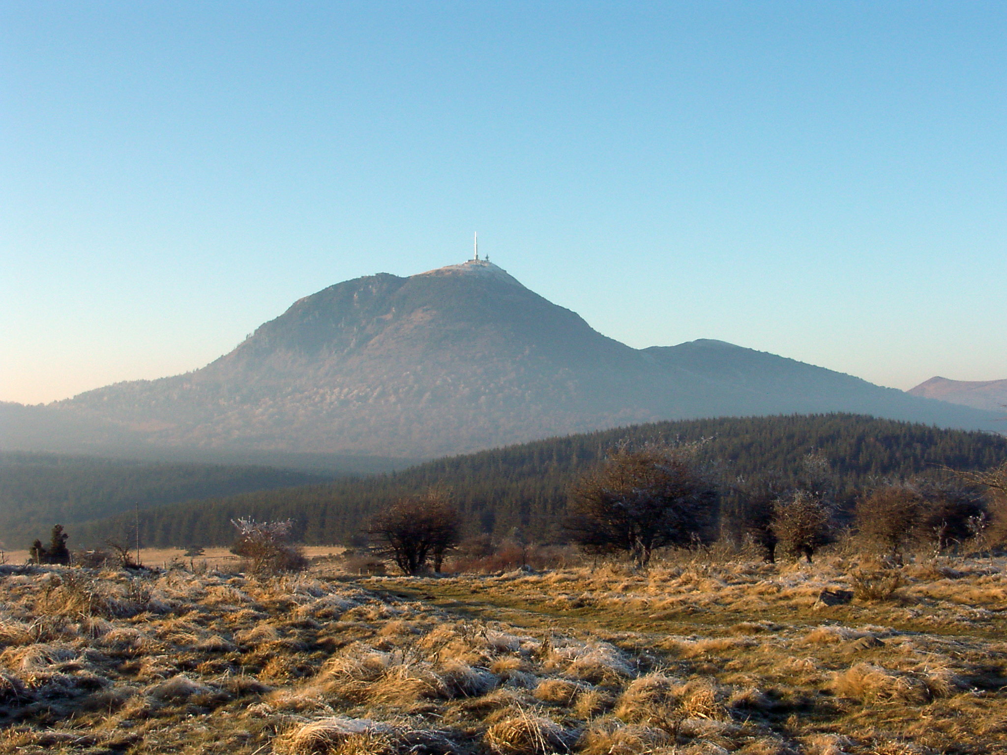
*Mont Gerbier de Jonc
Mont Gerbier de Jonc is a mountain of volcanic origin located in the Massif Central in France. It is made of a type of rock called phonolite. It rises to an altitude of , and its base contains three springs that are the source of the Loire, France ...
, Ardèche
Ardèche (; oc, Ardecha; frp, Ardecha) is a department in the Auvergne-Rhône-Alpes region of Southeastern France. It is named after the river Ardèche and had a population of 328,278 as of 2019.Puy-de-Dôme
Puy-de-Dôme (; oc, label=Auvergnat, lo Puèi de Doma or ''lo Puèi Domat'') is a department in the Auvergne-Rhône-Alpes region in the centre of France. In 2019, it had a population of 662,152.Clermont-Ferrand
Clermont-Ferrand (, ; ; oc, label=Auvergnat (dialect), Auvergnat, Clarmont-Ferrand or Clharmou ; la, Augustonemetum) is a city and Communes of France, commune of France, in the Auvergne-Rhône-Alpes regions of France, region, with a population ...
Greece
* Gyali,Dodecanese
The Dodecanese (, ; el, Δωδεκάνησα, ''Dodekánisa'' , ) are a group of 15 larger plus 150 smaller Greek islands in the southeastern Aegean Sea and Eastern Mediterranean, off the coast of Turkey's Anatolia, of which 26 are inhabited. ...
*Methana Volcano
The Methana volcano peninsula is situated approximately southwest of Athens in Greece.
Geological history
The Methana (Μέθανα) peninsula contains some 32 volcanoes, including the Methana volcano, that are mostly andesitic and dacitic la ...
Iceland
*Torfajökull
Torfajökull ( Icelandic for "Torfi's glacier"; ) is a rhyolitic stratovolcano, caldera (central volcano) and complex of subglacial volcanoes, located north of Mýrdalsjökull and south of Þórisvatn Lake, Iceland. Torfajökull last erupted in 1 ...
Italy
* Monte Amiata, TuscanyUnited Kingdom
* Glynn Hill,County Antrim
County Antrim (named after the town of Antrim, ) is one of six counties of Northern Ireland and one of the thirty-two counties of Ireland. Adjoined to the north-east shore of Lough Neagh, the county covers an area of and has a population o ...
, Northern Ireland
* Scafell Dacite (including Great Gable
Great Gable is a mountain in the Lake District, United Kingdom. It is named after its appearance as a pyramid from Wasdale, though it is dome-shaped from most other directions. It is one of the most popular of the Lakeland fells, and there are ...
), Cumbria
Cumbria ( ) is a ceremonial and non-metropolitan county in North West England, bordering Scotland. The county and Cumbria County Council, its local government, came into existence in 1974 after the passage of the Local Government Act 1972. Cumb ...
, England
England is a country that is part of the United Kingdom. It shares land borders with Wales to its west and Scotland to its north. The Irish Sea lies northwest and the Celtic Sea to the southwest. It is separated from continental Europe b ...
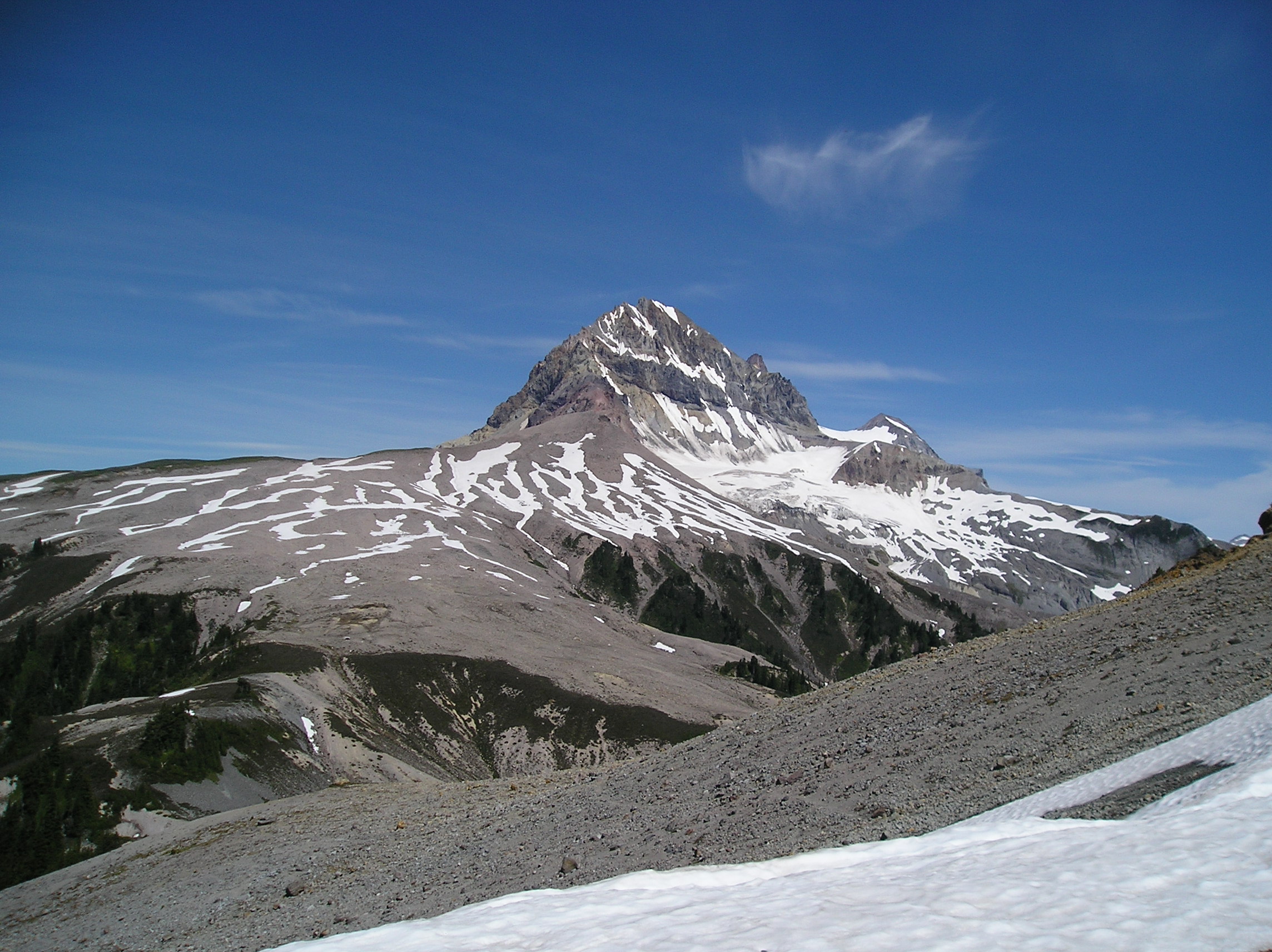
Geology of England and Wales, pp118ff/ref> * Skerry Fell Fad,
Argyll and Bute
Argyll and Bute ( sco, Argyll an Buit; gd, Earra-Ghàidheal agus Bòd, ) is one of 32 unitary authority council areas in Scotland and a lieutenancy area. The current lord-lieutenant for Argyll and Bute is Jane Margaret MacLeod (14 July 2020) ...
, Scotland
North America
Canada

Grenada
*Mount Saint Catherine
Mount Catherine ( ar, جبل كاثرين; el, Όρος της Αγίας Αικατερίνης), locally known as Gabal Katrîne, is the highest mountain in Egypt. It is located near the city of Saint Catherine in the South Sinai Governorate ...
Mexico
* Popocatepetl, Mexico *El Chichon
EL, El or el may refer to:
Religion
* El (deity), a Semitic word for "God"
People
* EL (rapper) (born 1983), stage name of Elorm Adablah, a Ghanaian rapper and sound engineer
* El DeBarge, music artist
* El Franco Lee (1949–2016), American po ...
, Chiapas, Mexico
United States


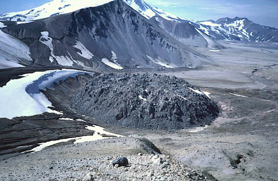
 * Augustine Volcano,
 Cook Inlet
Cook Inlet ( tfn, Tikahtnu; Sugpiaq: ''Cungaaciq'') stretches from the Gulf of Alaska to Anchorage in south-central Alaska. Cook Inlet branches into the Knik Arm and Turnagain Arm at its northern end, almost surrounding Anchorage. On its sou ...
, Alaska
Alaska ( ; russian: Аляска, Alyaska; ale, Alax̂sxax̂; ; ems, Alas'kaaq; Yup'ik: ''Alaskaq''; tli, Anáaski) is a state located in the Western United States on the northwest extremity of North America. A semi-exclave of the U.S., ...
* Lassen Peak, Shasta County, California
* Mono-Inyo Craters, California
California is a U.S. state, state in the Western United States, located along the West Coast of the United States, Pacific Coast. With nearly 39.2million residents across a total area of approximately , it is the List of states and territori ...
*Panum Crater
Panum Crater is a volcanic cone that is part of the Mono–Inyo Craters, a chain of recent volcanic cones south of Mono Lake and east of the Sierra Nevada, in California, United States. Panum Crater is between 600 and 700 years old, and it exhibit ...
, California
California is a U.S. state, state in the Western United States, located along the West Coast of the United States, Pacific Coast. With nearly 39.2million residents across a total area of approximately , it is the List of states and territori ...
* Newberry Volcano, Oregon
Oregon () is a U.S. state, state in the Pacific Northwest region of the Western United States. The Columbia River delineates much of Oregon's northern boundary with Washington (state), Washington, while the Snake River delineates much of it ...
*Paulina Peak
Paulina Peak is a summit in Deschutes County, Oregon, United States. Formed by the Newberry Volcano, it is part of Newberry National Volcanic Monument
Newberry National Volcanic Monument was designated on November 5, 1990, to protect the area ...
, Newberry Volcano, Oregon
Oregon () is a U.S. state, state in the Pacific Northwest region of the Western United States. The Columbia River delineates much of Oregon's northern boundary with Washington (state), Washington, while the Snake River delineates much of it ...
*Hayrick Butte
Hayrick Butte is a tuya, a type of subglacial volcano, in Linn County, Oregon. Located in the Willamette National Forest near Santiam Pass, it lies adjacent to the cinder cone Hoodoo Butte, which has a ski area. Hayrick Butte likely formed wh ...
, Oregon
Oregon () is a U.S. state, state in the Pacific Northwest region of the Western United States. The Columbia River delineates much of Oregon's northern boundary with Washington (state), Washington, while the Snake River delineates much of it ...
*Hogg Rock
Hogg Rock is a tuya volcano and lava dome in the Cascade Range of northern Oregon, United States, located close to Santiam Pass. Produced by magma with an intermediate andesite composition, it has steep slopes and thick glassy margins. Hogg ...
, Oregon
Oregon () is a U.S. state, state in the Pacific Northwest region of the Western United States. The Columbia River delineates much of Oregon's northern boundary with Washington (state), Washington, while the Snake River delineates much of it ...
* Mount Mazama, Oregon
Oregon () is a U.S. state, state in the Pacific Northwest region of the Western United States. The Columbia River delineates much of Oregon's northern boundary with Washington (state), Washington, while the Snake River delineates much of it ...
*Middle Butte
Middle Butte is a summit located in Bingham County, Idaho, United States.
Description
Middle Butte is situated 40 miles east of Craters of the Moon National Monument and Preserve, 35 miles west of the community of Idaho Falls, and can be seen ...
, Idaho
Idaho ( ) is a state in the Pacific Northwest region of the Western United States. To the north, it shares a small portion of the Canada–United States border with the province of British Columbia. It borders the states of Montana and Wyom ...
* West Crater, Washington
Washington commonly refers to:
* Washington (state), United States
* Washington, D.C., the capital of the United States
** A metonym for the federal government of the United States
** Washington metropolitan area, the metropolitan area centered on ...
* Novarupta, Alaska
Alaska ( ; russian: Аляска, Alyaska; ale, Alax̂sxax̂; ; ems, Alas'kaaq; Yup'ik: ''Alaskaq''; tli, Anáaski) is a state located in the Western United States on the northwest extremity of North America. A semi-exclave of the U.S., ...
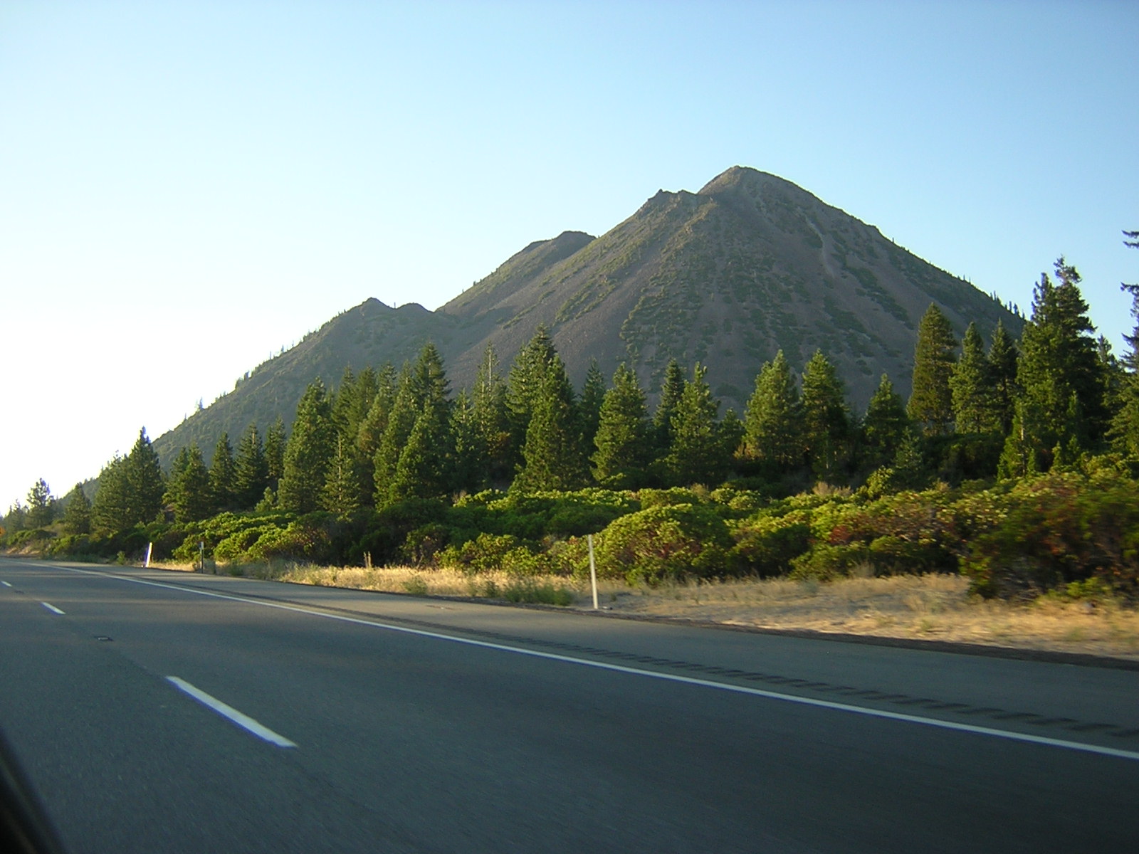
* Black Butte, Siskiyou County
*Chaos Crags
Chaos Crags is the youngest group of lava domes in Lassen Volcanic National Park, California. They formed as six dacite domes 1,100-1,000 years ago, one dome collapsing during an explosive eruption about 70 years later. The eruptions at the Ch ...
* Coso Volcanic Field
* Mammoth Mountain, Inyo National Forest
* Sutter Buttes, Sacramento Valley
, photo =Sacramento Riverfront.jpg
, photo_caption= Sacramento
, map_image=Map california central valley.jpg
, map_caption= The Central Valley of California
, location = California, United States
, coordinates =
, boundaries = Sierra Nevada (ea ...
*Big Southern Butte
Big Southern Butte is the largest and youngest (300,000 years old) of three rhyolitic domes formed over a million years near the center of the Eastern Snake River Plain in the U.S. state of Idaho. It is one of the largest volcanic domes on earth ...
, Butte County, Idaho
*Cinnamon Butte
Cinnamon Butte is a group of cinder cone volcanoes and lava domes in the Cascade Range of Oregon. All of the vents are older than approximately 6,845 years as they are all covered in ash from the eruption of Mount Mazama.
Notable Vents
S ...
, Oregon
Oregon () is a U.S. state, state in the Pacific Northwest region of the Western United States. The Columbia River delineates much of Oregon's northern boundary with Washington (state), Washington, while the Snake River delineates much of it ...
* Marble Mountain-Trout Creek Hill, Washington
Washington commonly refers to:
* Washington (state), United States
* Washington, D.C., the capital of the United States
** A metonym for the federal government of the United States
** Washington metropolitan area, the metropolitan area centered on ...
* Mount Elden, Coconino County, Arizona
Coconino County is a County (United States), county in the north-central part of the U.S. state of Arizona. Its population was 145,101 at the 2020 United States census, 2020 census. The county seat is Flagstaff, Arizona, Flagstaff. The count ...
*Kendrick Peak
Kendrick Peak or Kendrick Mountain is one of the highest peaks in the San Francisco volcanic field north of the city of Flagstaff in the U.S. State of Arizona and is located on the Coconino Plateau in Coconino County.
Kendrick Peak rises to ...
, Coconino County, Arizona
Coconino County is a County (United States), county in the north-central part of the U.S. state of Arizona. Its population was 145,101 at the 2020 United States census, 2020 census. The county seat is Flagstaff, Arizona, Flagstaff. The count ...
near Flagstaff, Arizona
Flagstaff ( ) is a city in, and the county seat of, Coconino County, Arizona, Coconino County in northern Arizona, in the southwestern United States. In 2019, the city's estimated population was 75,038. Flagstaff's combined metropolitan area has ...
*Bill Williams Mountain
Bill Williams Mountain is a peak and lava dome volcano located about west of Flagstaff and south of Williams, Arizona in the Kaibab National Forest. It is named for Old Bill Williams, a scout, guide, and mountain man, who lived in the 1800s. ...
, Coconino County, Arizona
Coconino County is a County (United States), county in the north-central part of the U.S. state of Arizona. Its population was 145,101 at the 2020 United States census, 2020 census. The county seat is Flagstaff, Arizona, Flagstaff. The count ...
near Flagstaff, Arizona
Flagstaff ( ) is a city in, and the county seat of, Coconino County, Arizona, Coconino County in northern Arizona, in the southwestern United States. In 2019, the city's estimated population was 75,038. Flagstaff's combined metropolitan area has ...
* Sitgreaves Mountain, Coconino County, Arizona
Coconino County is a County (United States), county in the north-central part of the U.S. state of Arizona. Its population was 145,101 at the 2020 United States census, 2020 census. The county seat is Flagstaff, Arizona, Flagstaff. The count ...
near Flagstaff, Arizona
Flagstaff ( ) is a city in, and the county seat of, Coconino County, Arizona, Coconino County in northern Arizona, in the southwestern United States. In 2019, the city's estimated population was 75,038. Flagstaff's combined metropolitan area has ...
* Sugarloaf Peak, Coconino County, Arizona
Coconino County is a County (United States), county in the north-central part of the U.S. state of Arizona. Its population was 145,101 at the 2020 United States census, 2020 census. The county seat is Flagstaff, Arizona, Flagstaff. The count ...
near Flagstaff, Arizona
Flagstaff ( ) is a city in, and the county seat of, Coconino County, Arizona, Coconino County in northern Arizona, in the southwestern United States. In 2019, the city's estimated population was 75,038. Flagstaff's combined metropolitan area has ...
* Steamboat Springs, Washoe County, Nevada
*Salton Buttes
The Salton Buttes are a group of volcanoes in California, on the Salton Sea. They consist of a -long row of five lava domes, named Mullet Island, North Red Hill, Obsidian Butte, Rock Hill and South Red Hill. They are closely associated with a f ...
, Salton Sea
The Salton Sea is a shallow, landlocked, highly saline body of water in Riverside and Imperial counties at the southern end of the U.S. state of California. It lies on the San Andreas Fault within the Salton Trough that stretches to the Gulf o ...
, California
California is a U.S. state, state in the Western United States, located along the West Coast of the United States, Pacific Coast. With nearly 39.2million residents across a total area of approximately , it is the List of states and territori ...
*Red Island Volcano
Red Island (or Red Hill) is a lava dome volcano in the Salton Trough, and part of the Salton Buttes, the only active volcanoes in Southern California. It is located in Imperial County, California. It contains two lava domes, Prospect Dome and Al ...
, Salton Sea
The Salton Sea is a shallow, landlocked, highly saline body of water in Riverside and Imperial counties at the southern end of the U.S. state of California. It lies on the San Andreas Fault within the Salton Trough that stretches to the Gulf o ...
, California
California is a U.S. state, state in the Western United States, located along the West Coast of the United States, Pacific Coast. With nearly 39.2million residents across a total area of approximately , it is the List of states and territori ...
South America
Argentina
Bolivia
* Cerro Chascon-Runtu Jarita complex *Nuevo Mundo volcano
Nuevo Mundo also known as Jatun Mundo Quri Warani (Hispanicized spellings ''Jatun Mundo Khori Huarani, Jatun Mundo Khorihuarani''), is a stratovolcano, lava dome and a lava flow complex between Potosí and Uyuni, Bolivia, in the Andes rising to a ...
Chile
250px, Aerial view of the rhyolitic lava dome of Volcán Chaitén in Chile (2009)Oceania
New Zealand
 * Ben Lomond,
 North Island
The North Island, also officially named Te Ika-a-Māui, is one of the two main islands of New Zealand, separated from the larger but much less populous South Island by the Cook Strait. The island's area is , making it the world's 14th-largest ...
*Mount Tarawera
Mount Tarawera is a volcano on the North Island of New Zealand within the older but volcanically productive Ōkataina Caldera. Located 24 kilometres southeast of Rotorua, it consists of a series of rhyolitic lava domes that were fissured d ...
, North Island
* Mangere Mountain, North Island
Australia
* Prospect Hill,New South Wales
)
, nickname =
, image_map = New South Wales in Australia.svg
, map_caption = Location of New South Wales in AustraliaCoordinates:
, subdivision_type = Country
, subdivision_name = Australia
, established_title = Before federation
, es ...
Extraterrestrial lava domes
 *
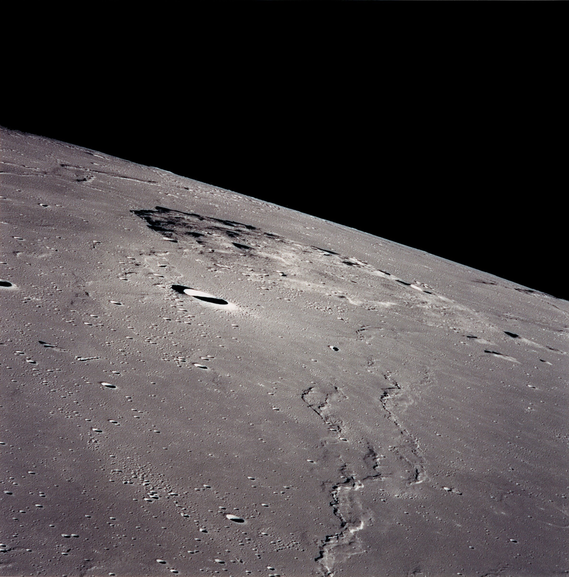
*Mons Rümker
Mons Rümker is an isolated volcanic formation that is located in the northwest part of the Moon's near side, at selenographic coordinates 40.8° N, 58.1° W. The feature forms a large, elevated mound in the northern part of the Oceanus Procellaru ...
, near side of the Moon
The Moon is Earth's only natural satellite. It is the fifth largest satellite in the Solar System and the largest and most massive relative to its parent planet, with a diameter about one-quarter that of Earth (comparable to the width of ...
See also
*List of stratovolcanoes
A list of stratovolcanoes follows below.
Africa
Cameroon
* Mount Cameroon
Democratic Republic of Congo
* Mount Nyiragongo, Goma; designated as a Decade Volcano
** It contains an active lava lake inside its crater which overflowed due t ...
*List of shield volcanoes
This list of shield volcanoes includes active, dormant and extinct shield volcanoes.
Shield Volcanoes are one of the three types of volcanoes. They have a short cone shape, and have basaltic lava which means the lava has low viscosity (viscosit ...
* List of cinder cones
References
{{reflist