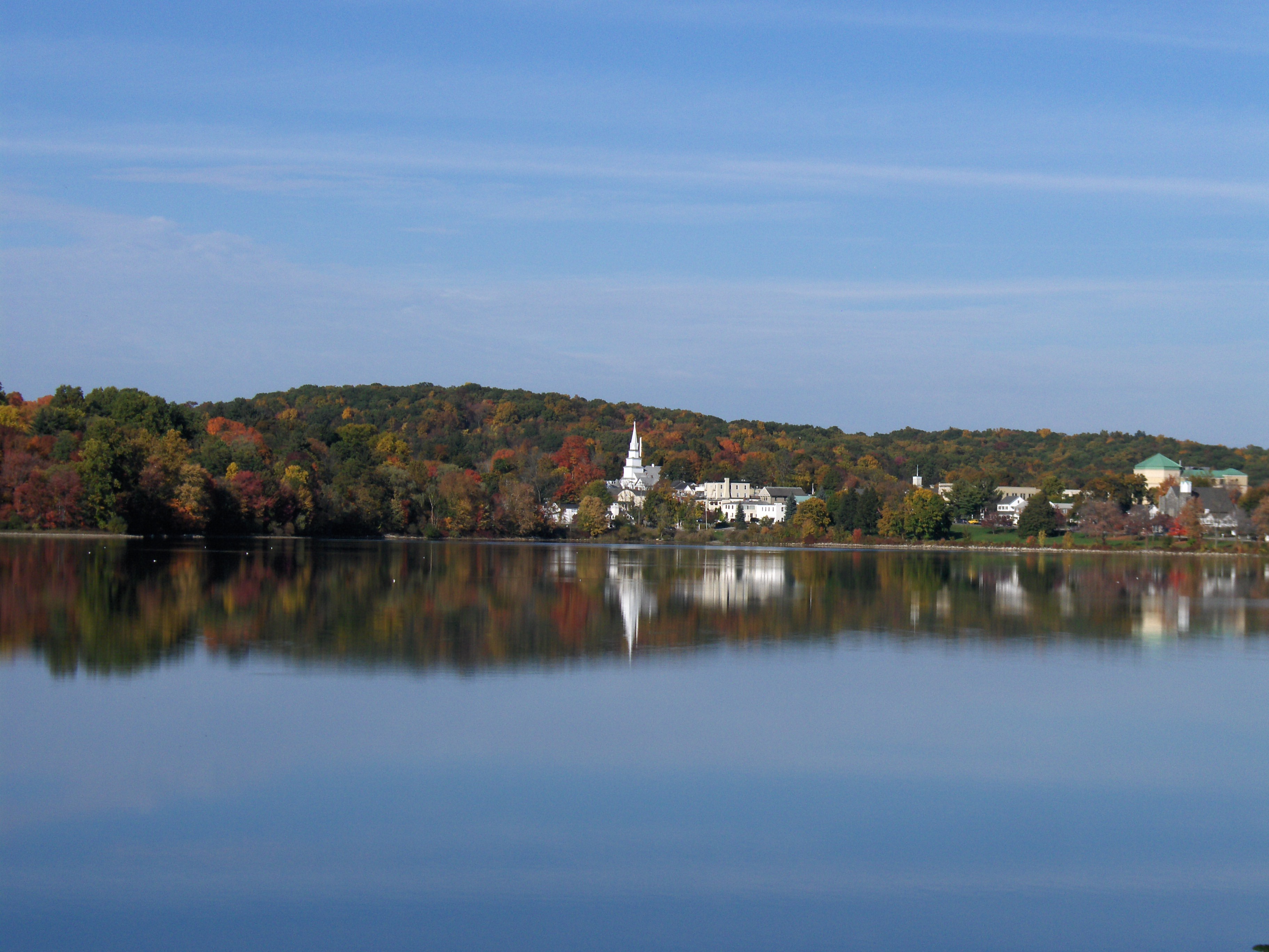
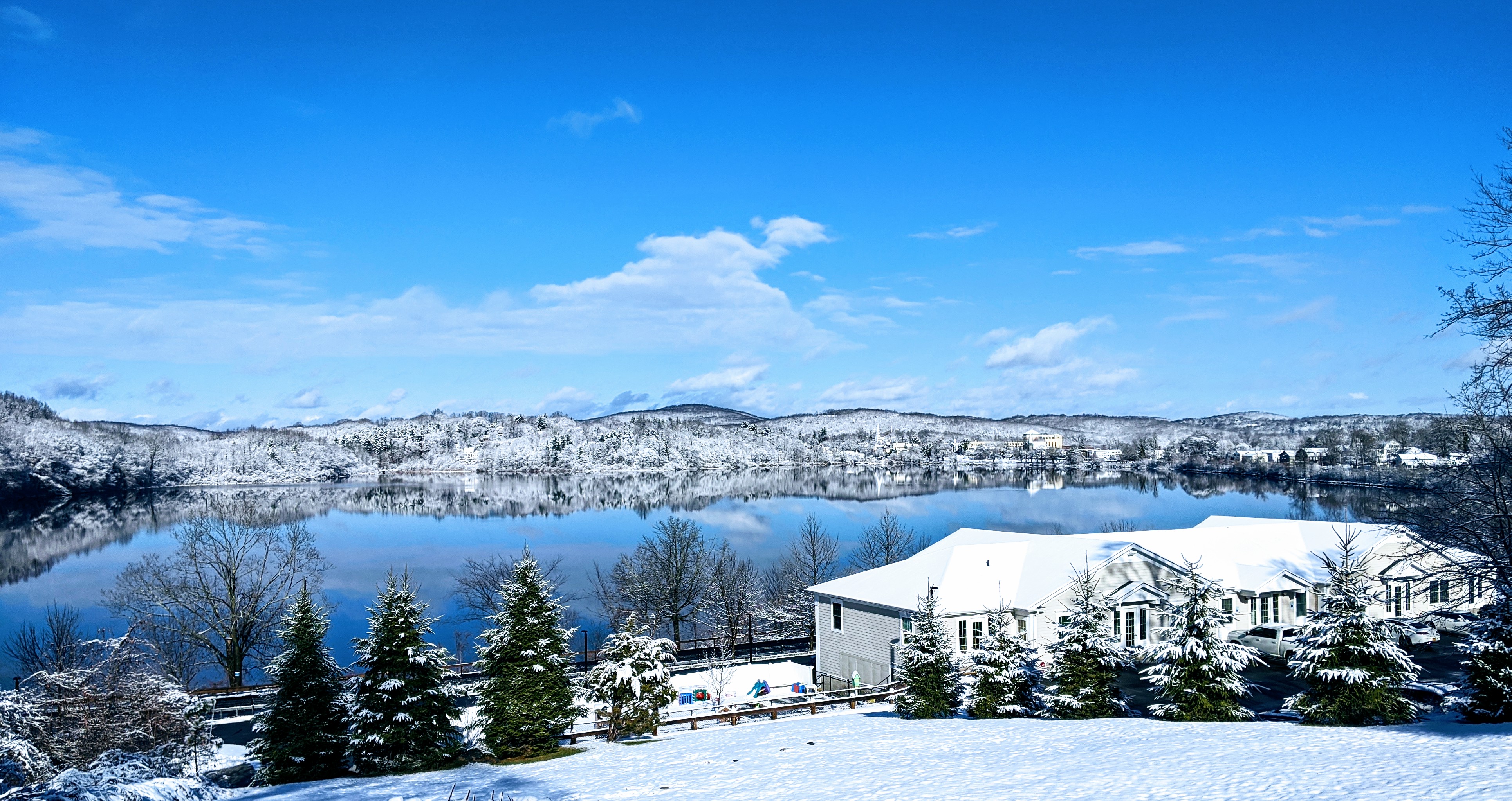
Lake Gleneida on:
[Wikipedia]
[Google]
[Amazon]
Lake Gleneida is a
 The lake was originally known as Shaw's Pond, after an early landowner. It had been a part of the Carmel landscape since the
/ref>Rules and Regulations for the Protection from Contamination, Degradation and Pollution of the New York City Water Supply and its Sources, Final Regulations, Chapter 18 – New York City, Subchapter A, Section 18-16 – Definitions (20) "Controlled lake means a lake from which the City may withdraw water pursuant to rights acquired by the City or as a right of ownership. The controlled lakes are: Kirk Lake, Lake Gleneida and Lake Gilead".
/ref> Recreational use of the lake falls under DEP regulations. Fishing,
controlled lake
A controlled lake is both a general and specific term to describe a body of water. In its general sense it describes a lake or reservoir which has its water level controlled by some form of dam. In the specific, it refers to three small lakes wit ...
in the hamlet of Carmel within the Town of Carmel in central Putnam County, New York
Putnam County is a county located in the U.S. state of New York. As of the 2020 census, the population was 97,668. The county seat is Carmel. Putnam County formed in 1812 from Dutchess County and is named for Israel Putnam, a hero in t ...
. Originally a smaller natural water body, Shaw's Pond, it was dammed by New York City
New York, often called New York City or NYC, is the most populous city in the United States. With a 2020 population of 8,804,190 distributed over , New York City is also the most densely populated major city in the Un ...
in 1870 and enlarged to for inclusion in its water supply system
A water supply network or water supply system is a system of engineered hydrologic and hydraulic components that provide water supply. A water supply system typically includes the following:
# A drainage basin (see water purification – sourc ...
. It is part of the New York City water system's Croton Watershed
The Croton Watershed is the New York City water supply system's name for its southernmost watershed and its infrastructure,{{efn, Including dams, spillways, tunnels, pumps, and related mechanical components not part of a hydrological drainage bas ...
.
Geography
The roughly heart-shaped lake is immediately to the southwest of downtown Carmel. It is surrounded by grassy parkland sloping down to the lake from the roads on the south and east, and woods on the other sides. NY 301 follows the north shore, ascending to its eastern terminus atNY 52
New York State Route 52 (NY 52) is a state highway in the southeastern part of the state. It generally runs from west to east through five counties, beginning at the New York–Pennsylvania border, Pennsylvania state line in the Delawa ...
across from the Putnam County courthouse. Route 52 follows the eastern shore for a short distance to the south of this intersection before it, too, ends at US 6
U.S. Route 6 (US 6), also called the Grand Army of the Republic Highway, honoring the American Civil War veterans association, is a main route of the U.S. Highway system. While it currently runs east-northeast from Bishop, California, to ...
, which continues around the southern shore. There is no road along the western side, although a local street, Glenvue Drive, traverses the top of the -high ridge there.
The lake fills a small depression in the middle of a hilly area. Its bottom continues its rapid drop from the shoreline, reaching a depth of slightly over in the middle of the lake, equivalent to the surface of a swampy depression to its east. Mean depth is . It typically contains , or of water.
There are no inlet brooks. A dam and spillway are located on its northwest end, with outflow draining into the New York City water supply system's West Branch Reservoir
The West Branch Reservoir is a reservoir in the New York City water supply system. Formed by impounding the upper reaches of the West Branch of the Croton River, it is located in the Putnam County, New York, towns of Kent, and Carmel, about ...
, where it joins with waters from the Delaware Aqueduct
The Delaware Aqueduct is an aqueduct in the New York City water supply system. It takes water from the Rondout, Cannonsville, Neversink, and Pepacton reservoirs on the west bank of the Hudson River through the Chelsea Pump Station, then into ...
. Water in excess of New York City's needs there goes over its spillway and into the West Branch Croton River, which is captured downstream by the Croton Falls Reservoir
The Croton Falls Reservoir is a reservoir in the New York City water supply system in the Putnam County, New York townships of Carmel, and Southeast, roughly north of New York City. Part of the system's Croton Watershed, it was formed by impou ...
.
History
 The lake was originally known as Shaw's Pond, after an early landowner. It had been a part of the Carmel landscape since the
 hamlet
''The Tragedy of Hamlet, Prince of Denmark'', often shortened to ''Hamlet'' (), is a tragedy written by William Shakespeare sometime between 1599 and 1601. It is Shakespeare's longest play, with 29,551 words. Set in Denmark, the play depicts ...
's designation as county seat
A county seat is an administrative center, seat of government, or capital city of a county or civil parish. The term is in use in Canada, China, Hungary, Romania, Taiwan, and the United States. The equivalent term shire town is used in the US st ...
upon Putnam's 1814 creation. It quickly became a popular spot for boating and fishing
Fishing is the activity of trying to catch fish. Fish are often caught as wildlife from the natural environment, but may also be caught from stocked bodies of water such as ponds, canals, park wetlands and reservoirs. Fishing techniques inclu ...
.
The name started appearing on maps around 1840. Not long after, residents became dissatisfied with the name and proposed grander names for it. In 1852, a committee of local residents finally settled on Lake Gleneida. New York City
New York, often called New York City or NYC, is the most populous city in the United States. With a 2020 population of 8,804,190 distributed over , New York City is also the most densely populated major city in the Un ...
bought rights to the lake around 1895 and tore down what houses were built near it.
Recreation
TheNew York City Department of Environmental Protection
The New York City Department of Environmental Protection (DEP) is the department of the government of New York City that manages the city's water supply and works to reduce air, noise, and hazardous materials pollution.
Under a 1.3 billion do ...
(DEP) owns Lake Gleneida, considered one of three controlled lakes in the city's water system. That means it may withdraw water as a right of ownership.New York State Department of Health Regulations, Part 128-1.6(a)(20)/ref>
/ref>
 Recreational use of the lake falls under DEP regulations. Fishing,
 ice fishing
Ice fishing is the practice of catching fish with lines and fish hooks or spears through an opening in the ice on a frozen body of water. Ice fishers may fish in the open or in heated enclosures, some with bunks and amenities.
Shelters
Longe ...
and boating are allowed with a valid DEP permit and New York State Department of Environmental Conservation-issued fishing license. Swimming is not permitted.
Boats used in the lake may not be used in any other body of water, to prevent the spread of zebra mussel
The zebra mussel (''Dreissena polymorpha'') is a small freshwater mussel. The species originates from the lakes of southern Russia and Ukraine, but has been accidentally introduced to numerous other areas and has become an invasive species in ma ...
s. This raised some local concern in 2005, since many were left on shore during the offseason and the town found them unsightly as it prepared to spend $2.3 million to spruce up the hamlet. DEP was able to get most of the owners to relocate them to storage areas out of sight of downtown.
References
{{authority control Gleneida Gleneida Gleneida Croton Watershed Water infrastructure of New York City 1870 establishments in New York (state) U.S. Route 6 Protected areas of Putnam County, New York Gleneida