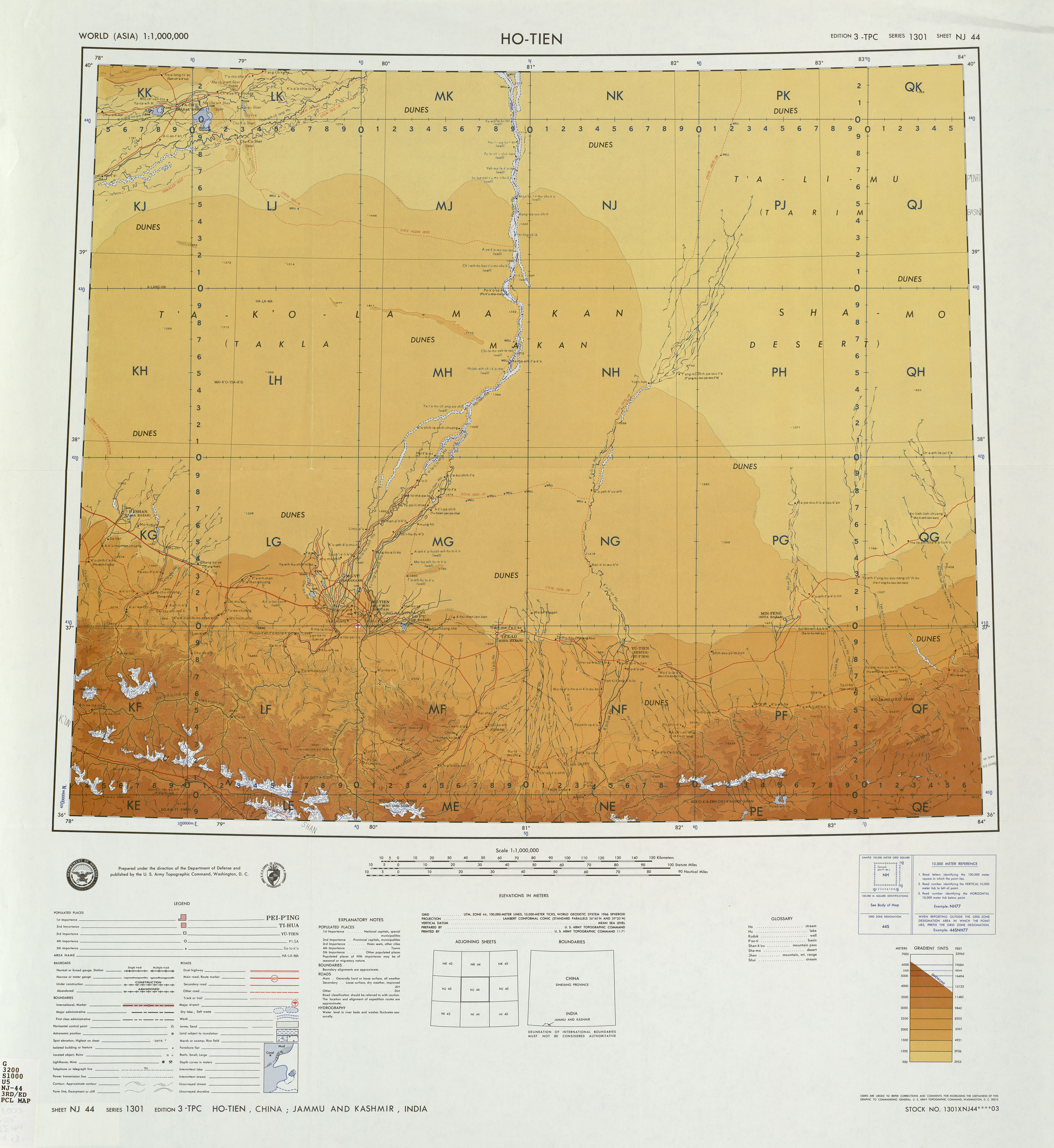
Khotan River on:
[Wikipedia]
[Google]
[Amazon]
The Hotan River (also known as the Khotan River or the Ho-t'ien River) is formed by the union of the White Jade (Yurungkash) and Karakash (Black Jade) Rivers, which flow north from the
from NASA'
Geomorphology from Space
. Retrieved March 29, 2014.
Kunlun Mountains
The Kunlun Mountains ( zh, s=昆仑山, t=崑崙山, p=Kūnlún Shān, ; ug, كۇئېنلۇن تاغ تىزمىسى / قۇرۇم تاغ تىزمىسى ) constitute one of the longest mountain chains in Asia, extending for more than . In the bro ...
into the Taklamakan Desert
The Taklimakan or Taklamakan Desert (; zh, s=塔克拉玛干沙漠, p=Tǎkèlāmǎgān Shāmò, Xiao'erjing: , dng, Такәламаган Шамә; ug, تەكلىماكان قۇملۇقى, Täklimakan qumluqi; also spelled Taklimakan and T ...
in northern China
China, officially the People's Republic of China (PRC), is a country in East Asia. It is the world's most populous country, with a population exceeding 1.4 billion, slightly ahead of India. China spans the equivalent of five time zones and ...
. The two rivers unite towards the middle of the desert, some north of the town of Hotan
Hotan (also known as Gosthana, Gaustana, Godana, Godaniya, Khotan, Hetian, Hotien) is a major oasis town in southwestern Xinjiang, an autonomous region in Western China. The city proper of Hotan broke off from the larger Hotan County to become ...
. The river then flows northwards across the desert and empties itself into the Tarim River
The Tarim River ( zh, p=Tǎlǐmù Hé, c=塔里木河; ug, تارىم دەرياسى, Tarim deryasi), known in Sanskrit as the Śītā, is an endorheic river in Xinjiang, China. It is the principal river of the Tarim Basin, a desert region of C ...
."Khotan-Darya". 1911 Encyclopædia Britannica. Because the river is fed by melting snow from the mountains, it only carries water during the summer and is dry the rest of the year. Prior to construction of the Tarim Desert Highway 200px, Vegetation on either side of the highway to prevent shifting sand dunes from covering it, as well as a blue pump house in the distance. 200px, PetroChina gas station on the highway route
The Tarim Desert Highway (), also known as the Cross- ...
in 1995, the Hotan river bed provided the only transportation system across the Tarim Basin
The Tarim Basin is an endorheic basin in Northwest China occupying an area of about and one of the largest basins in Northwest China.Chen, Yaning, et al. "Regional climate change and its effects on river runoff in the Tarim Basin, China." Hydr ...
.The Southwest Taklimakan Desertfrom NASA'
Geomorphology from Space
. Retrieved March 29, 2014.

Wells
In the mid-20th century, wells along the course of the river included (south to north): Hsüeh-erh-ch'i-k'o-ma, Chi-la-mu-yeh-te-tao, Ai-k'o-t'i-ken, Ch'i-erh-ko-han-t'u-mu-shu-k'o, A-ya-k'o-wu-ssu-tan, Man-ta-t'u-mu-shu-k'o, Lo-tsa-pai-t'u-mu-shu-k'o, Yeh-ma-la-k'o-tao, Po-lo-ch'u-shih-kan, Hsi-t'i-pa-ku-t'an and Ya-erh-te-ku-tzu.References
Notes
Rivers of Xinjiang Sites along the Silk Road Hotan {{China-river-stub