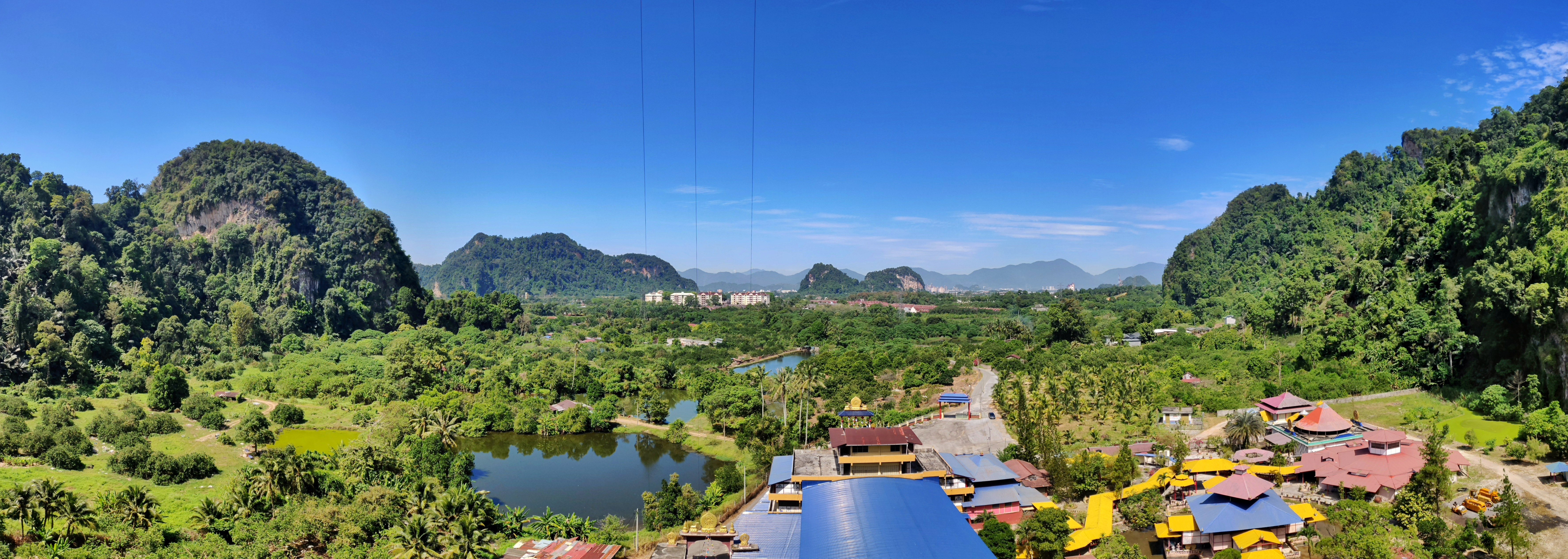
Kinta Valley National Geopark on:
[Wikipedia]
[Google]
[Amazon]


 The Kinta Valley National Geopark (


 The Kinta Valley National Geopark (
Malay
Malay may refer to:
Languages
* Malay language or Bahasa Melayu, a major Austronesian language spoken in Indonesia, Malaysia, Brunei and Singapore
** History of the Malay language, the Malay language from the 4th to the 14th century
** Indonesi ...
: ''Geopark Kebangsaan Lembah Kinta'', Jawi: ڬيوڤارك كبڠساءن لمبه كينتا) is a geopark
A geopark is a protected area with internationally significant geology within which sustainable development is sought and which includes tourism, conservation, education and research concerning not just geology but other relevant sciences.
In 20 ...
covering an area of 1,952 km², spanning across two districts within the Kinta Valley
The Kinta Valley is a conurbation in central Perak, Malaysia, surrounding and including the state capital Ipoh. Historically the Kinta Valley was very rich in tin, and their mines have been among the most productive in the world.
The valley is ...
, which are the districts of Kinta and Kampar in eastern Perak
Perak () is a state of Malaysia on the west coast of the Malay Peninsula. Perak has land borders with the Malaysian states of Kedah to the north, Penang to the northwest, Kelantan and Pahang to the east, and Selangor to the south. Thailand's ...
, Malaysia
Malaysia ( ; ) is a country in Southeast Asia. The federation, federal constitutional monarchy consists of States and federal territories of Malaysia, thirteen states and three federal territories, separated by the South China Sea into two r ...
. Inaugurated on 25 October 2018, the Kinta Valley National Geopark is Malaysia's second geopark after Langkawi
Langkawi, officially known by its sobriquet Langkawi, the Jewel of Kedah ( ms, Langkawi Permata Kedah ), is a duty-free island and an archipelago of 99 islands (plus five small islands visible only at low tide in the Strait of Malacca) locate ...
, and it is also the largest of its kind in the country.
Bounded by the Titiwangsa
Titiwangsa is one of the main areas located in the outskirts of Kuala Lumpur, Malaysia. The Kuala Lumpur General Hospital is located south of Titiwangsa. The current member of parliament for Titiwangsa is Johari Abdul Ghani from Barisan Nasional ...
and Kledang Ranges,https://visitperak.com.my/geopark-lembah-kinta/ the area is known for its picturesque karst
Karst is a topography formed from the dissolution of soluble rocks such as limestone, dolomite, and gypsum. It is characterized by underground drainage systems with sinkholes and caves. It has also been documented for more weathering-resistant ro ...
landscape, where numerous individual vegetation-covered hills of limestone
Limestone ( calcium carbonate ) is a type of carbonate sedimentary rock which is the main source of the material lime. It is composed mostly of the minerals calcite and aragonite, which are different crystal forms of . Limestone forms whe ...
, known as mogote
A mogote () is a generally-isolated steep-sided residual hill in the tropics composed of either limestone, marble, or dolomite. Mogotes are surrounded by nearly flat alluvial plains. The hills typically have a rounded, tower-like form.
Overvie ...
s, dominate the landscape of the area. One of the best known caves in the geopark is Gua Tempurung
Tempurung Cave ( ms, Gua Tempurung) is a cave in Gopeng, Kampar District, Perak, Malaysia, located within the Kinta Valley Geopark. It is popular among spelunkers, or caving enthusiasts. More than 3 km long, it is one of the longest caves in Pe ...
, located in the outskirts of Gopeng
Gopeng is a town located in Mukim Teja, Kampar District, Perak, Malaysia. It is situated approximately south of Ipoh, the state capital.
History
Gopeng was the most important town in the Kinta Valley until 1890, when Ipoh became more prominen ...
, near the geopark's southern boundary.
References
Landforms of Perak {{Perak-geo-stub