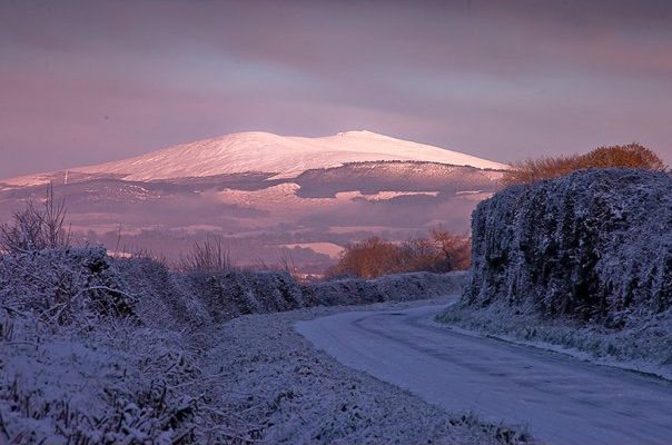
Kilcavan, County Wicklow on:
[Wikipedia]
[Google]
[Amazon]
 Kilcavan is an area in south
 Kilcavan is an area in south
 County Wicklow
County Wicklow ( ; ga, Contae Chill Mhantáin ) is a county in Ireland. The last of the traditional 32 counties, having been formed as late as 1606, it is part of the Eastern and Midland Region and the province of Leinster. It is bordered by t ...
in Ireland, approximately north-east of Carnew. The area, comprising the townland
A townland ( ga, baile fearainn; Ulster-Scots: ''toonlann'') is a small geographical division of land, historically and currently used in Ireland and in the Western Isles in Scotland, typically covering . The townland system is of Gaelic origi ...
s of Kilcavan Lower and Kilcavan Upper, is located at the southern end of the Wicklow Mountains
The Wicklow Mountains (, archaic: ''Cualu'') form the largest continuous upland area in the Republic of Ireland. They occupy the whole centre of County Wicklow and stretch outside its borders into the counties of Dublin, Wexford and Carlow. Wh ...
.
Name
TheIrish language
Irish ( Standard Irish: ), also known as Gaelic, is a Goidelic language of the Insular Celtic branch of the Celtic language family, which is a part of the Indo-European language family. Irish is indigenous to the island of Ireland and was ...
name of the area is ''Cill Choamháin'', referring to a church (''cill'') associated with a person named Caomhán. Early anglicised versions of this name include a reference, in the Calendar of Patent Rolls of James I (1608), to Killkavane. Other references include Kilkevine (1636), Killcavan (), and Kilkeavan (1667). 19th century records, attributed to place-name archivist John O'Donovan John O'Donovan may refer to:
*John O'Donovan (scholar) (1806–1861), Irish language scholar and place-name expert
*John O'Donovan (politician) (1908–1982), Irish TD and Senator
*John O'Donovan (police commissioner) (1858–1927), New Zealand pol ...
, refer to ''Cill Caemhain'' or "St Cavan's church".
History
Former church
Near the R748 road between Carnew and the Kilcavan Gap, in Kilcavan Upper, is the site of an ecclesiastical enclosure. This circular enclosure is marked as the site of Kilcavan Church on mid-19th century Ordnance Survey maps. Today there is very little left of the church except scattered granite stones and a "crude Latin cross (WI047-006003-)" which is incorporated in a field boundary to the south of the church site. Kilcavan Church was named after Saint Caomháin, who founded the monastery of Airdne Coemain, now Ardcavan, County Wexford, . Caomháin may be the same priest named Caeman of Dairinis in other sources, who Saint Finnian of Clonard, visited before he went to Aghowle.Quarrying
From at least 1800 until the early 1940s, theslate
Slate is a fine-grained, foliated, homogeneous metamorphic rock derived from an original shale-type sedimentary rock composed of clay or volcanic ash through low-grade regional metamorphism. It is the finest grained foliated metamorphic rock. ...
quarries of Kilcavan provided a source of employment for local inhabitants. The extracted slate, which was "of a dark colour", was mainly exported, but also used locally and elsewhere within Ireland.
In addition to slate and stone for building, the quarries at Kilcavan also exported the component used as a base for the " Battleship Gray" paint used on warships. The slate quarry closed in 1942.
Land use
In the very early nineteenth century the area was in the control of Lord Fitzwilliam and was originally leased only toProtestants
Protestantism is a branch of Christianity that follows the theological tenets of the Protestant Reformation, a movement that began seeking to reform the Catholic Church from within in the 16th century against what its followers perceived to b ...
. This changed after 1808, and Catholics
The Catholic Church, also known as the Roman Catholic Church, is the largest Christian church, with 1.3 billion baptized Catholics worldwide . It is among the world's oldest and largest international institutions, and has played a ...
were given the chance to sub-lease land.
References
{{coord, 52.731, -6.476, region:IE, display=title Townlands of County Wicklow