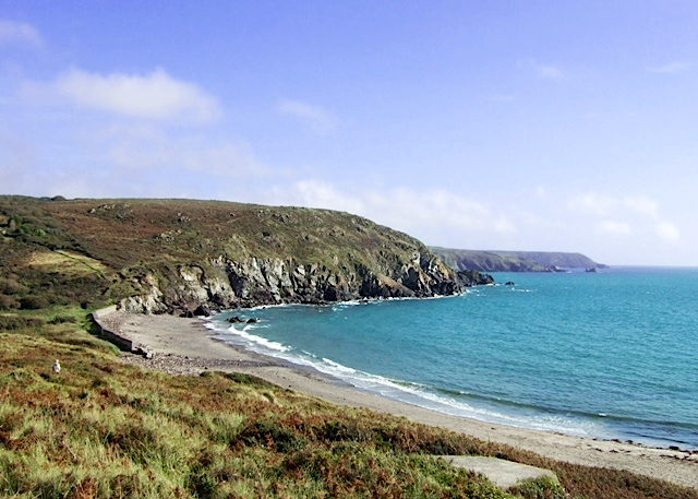
Kennack Sands on:
[Wikipedia]
[Google]
[Amazon]
 Kennack Sands is a beach and
 Kennack Sands is a beach and
 sand-dune
A dune is a landform composed of wind- or water-driven sand. It typically takes the form of a mound, ridge, or hill. An area with dunes is called a dune system or a dune complex. A large dune complex is called a dune field, while broad, fl ...
system on the east coast of the Lizard Peninsula, Cornwall, England, UK.
Geography
The beach is approximately long and backed by cliffs, Kennack Towans (sand-dune system) andCarn
''Carn'' is the official magazine of the Celtic League. The name, a Celtic word which has been borrowed into English as ' cairn', was chosen for its symbolic value and because it can be found in each of the living Celtic languages. The subtit ...
Kennack. Inland is the abandoned Gwendreath Quarry. The beach is used for recreation and divided into two by an outcrop of rocks called the Caerverracks. Kennack Sands has a gently sloping beach so the beach width varies considerably with the tide. There is a rocky outcrop that splits the beach into two so the beach may be referred to as Kennack Sands west and Kennack Sands East. The rock that splits the beaches is called Caerverracks and the hill above this Carn Kennack. There is a path that runs over Carn Kennack allowing access to the east beach which is a designated nature reserve.
It is a popular site for launching inflatables for underwater diving. Less than off-shore the depth of water is over .
The nearest village is Kuggar, inland. There is a car park and café on the western side of the beach and on the road to Kuggar there are caravan and camping sites.
History
Pill boxes and an anti-tank wall were built on the back of the beach in case of invasion during the Second World War.References
Beaches of Cornwall Lizard Peninsula Surfing locations in Cornwall {{Cornwall-geo-stub